
Hi,
Wow! the Second Yarmouk bridge Also called Jiser El-Hamme is not a place you visit everyday. In a matter of fact, since it is a closed military area on the Israeli-Jordanian border – you are never allowed to visit it.
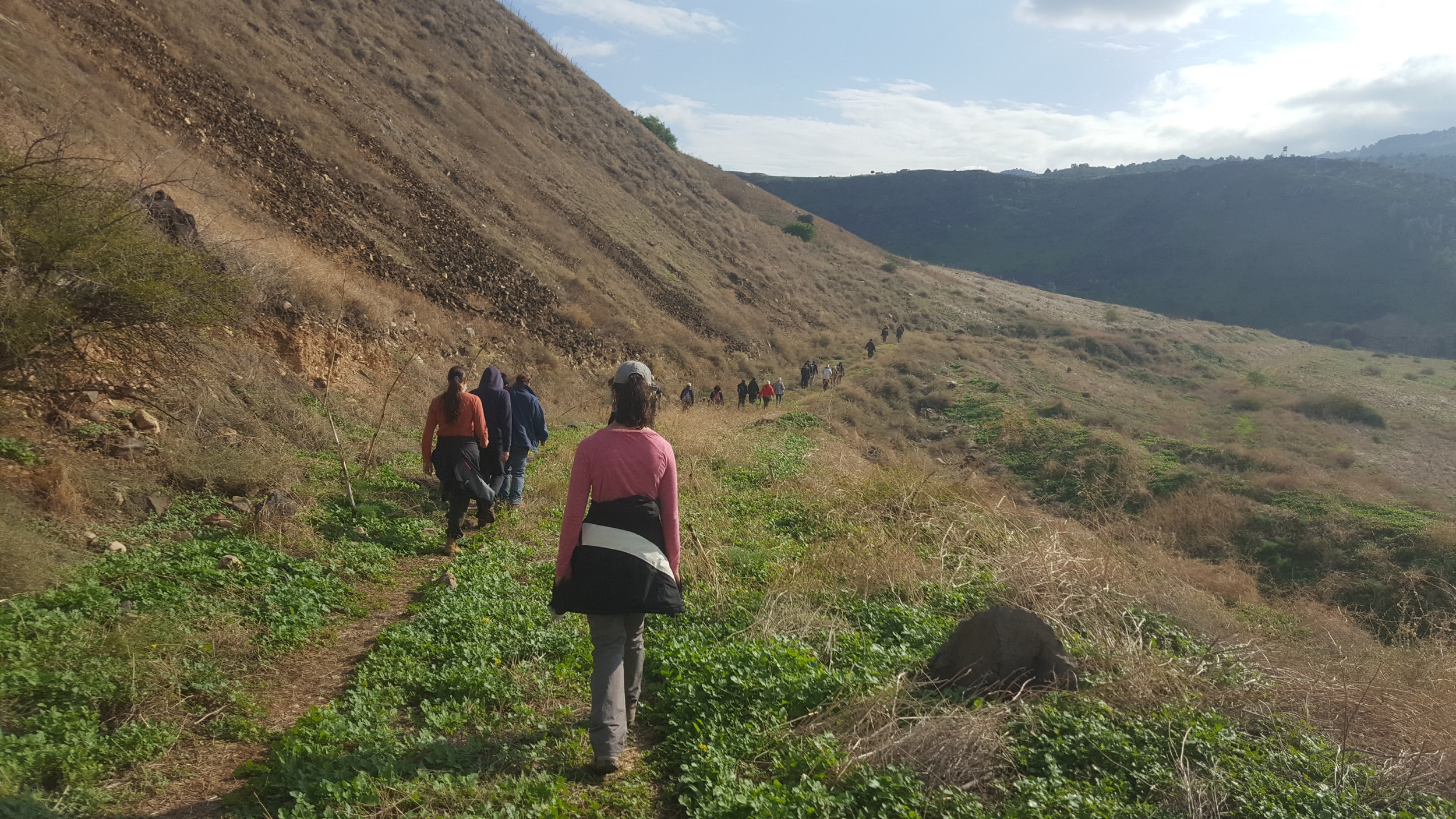
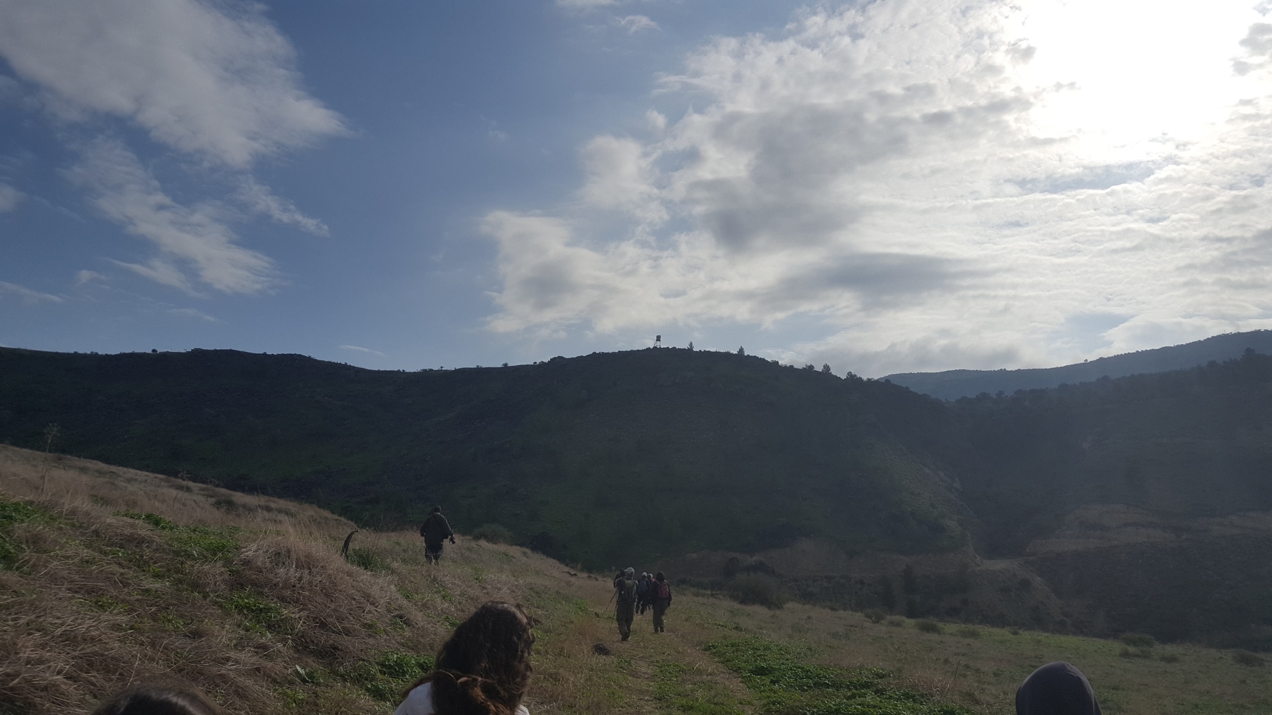
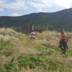
So we arranged Fatma (my sister) to take the kids to the kindergarten and went out early in the morning to visit it with Amitim Latiyulim and Keshet-Yonatan.
The hike have been delayed a bit, as we had to wait for the IDF to open the gate. The Yarmouk river is the the Israeli–Jordanian border, the area up to the road was set as a closed military zone.
The railway that passed on the bridge The Jezreel valley railway which was the second railway to be built in Israel, after the Jaffa – Jerusalem railway (opened in 1892 you can see more in the post on The railway track system in Israel in WWI). It was a branch of The Hejaz railway and connected to it to Haifa. The Hejaz railway itself run from Damescus to Medina and was built at the time The Ottoman Empire. It is named after the the Hejaz region of Saudi Arabia. and directed by German engineer Heinrich Meissner. If you open the map you can see the Hejaz railway run deep in the land in the desert, which cause logistic problems. The idea of the branch to Haifa was to allow access to the big port to allow to ease the logistics of the construction.
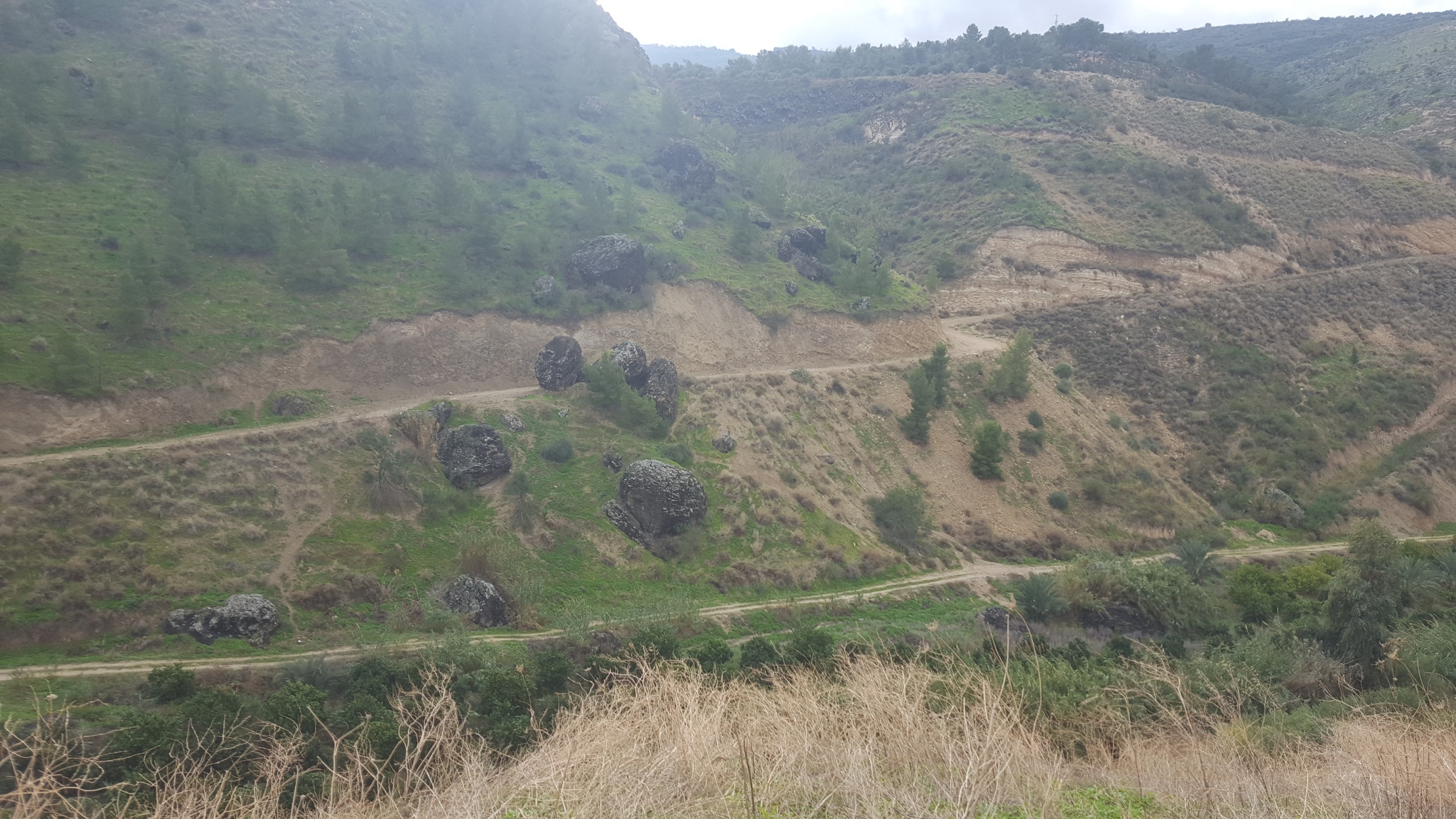
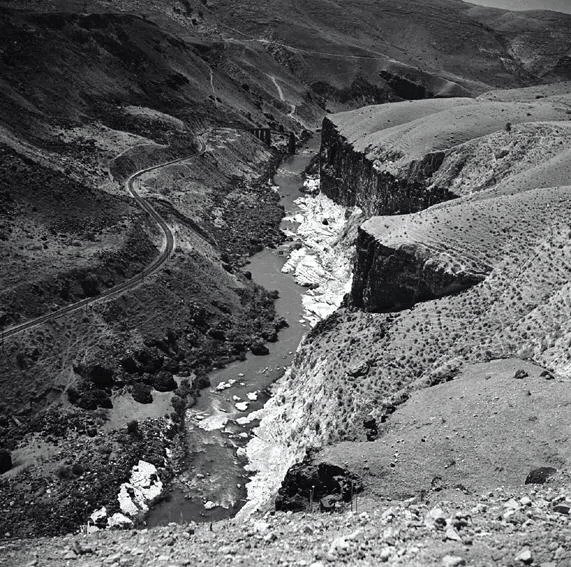
The bridge is part of a system of 8 tunnels (1,100m long) and 14 bridges and some 315 water crossing and aqueducts that allow the Jezreel valley railway to climb from Tzemach to Daraa (Syria): 73 km long with 529m height difference along the slopes of the Yarmouk river. You can see some pics of it here, and here. Or have a look on the hike we had to one of the tunnels, or post on the rest of the bridges of it in Israel.
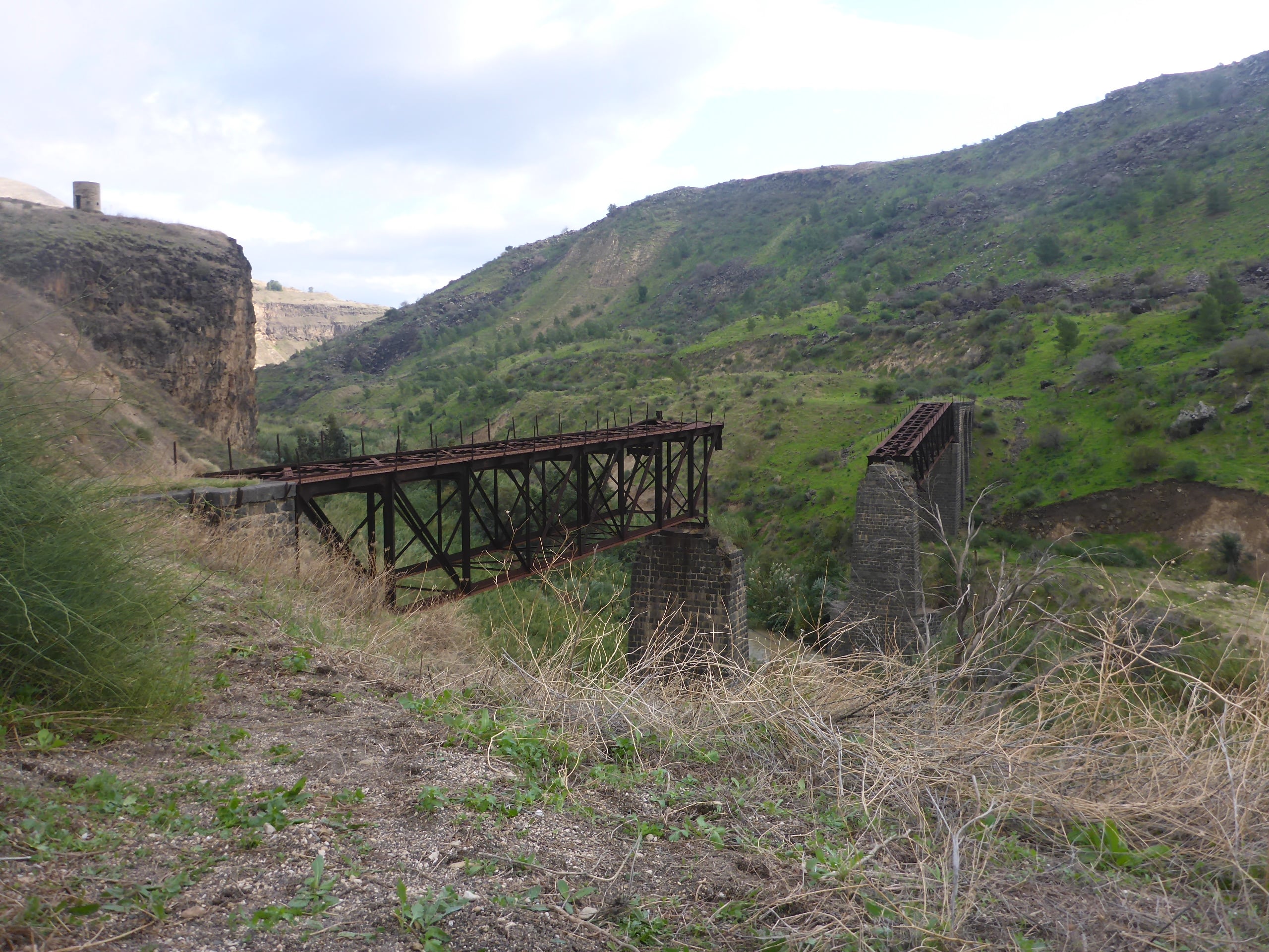
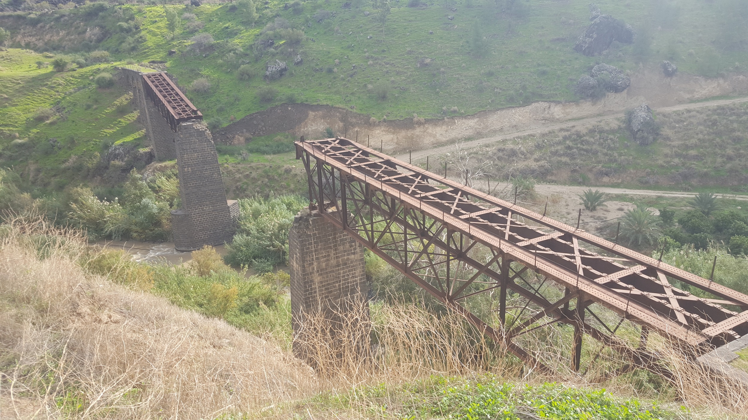
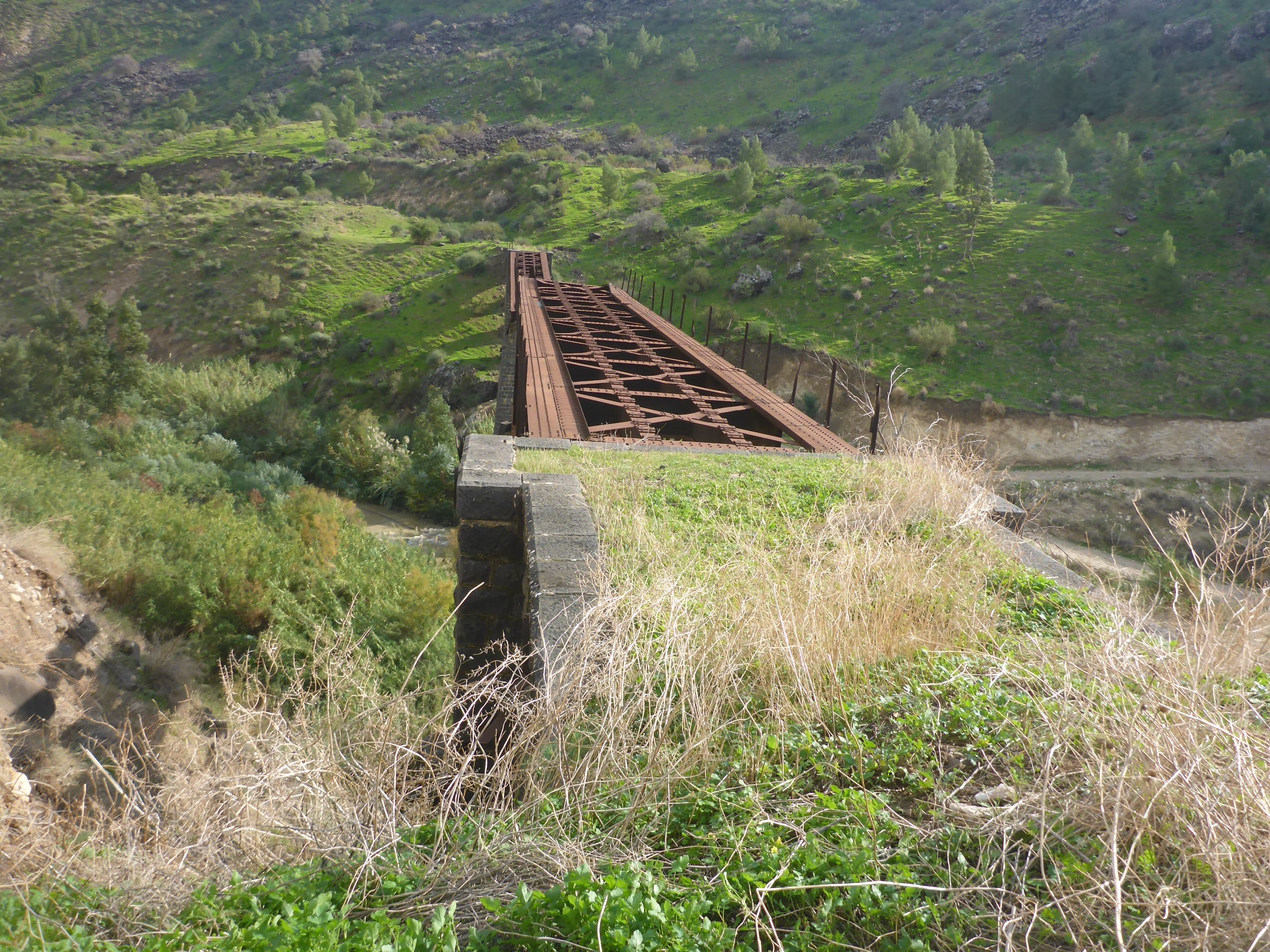
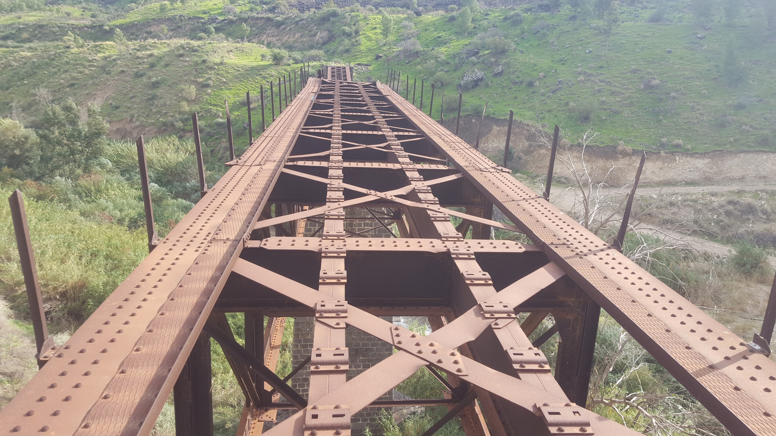
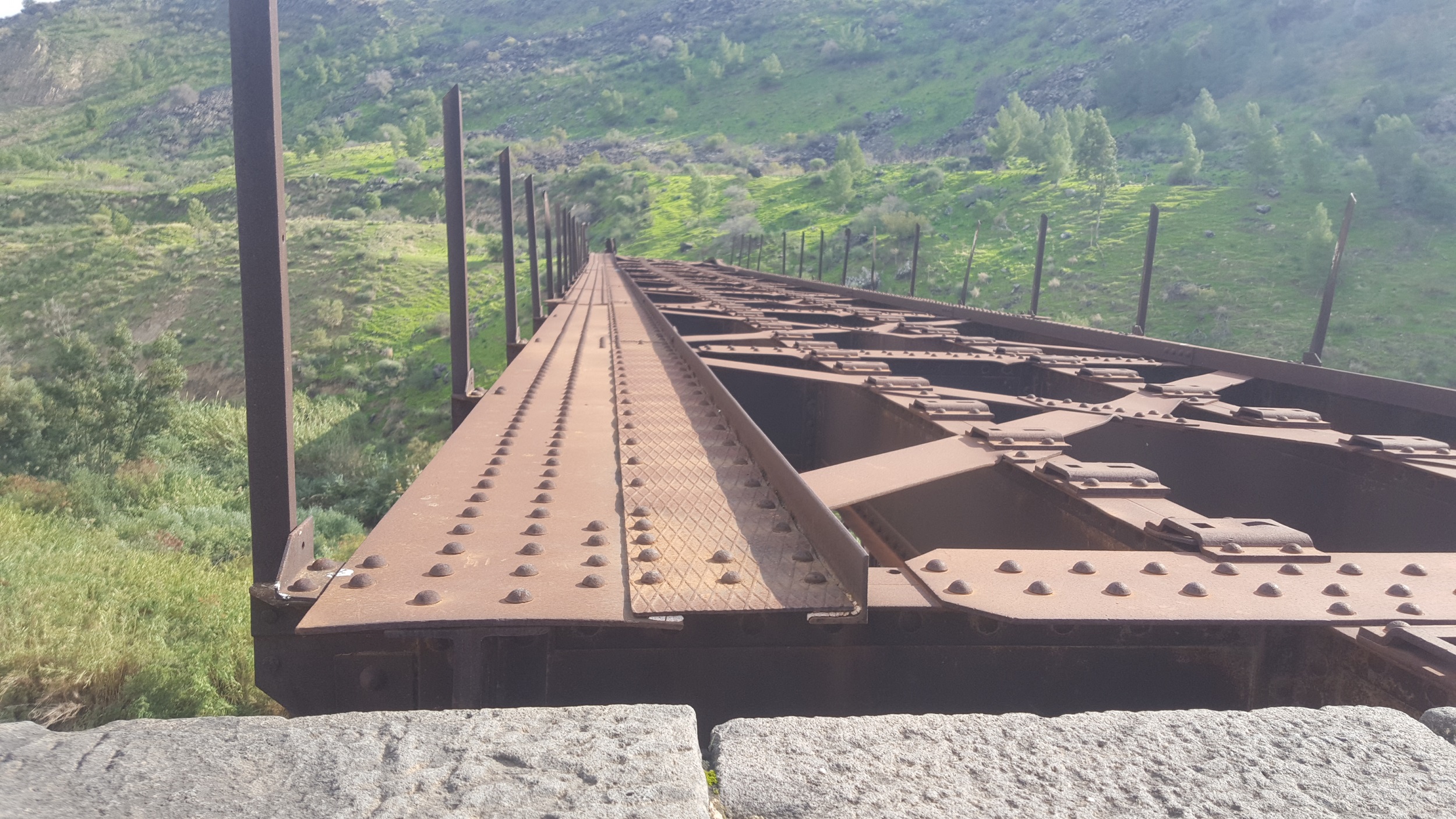
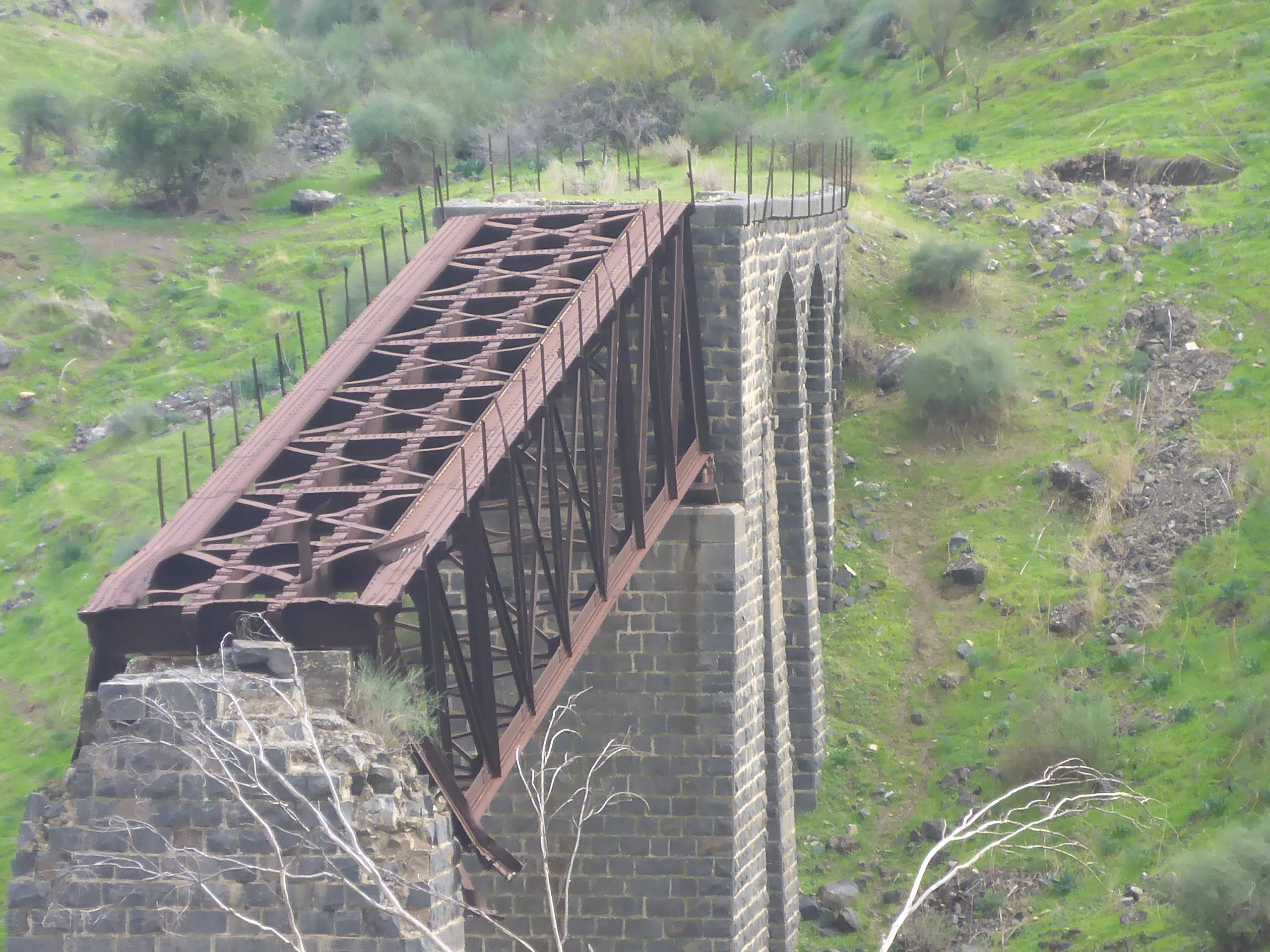
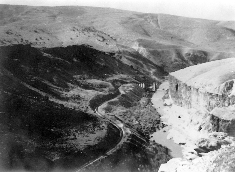
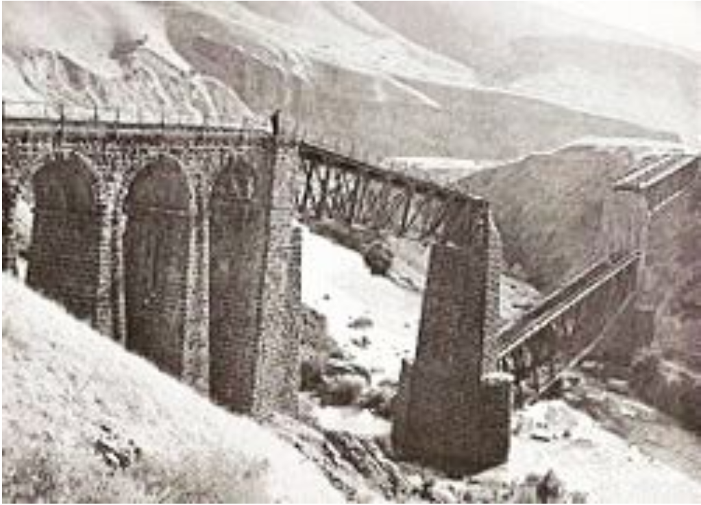
The second Yarmouk bridge (Jaser-el-Hawi) is located on the 97 km of Jezreel valley railway (measured from Haifa east station). It is 180 below sea level, 130 meter long (the longest in Israel at this time) and 20 meter above the Yarmouk river. The bridge consists of 3 steel trusses (the middle one been blown up) and was connected to the banks with 3 arches on the east side and none on the west side.
The bridge have been blown up twice:
The first time was on the June 17th, 1916. It might been the Ottomans on their retreat or as a protest against Sykes–Picot Agreement, that disconnected the settlements of Galilee Panhandle from rest of Jewish settlements.
The second time the bridge have been blown up by the Para-military Hagana organization along with the Etzel and Lehi organizations on Markolet operation (Night of Bridges) on the night of 16-17 of June 1946 at 23:30. The target was to destroy 11 bridges that connect Israel to its surroundings Arab countries, and by that disconnect the country, as a protest on the British White Paper that restricted the Jewish immigration to Israel. Kind of preventing the Britsh to cross the borders, as they prevent to Jewish people to do.
A class of 40, in the command by Aharon Spectur, of the C company on the third battalion of the Palmach that went out from Kibbutz Afikim on a wagon pulled by a tractor and walked 4 km. The bridge had not been guarded, and 400kg of Explosives, placed in 4 corners were used to blow it up. They had a short gun fight with the Transjordan Frontier Force (killing 2 soldiers) on the way back climbing to the east bank of the Yarmouk, but manage to come back to their base on Kibbutz Ashdot Ya’akov walking in the Yarmouk river to leave no traces and no injuries. Another 2 soldier entered the post office in Kinneret, and called Tiberius police and announced that buildings around the sea of Galilee will explode in half an hour, what caused distraction.
As the rest of the 10 bridges been blown up that night were fixed and back to operation, this bridge is the only bridge left as it was. People who wish to use the railway to Transjordan took a cab from Tzemah station to El-Hamma station and a train from there on to Transjordan. Since the place was set as the Israeli-Jordanian border it was set as a closed military zone.
Take Care
Gad
P.S.
When Colonel Lawrence stood above the bridge at the first time he planned to bomb it (it was failed on 7 November 1917) he described the bridge: “It stood just over the westernmost of the Yarmuk bridges, a steel masterpiece whose destruction would fairly enrol me in the Gadarene school (Seven Pillars of Wisdom)”
The bridge now days
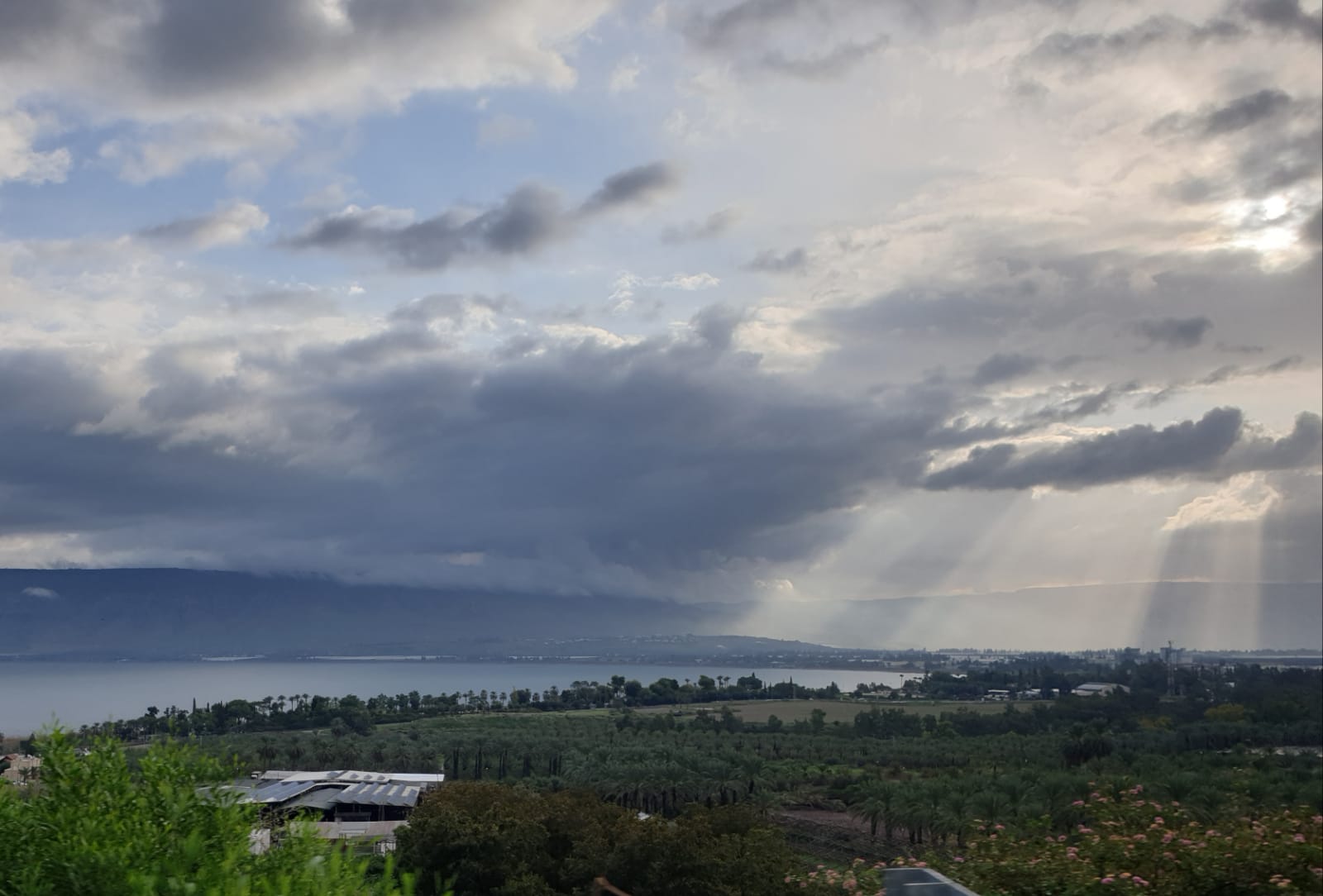 On the way to the hike, we cough a wonderful pic of the Kinneret. The Yarmouk valley is where the ray of sun hits – leading us to the point
 The view of the destroyed bridge on a pic from 2019, this is were we are headed to (Source: Mirell Lotan, Wikipiki): 130 meter long! one the west 30m long arch, a 50m long steel span, a Eastern arch and 4 more arches (20m at all).
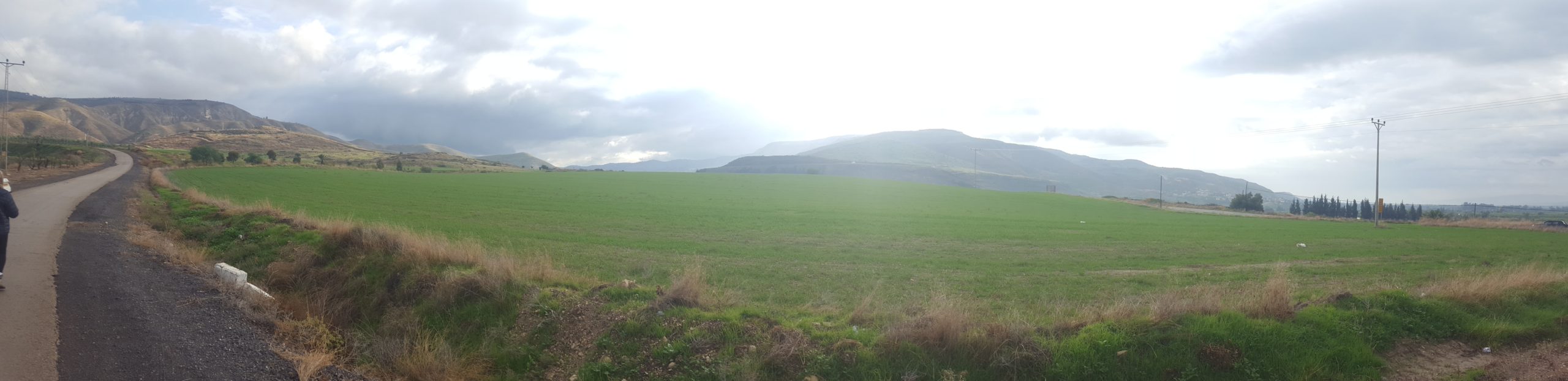
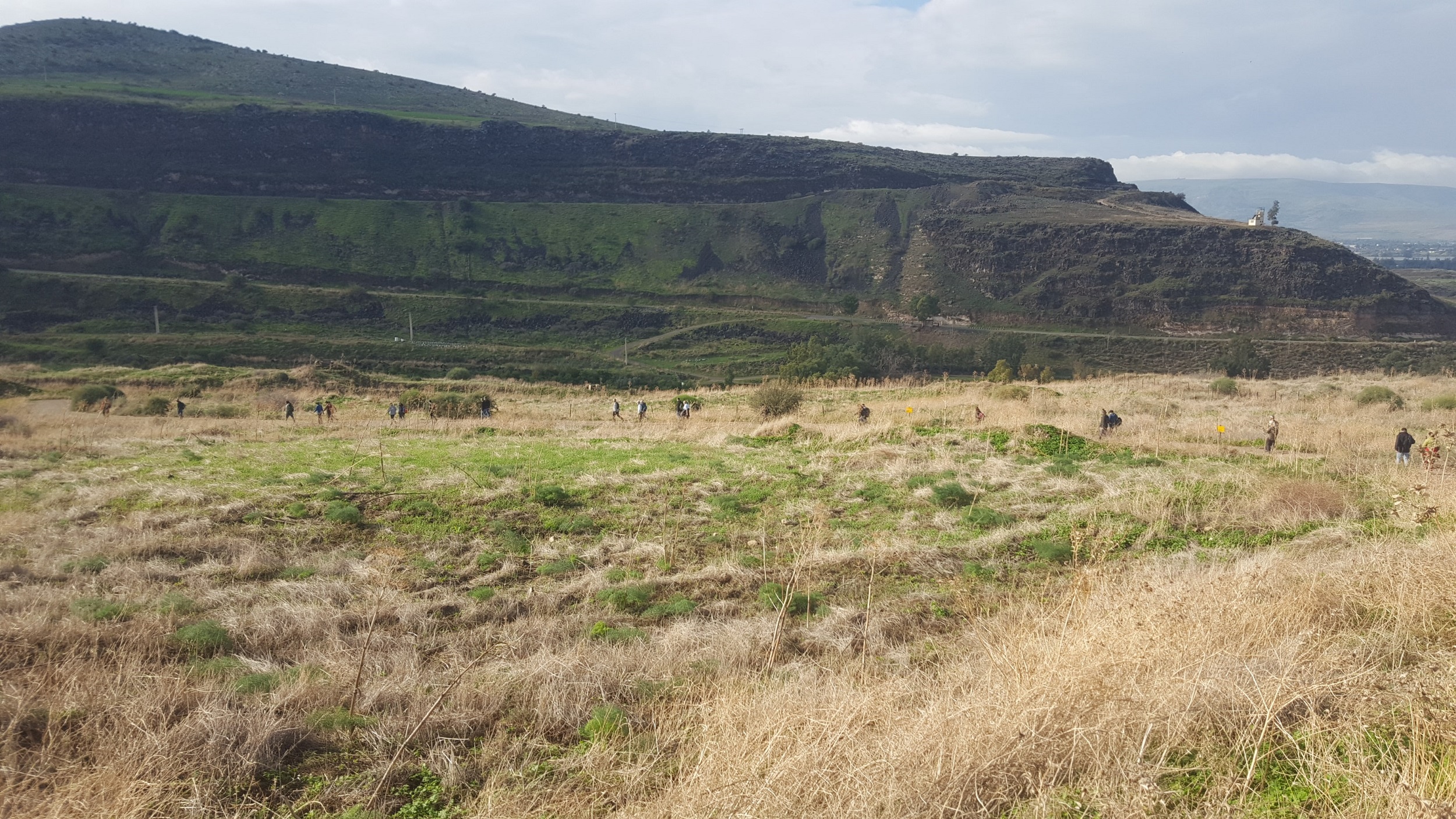
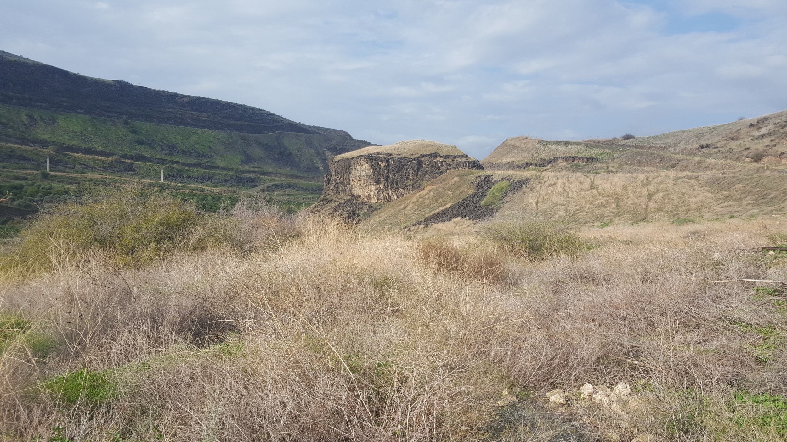
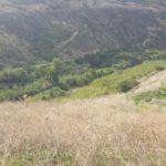
The Yarmouk valley is in between the Golan heights on the left and Joardn mountains on the right
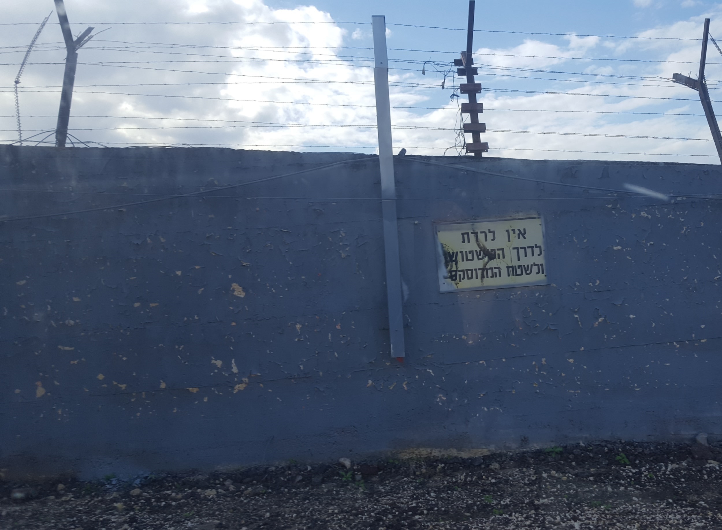 The border fence with the sign declares not to go down from the road to the path on side that used to show tracks of people who crossed the fence. There are 14 walls along the way for cover from Jordanian shots when the border was dangerous.
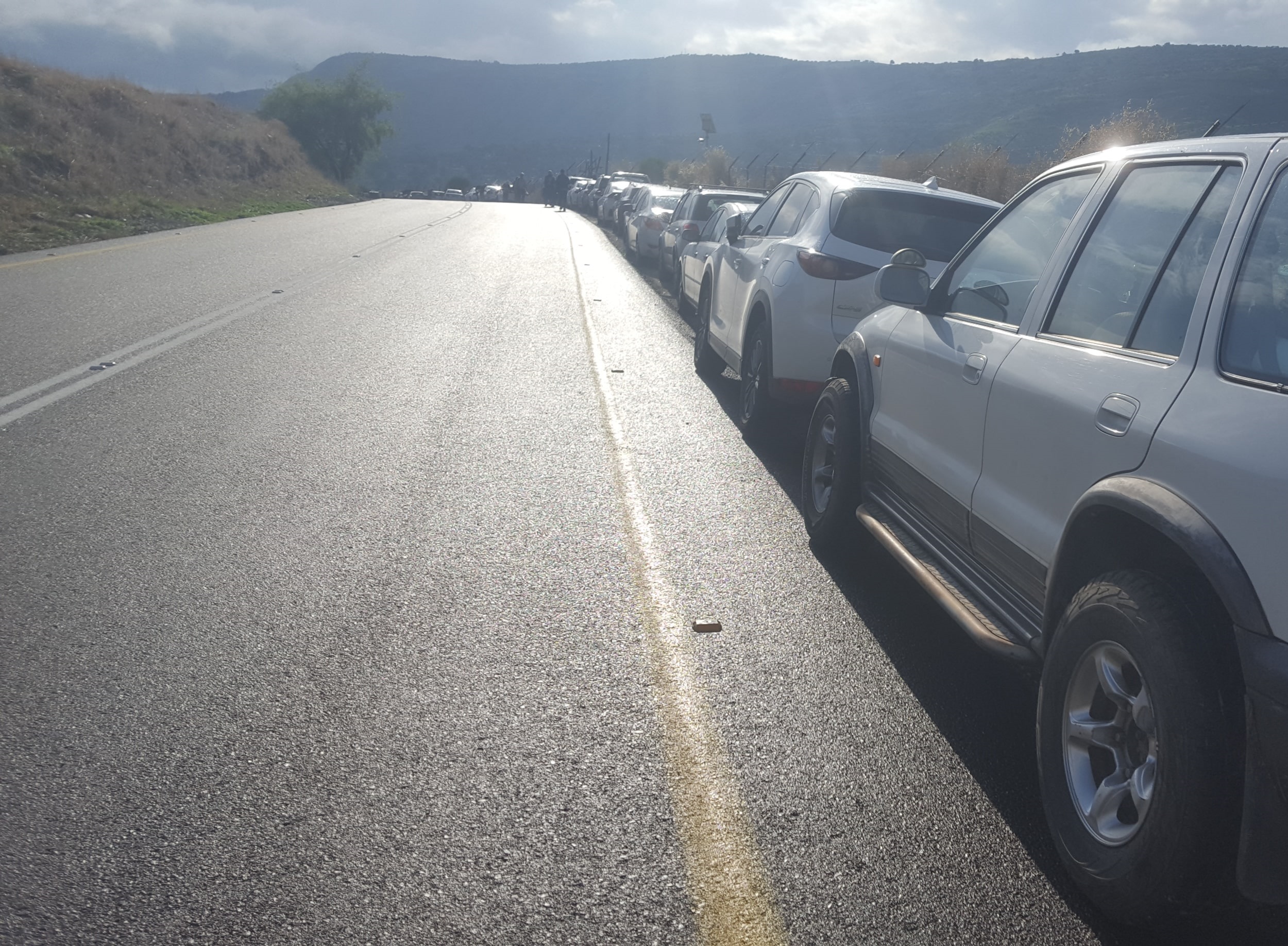 Our cars parking on the road we been asked not to go to…
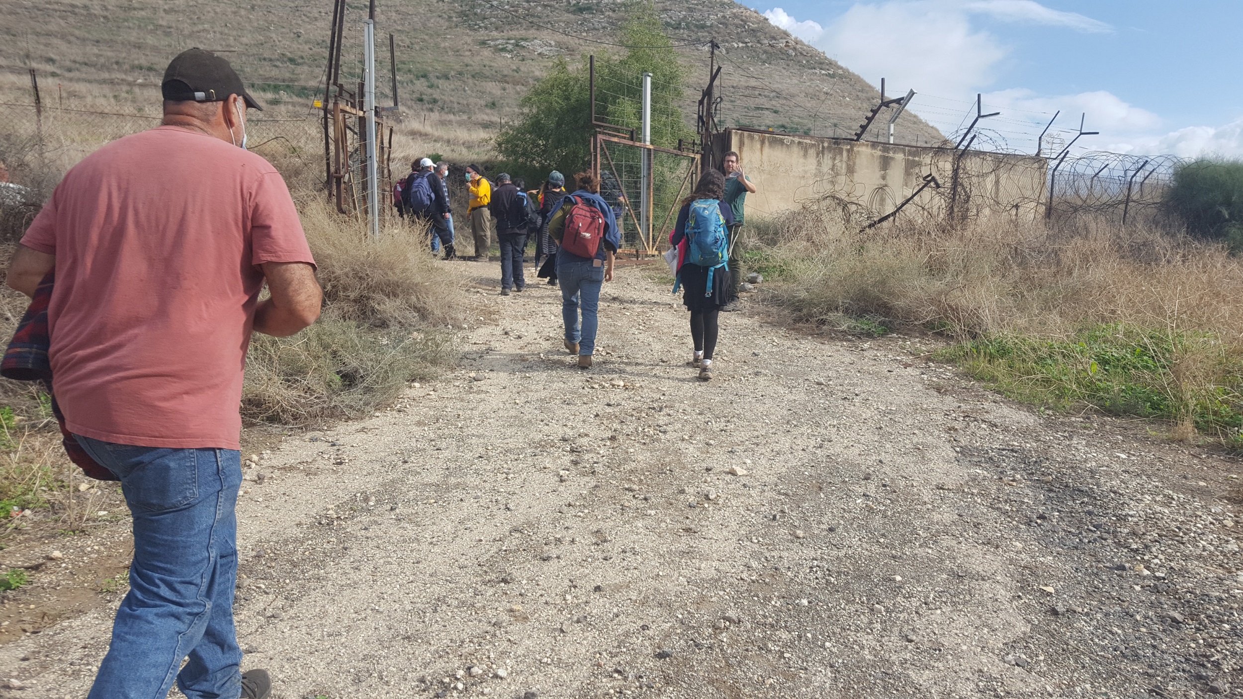
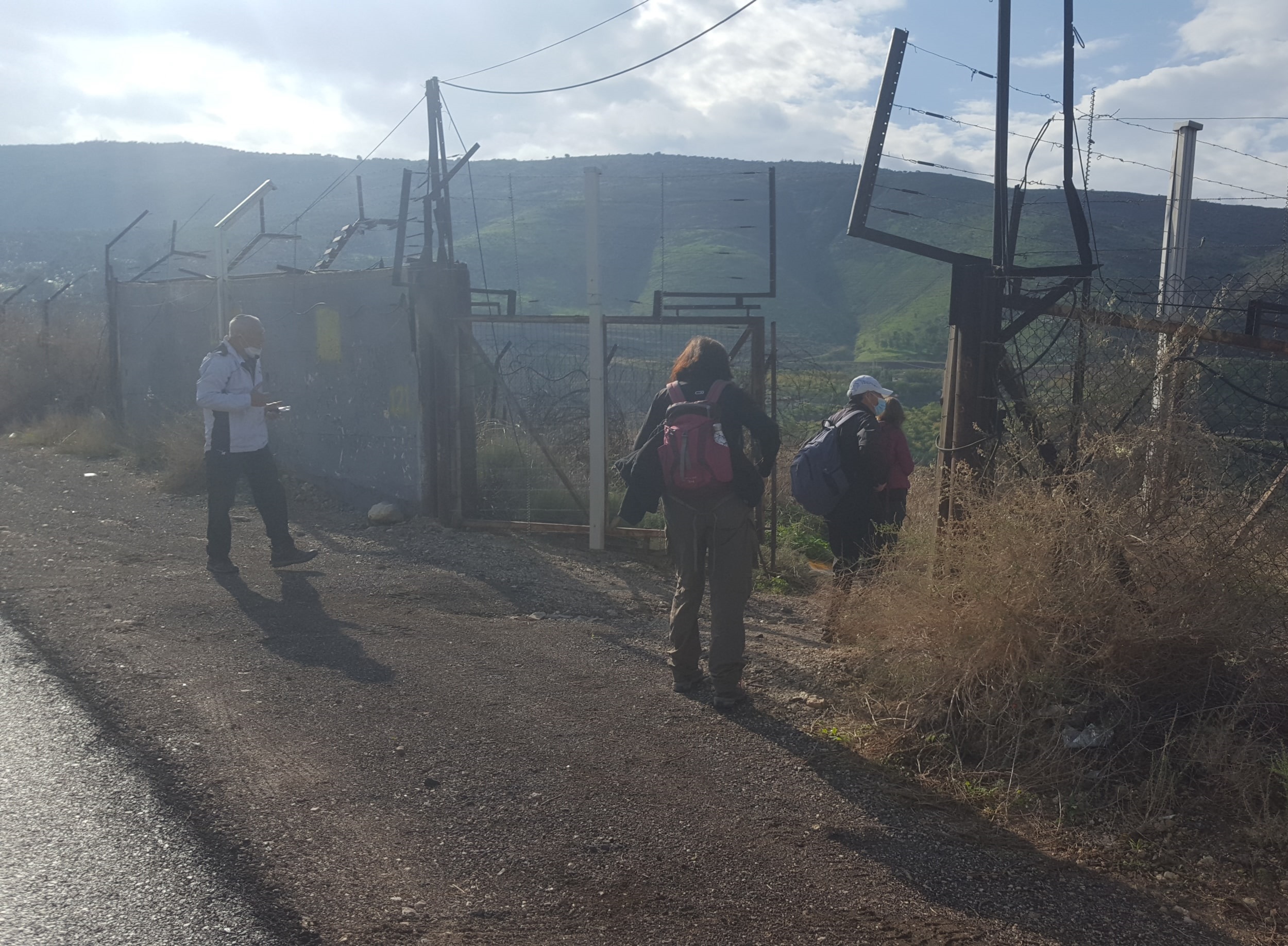 Crossing the fence through the gate the IDF opened for us
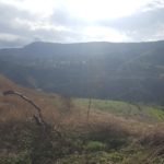
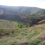
Over the border fence and looking on the Yarmouk valley
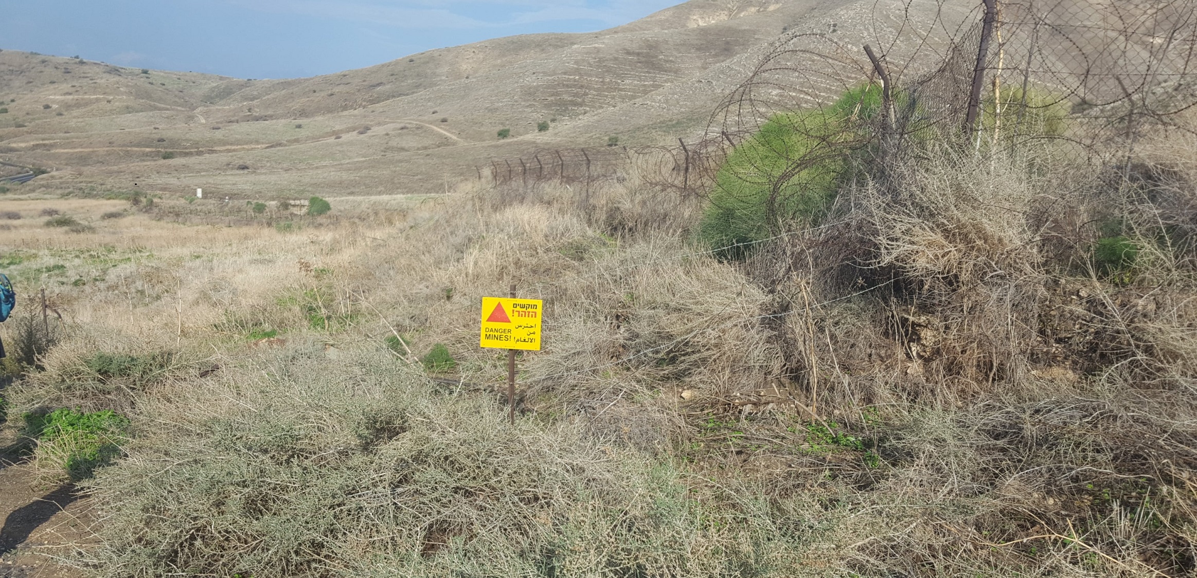 One of the many minefield we walked around and between. I had part on one of those east from here.
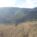
 Looking east to the Jordan valley
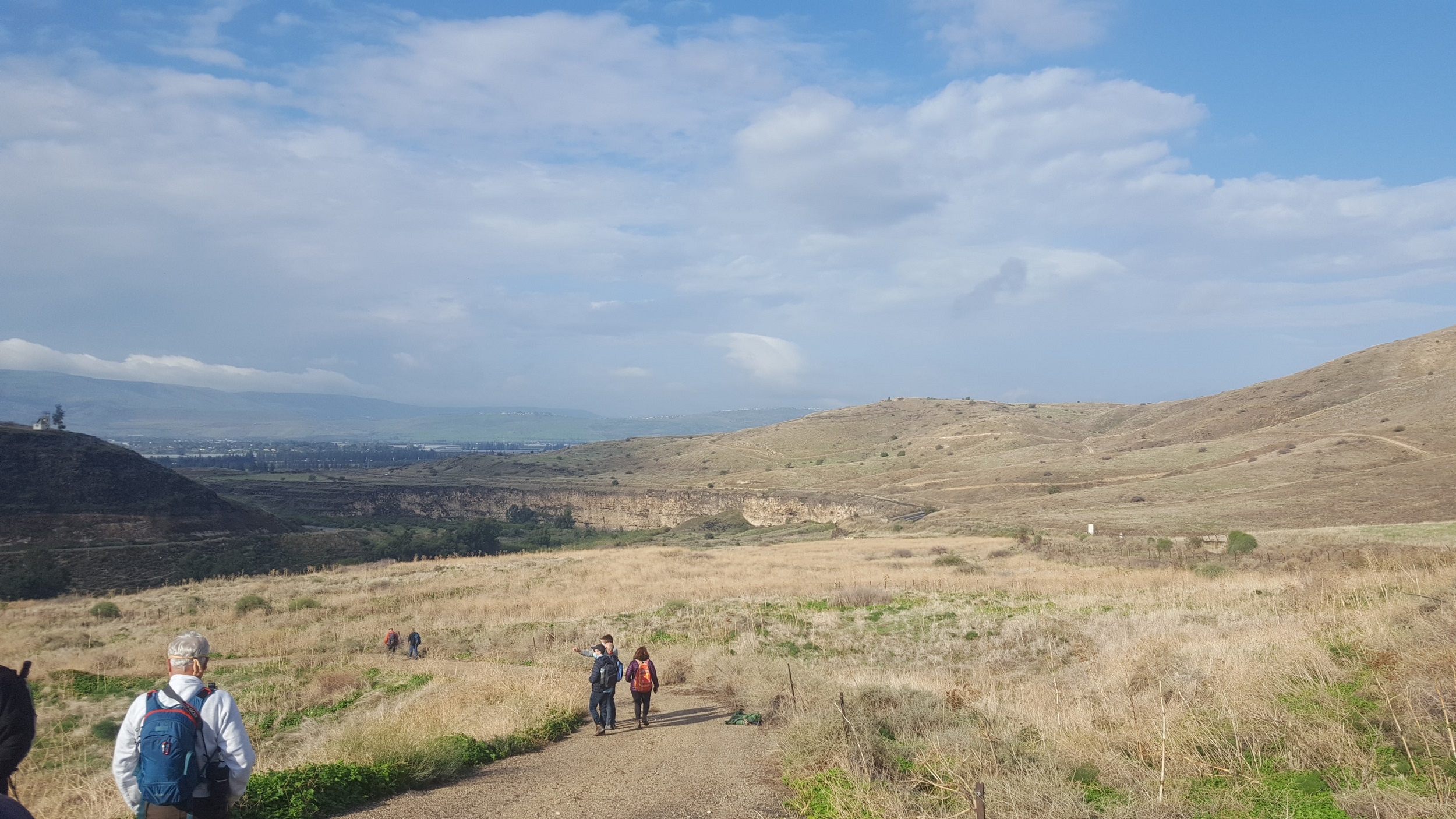
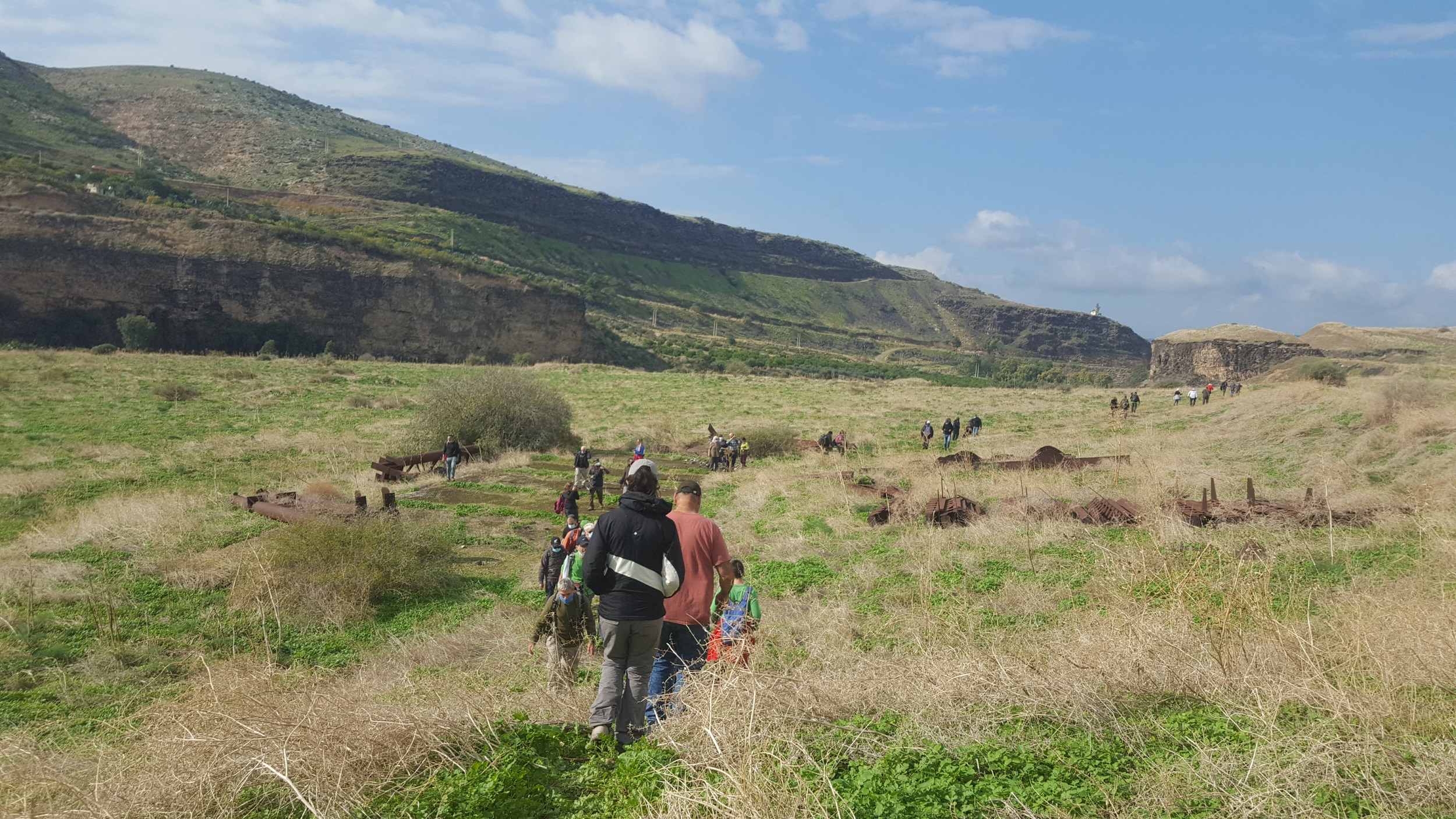
 The line of hikers, which had to keep 2 meter apart for the Coronavirus and keep a mask on.
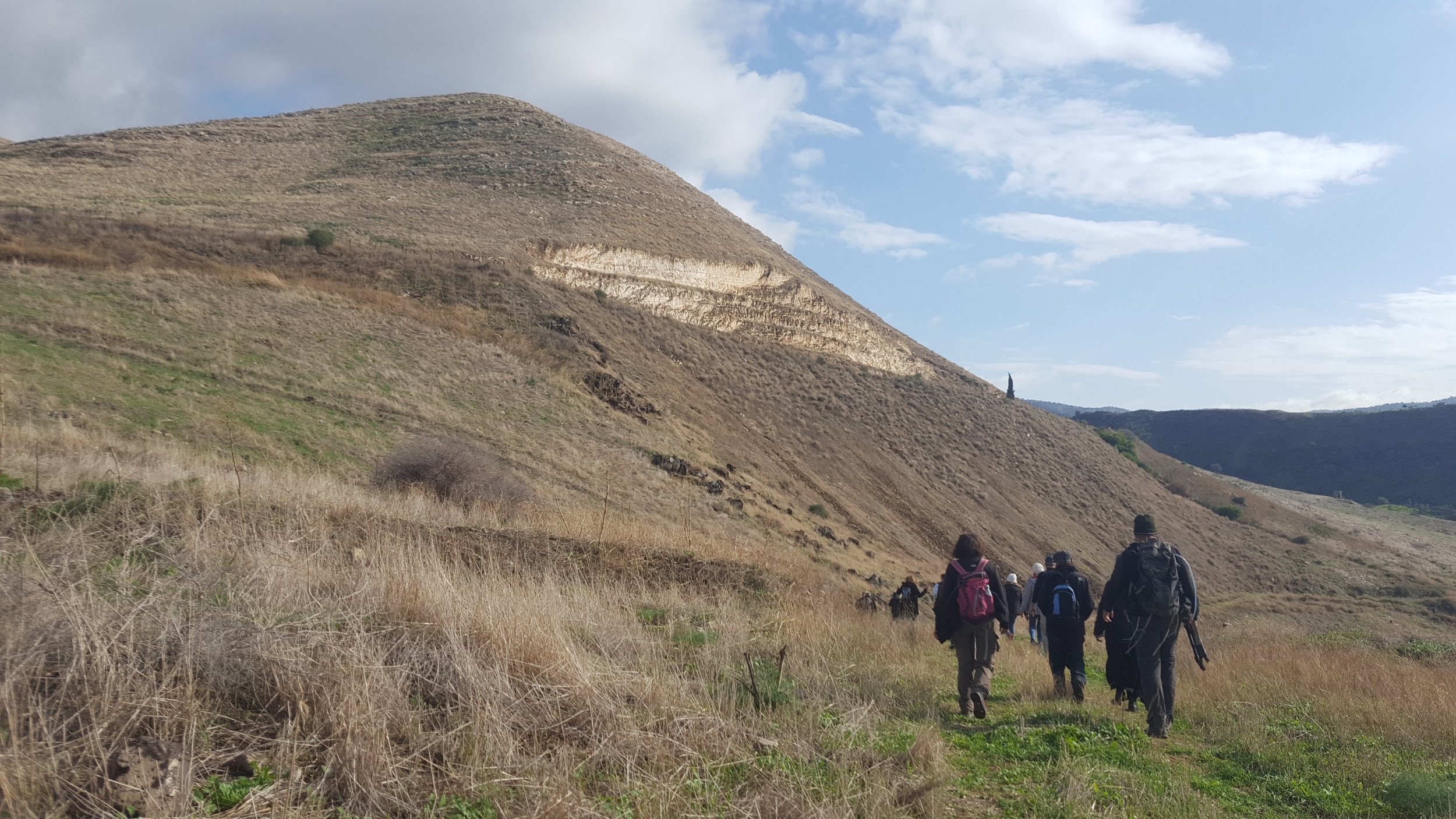 Walking West, the cut in slope up for the road to Hamat Gader shows the chalk stone
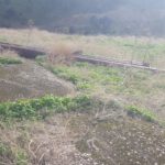
 And going down to the level of the train and the bridge
 Looking back you can see the railway embankment and curt in the stone
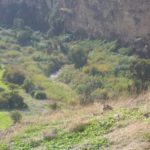
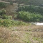
Here is the Yarmouk river!
 On top of the hill on the other bank – a Jordanian guarding post
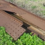
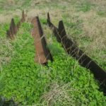
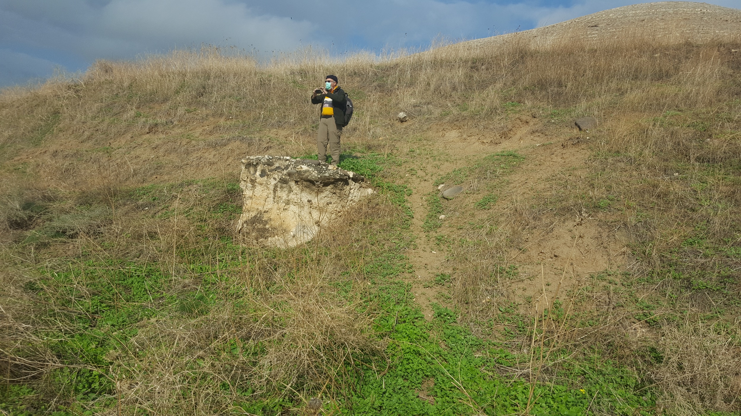
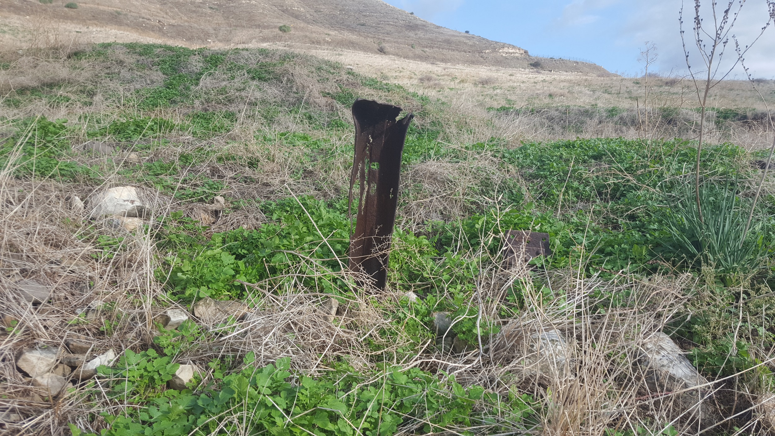 Wow! a piece of the the railway – the railway slippers. They used those kind of slippers as you can see here
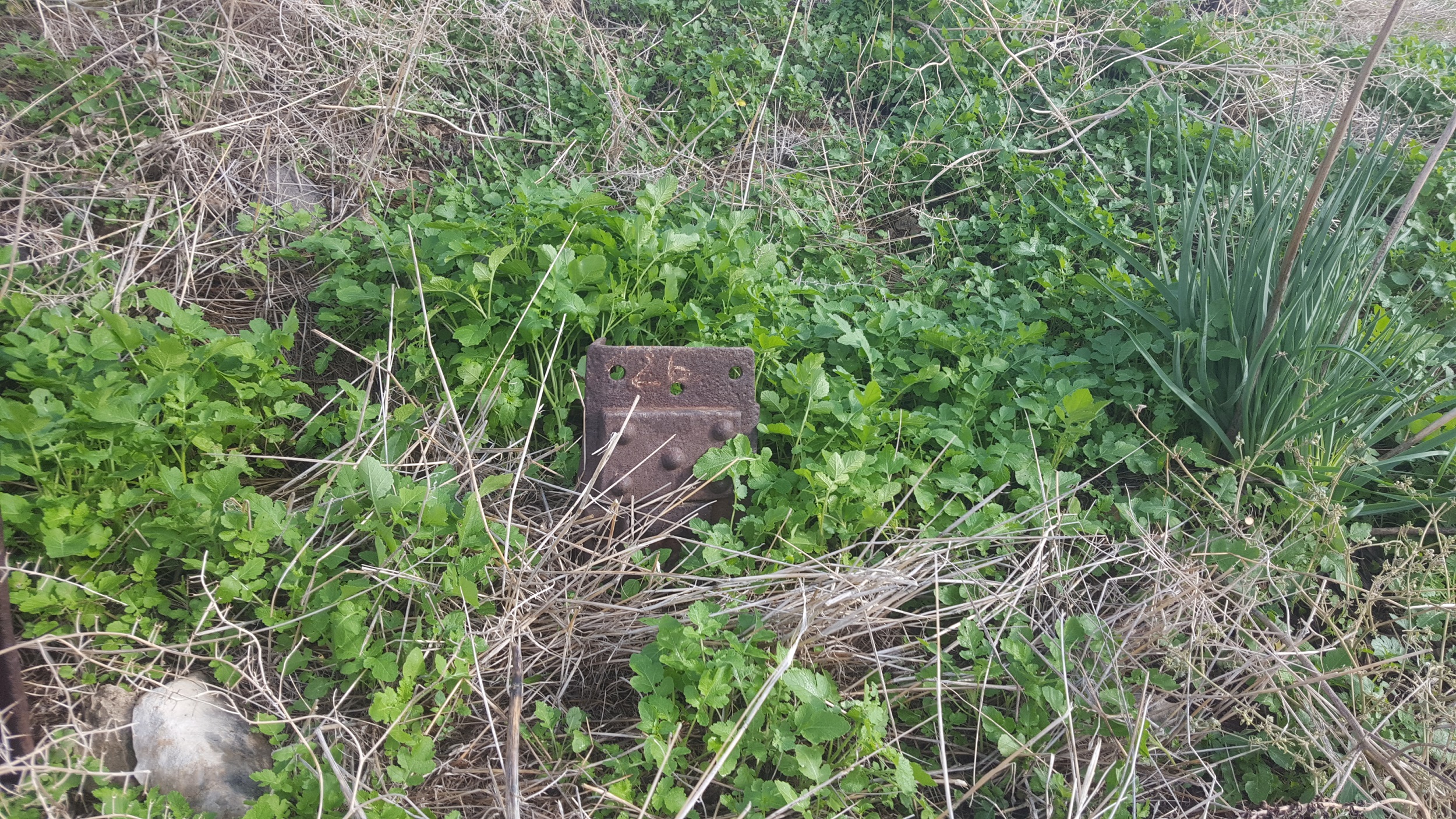 And here comes another part
 ![]()
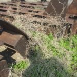
A water cross over – one of 324 along this part
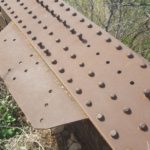
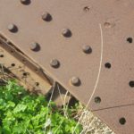
First steel piece of the bridge ![]() with steel nails, not common here
with steel nails, not common here
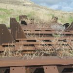
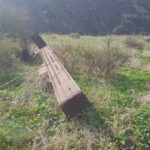
The bed steel of the middle trestle
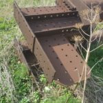
I assume it is part of the demo middle truss, different from the other two which is mainly plates and L angle profiles. Make sense as it was rebuilt by the Canadian Bridge company.
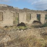
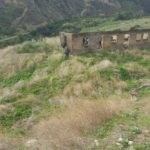
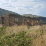
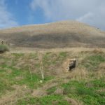
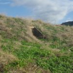
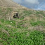
Climbing to the hill with the old un-reinforced building, from here we can see the…
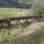
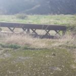
 The bridge!
 And from the side
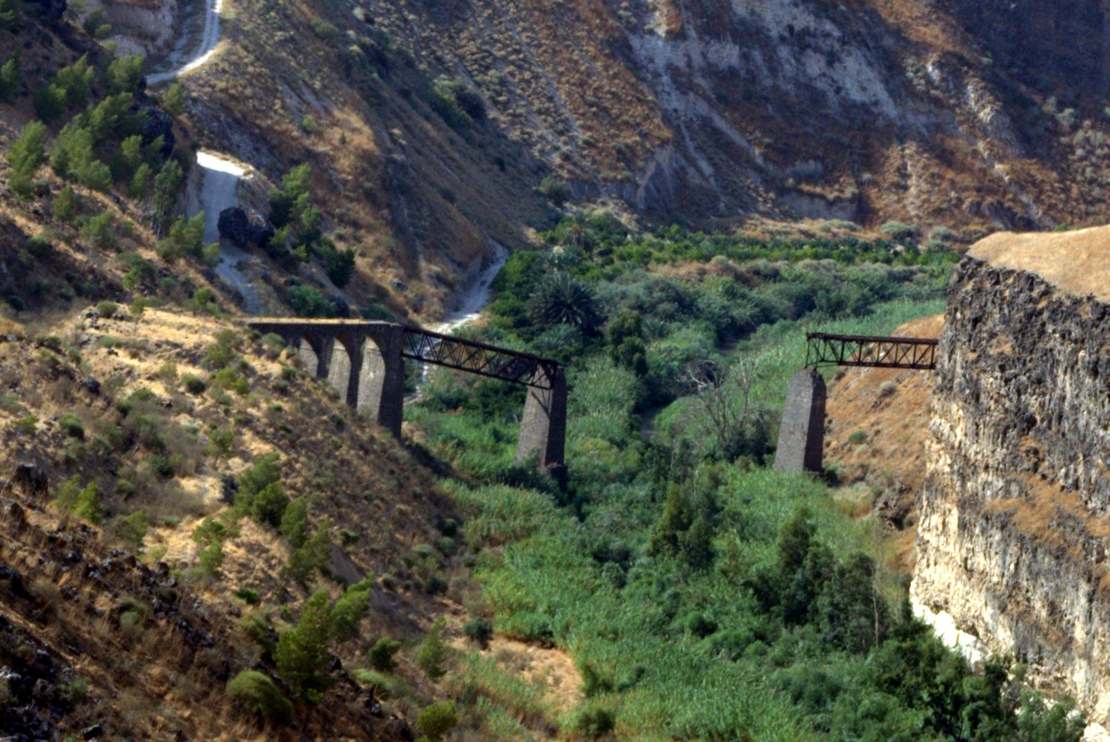
 A view along the bridge. You can see how track of the railway on the other bank going to the left.
Video of the bridge and the Yarmouk river below
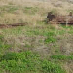
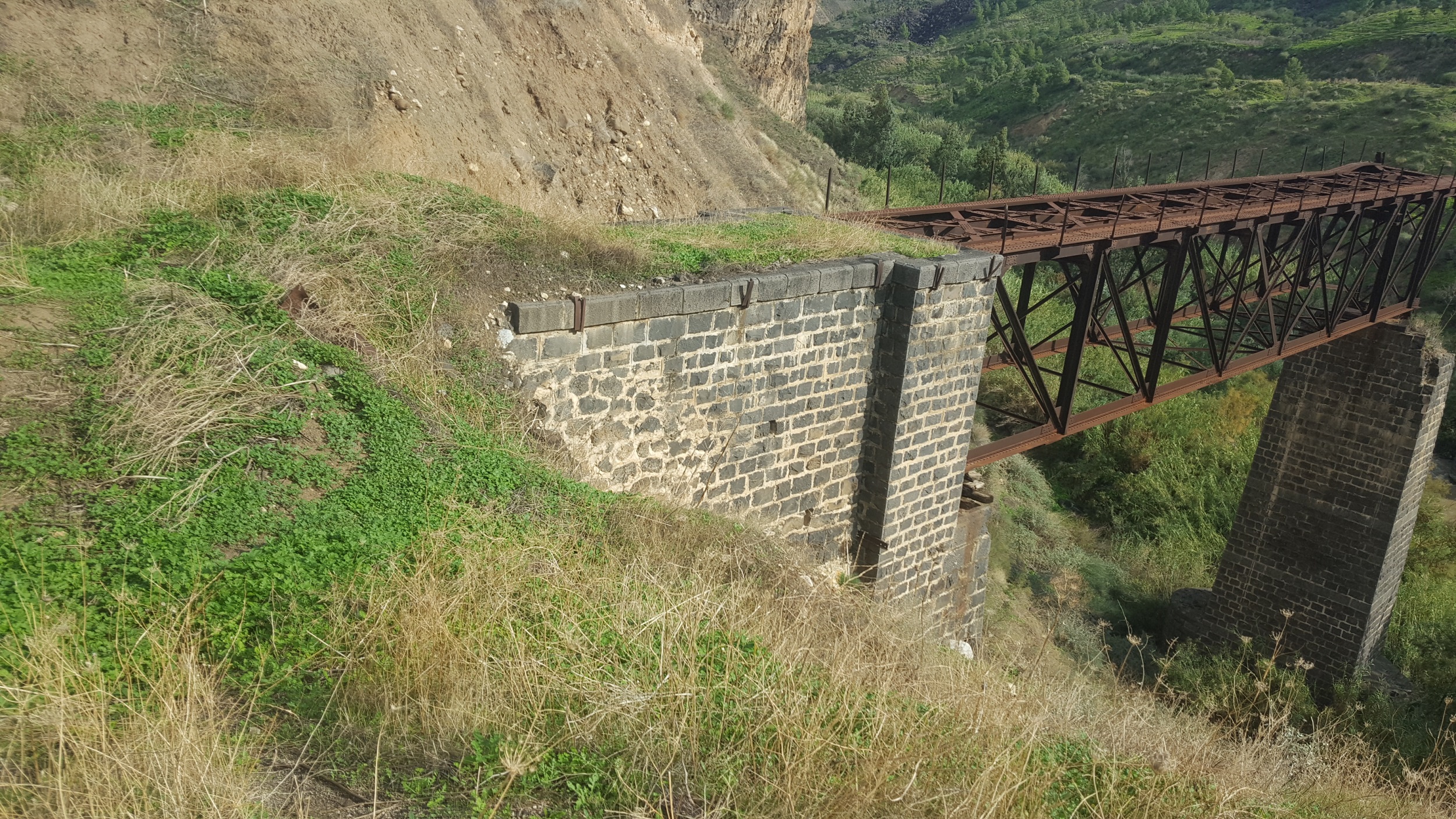 The stone embankment from west
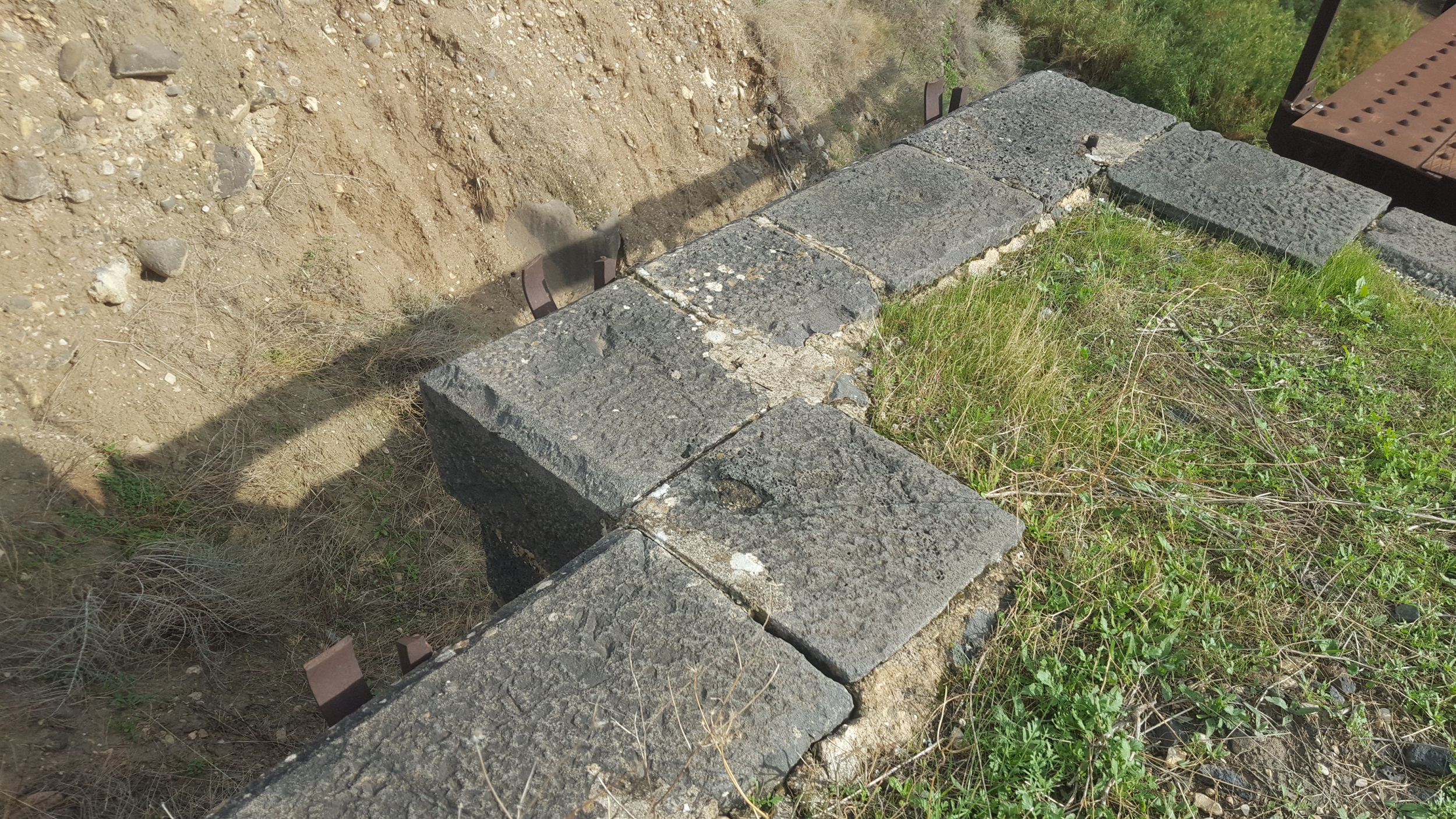 The stones of the embankment
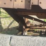
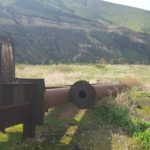
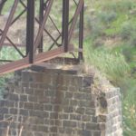
The Westren support of the Westren trestle, I would expect something more permanent but those logs are here for about a hundred year and still hold on.
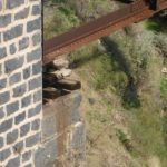
 The top of the Eastern trestle
 lower view on the Eastern trestle
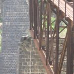
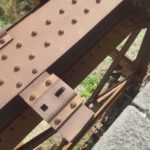
The Eastern support of the Westren trestle, Here it seems the trestle stands directly on the stone column
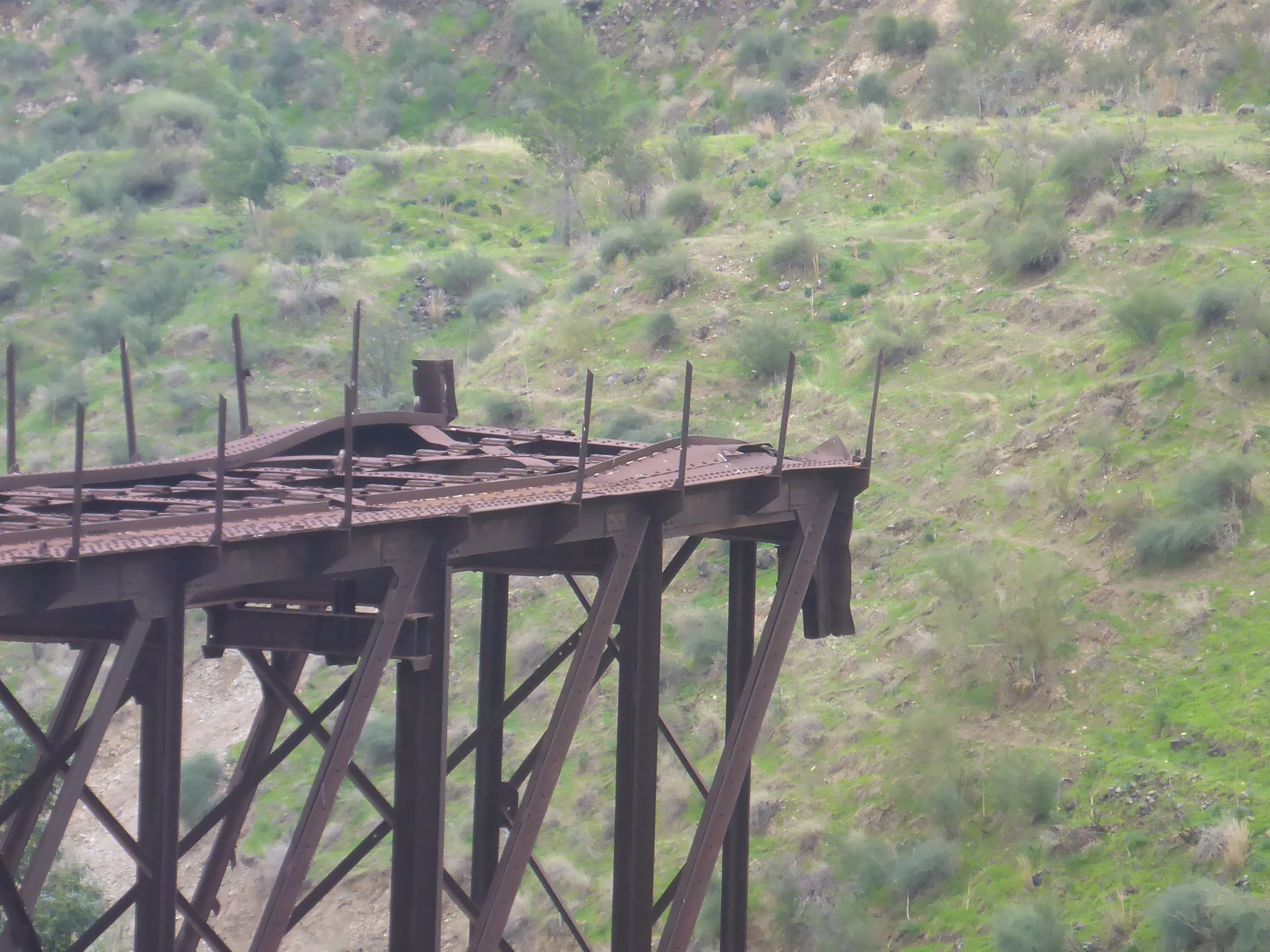 The western edge of the Eastern trestle – the results of the explosion can still be seen
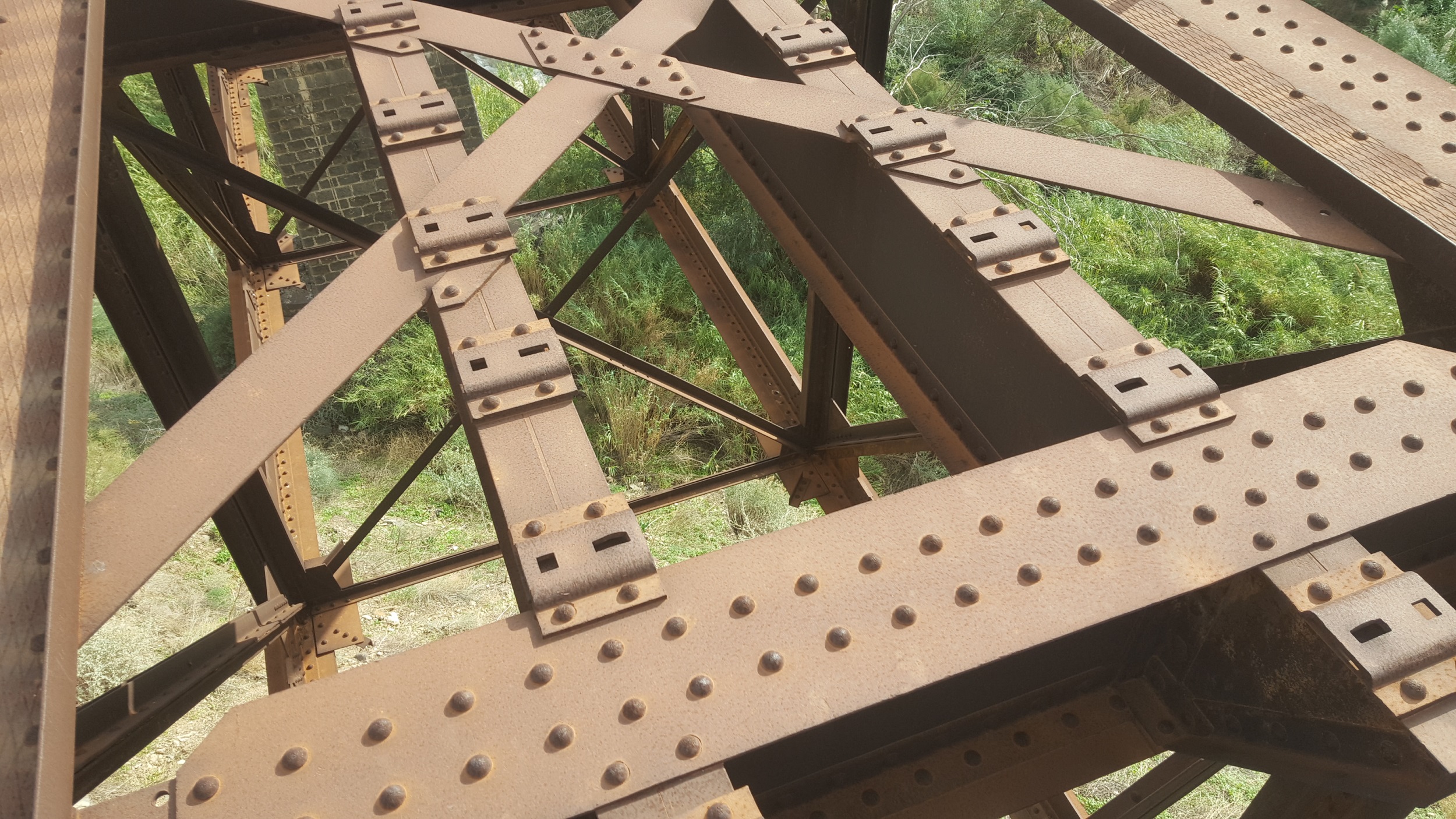 It seems the lower bed is missing some horizontal bracing, seems the contractor save a bit on the Sultan…
 The Eastern trestle. I could never understand what happened to it, looking from far away (see a pic like that below) – does the column collapsed? Is it some angle of view thing? Now it is clear – if fell off from the column due to the explosion and now the top part of it is sitting on the column.
(Image deleted due to copyright demand)
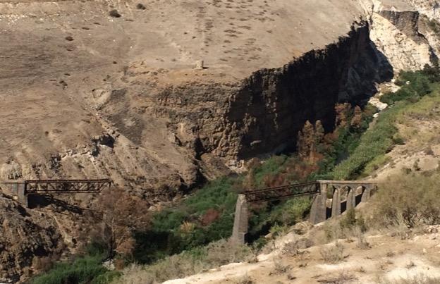
A far away view (Source: Amos Gal, Wikimedia)
 A far away view from the other side (Source: @PeterMillett1, Twitter)
The Yarmouk river down below, we later on visit the deviation dam down the stream
 Amit Ararat, on the Amits of Amitim LeTiyulim looking from above
 The Southern slopes on the Jordanian side
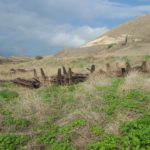
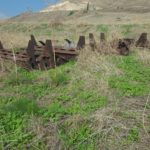
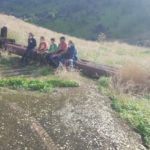
 Walking back to the area where the parts of demolished truss are
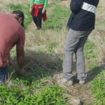
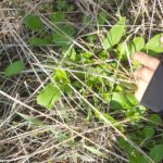
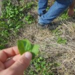
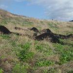
On the way, one our group showed us we are walking in an area full of Rocket and Watercress, which we used in our sandwiches and salads. We kept walking and eating along
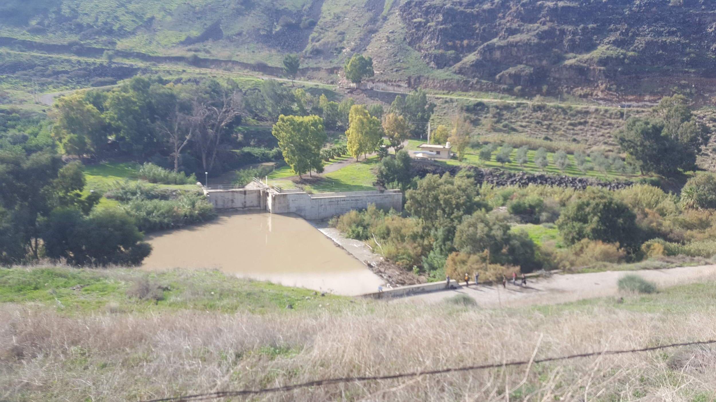 Before going back home – we went down the dam on the Yarmouk that used to divide its water between Israel (what is running to the Jordan river) and to Jordan (the country). But this is for a different post
 ![]()
 Climbing up back the border
 And we are back in, no need for passport, but also no Duty free
Construction of the bridge
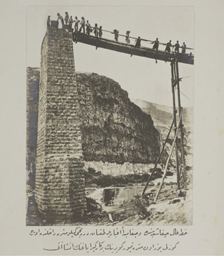 Construction of the stone column at the beginning of the Bridge (Source: www.palestine-studies.org)
The construction of the bridge by the Ottoman 1904 (Source: The Bridge point view sign)
 The second and largest Yarmouk Valley Bridge (Source: GettyImages.com)
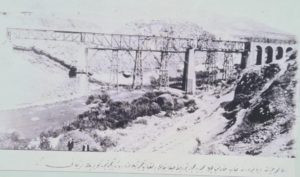
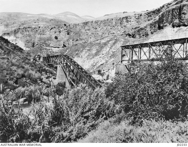
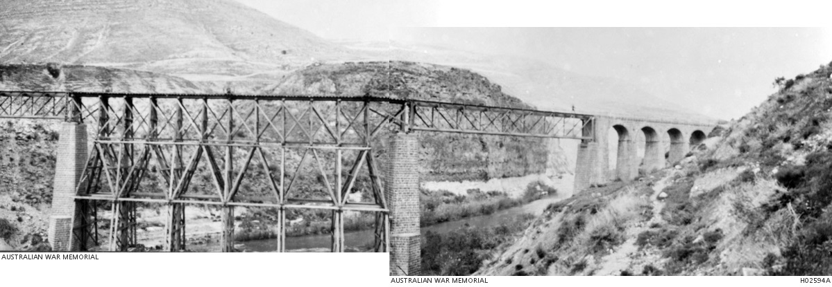
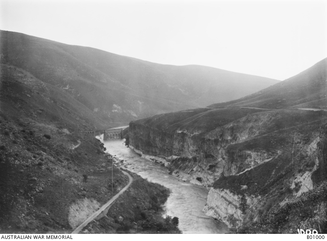
 The bridge before it has been sabotaged (Source: Australian war memorial)
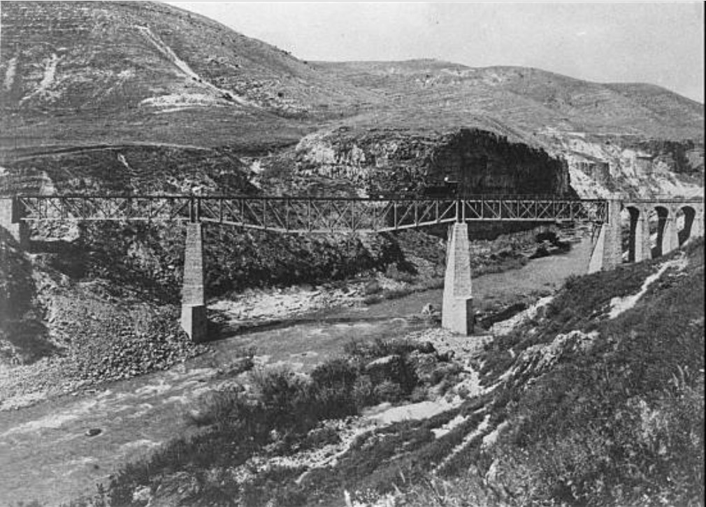
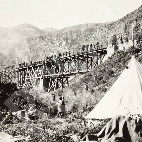
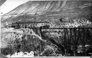
 The railway line (left) and bridge over the Yarmuk River. c1918 (Source: Australian war memorial)
The first explosion – 1917
The bridge was sabotaged first during WWI (on 21.09.1917 or 25-26.09.2917) by the Turkish retreat forces, or by forces protesting against Sykes–Picot Agreement, that disconnected the settlements of Galilee Panhandle from rest of Jewish settlements. It was later on been repaired by the Canadian Bridging.
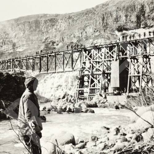
 Railway bridge between Semakh and El Hamme in Palestine – 1917, which was destroyed by the Turks in their retreat, and later repaired by Canadian Bridging Company (Source: Australian war memorial)
Re Construction of the bridge – 1918-1922
 Yarmouk Gorge from Camp, 1918 (Source: www.palestine-studies.org)
 Advance on Damascus – Passing Yarmouk Gorge, 1918 (Source: www.palestine-studies.org)
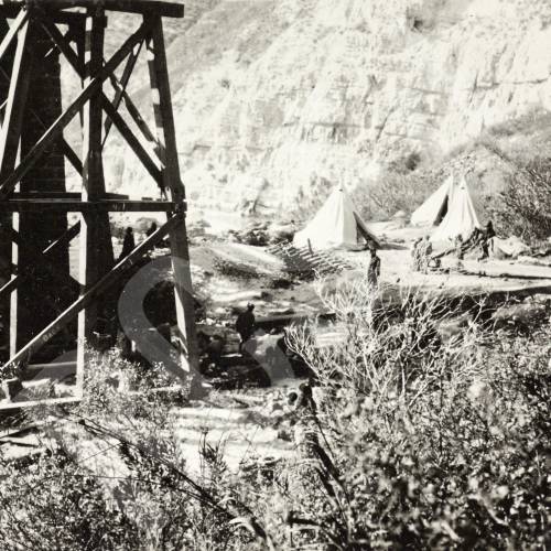 Camp Below Bridge at Yarmouk Gorge, 1918 (Source: archiveandlibrary.rcsed.ac.uk)
 1919. The Bridge tempoerary re built over the Yarmuk river, by the Canadian Bridging Company. Here it claimed The bridge was destroyed by the retreating Turkish Army. (Source: Australian war memorial)
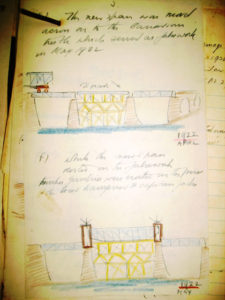
 Moving the 120 ton new steel span over the bridge – April 1922 (Source: Australian war memorial) – Damage to Yarmuk Bridge No.2 – Km.93.400 H.R. Main Line on 16/17 June, 1946
 Placing the main steel span in place – May 1922. Notice the pedestrian bridge at bottom of the picture (Source: ArcYonatan.blogspot.com)
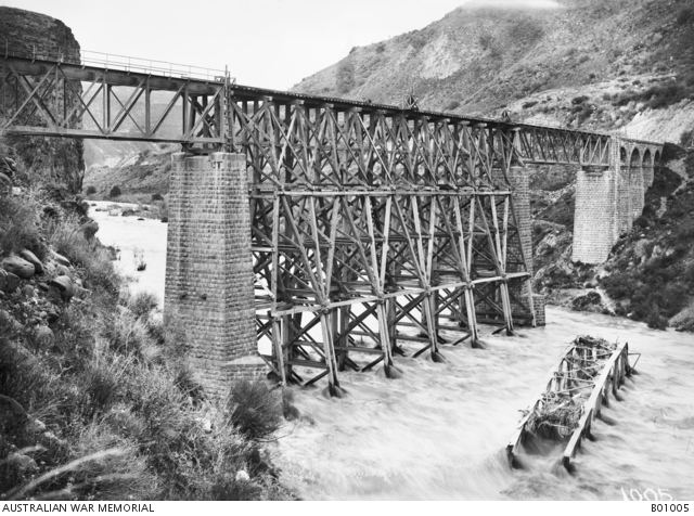 The rebuilt railway bridge over the Yarmuk River – June 1922. Note the destroyed section lying in the past flowing river. (Source: Australian war memorial)
the repaired bridge – 1922-1946
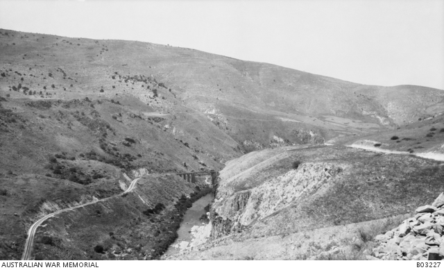
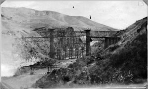
 A view of Yarmuk Gorge. In the background the railway bridge crosses the river. 02.1919 (Source: Australian War Museum)
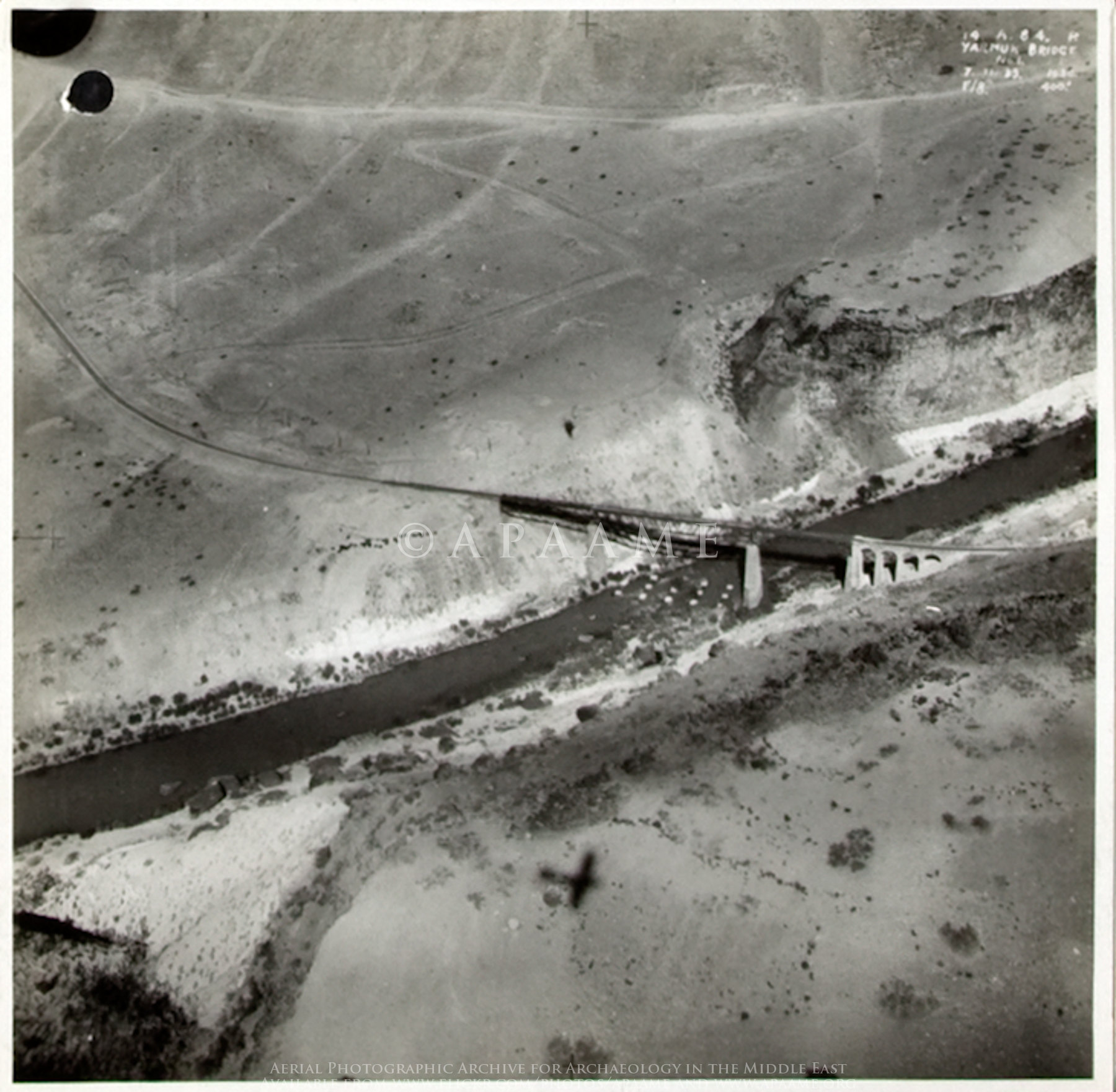 An Ariel photo of the bridge on 1934 (Source: Royal Air Force – The National Archives)
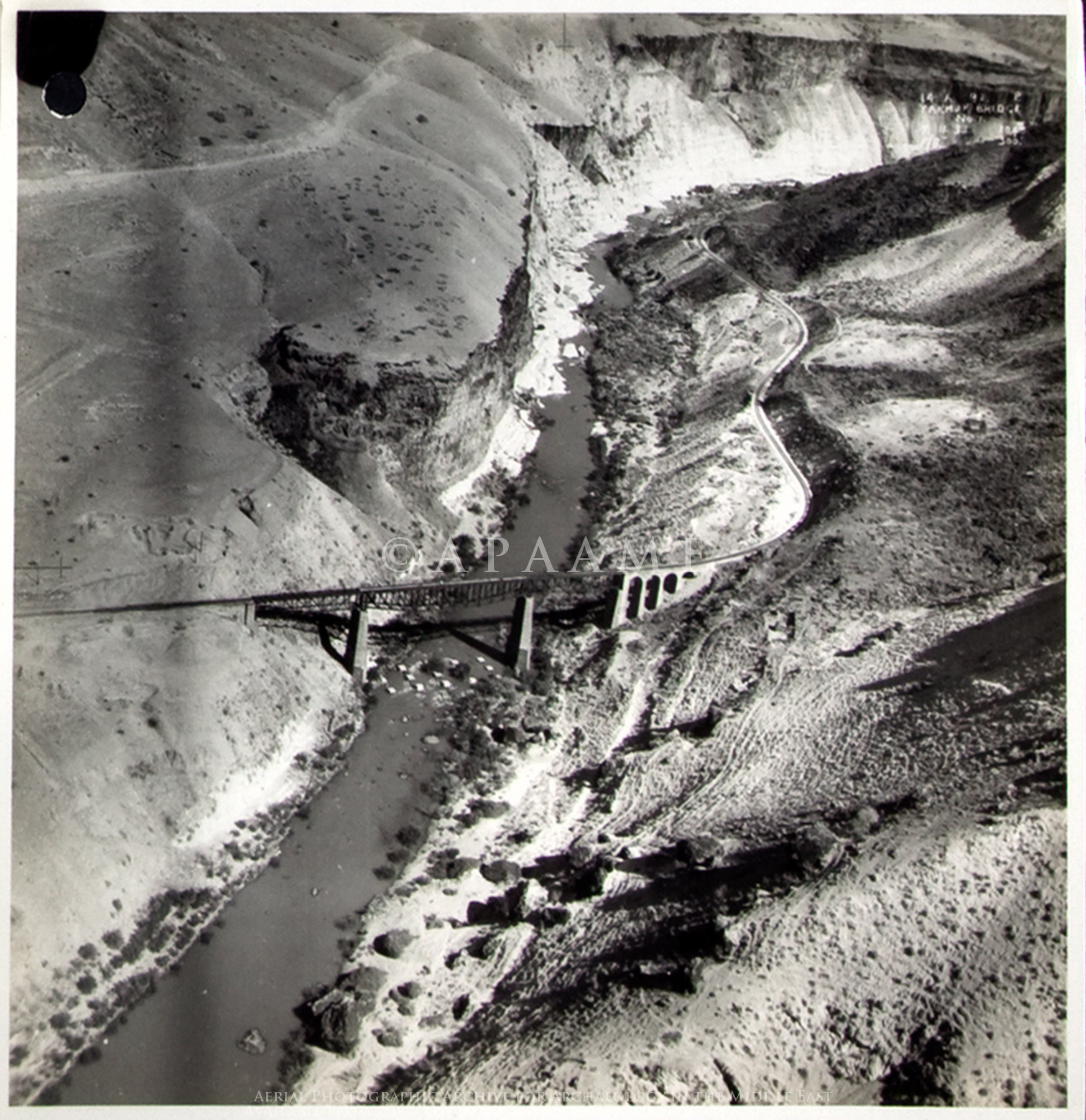 Another Ariel photo of the bridge on 1934 (Source: Royal Air Force – The National Archives)
Another Ariel photo of the bridge on 1934 (Source: Royal Air Force – The National Archives)
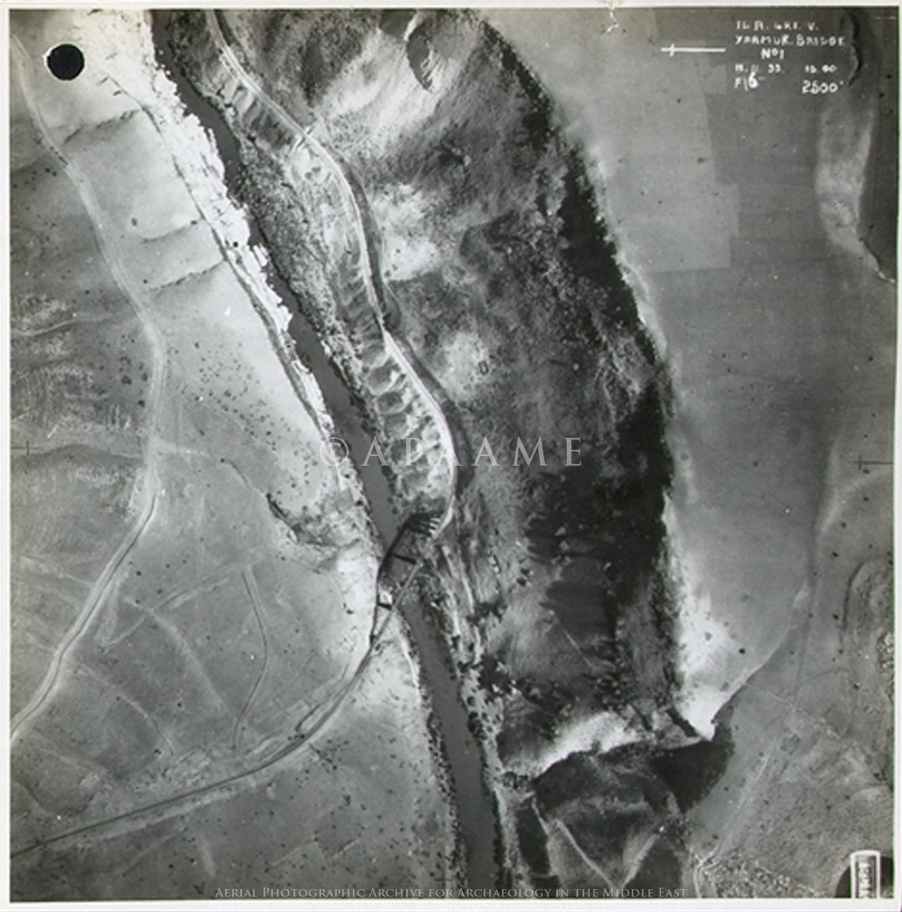
 The destroyed bridge and the railway, pic from around 1946 (Source: danielventura.wikia.org)
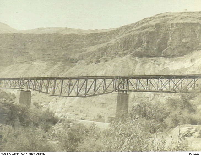
 The bridge before the second explosion (Source: www.palmach.org.il)
the Second explosion – 1946
 A close up view on the ruined bridge after the night of bridges explosion. The middle part, that has been sabotaged is lying in the Yarmouk river. The nearer part (Which is the eastern part) was stopped from falling off by the column it have been standing on before. The part stay the same today, as it was 74 years ago, as we saw today. (Source: www.yavnenet.co.il)
There were plans to rebuilt the bridge, but they were abandon for the understanding the mandate will probably expire. The design was done by the Haifian engineering company Fanta-Goldsmith that sketch the history of the Bridge and a proposal to fix it:
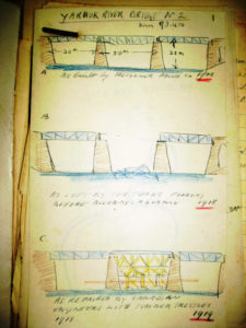
The built bridge, the explosion and the temporary supports on 1919 (Damage to Yarmuk Bridge No.2 – Km.93.400 H.R. Main Line on 16/17 June, 1946; Source: Mandate Railway engineering department 129/3227(2))
Moving and placing the new steel span (Damage to Yarmuk Bridge No.2 – Km.93.400 H.R. Main Line on 16/17 June, 1946; Source: Mandate Railway engineering department 129/3227(2))
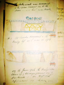
The rebuilt bridge (Damage to Yarmuk Bridge No.2 – Km.93.400 H.R. Main Line on 16/17 June, 1946; Source: Mandate Railway engineering department 129/3227(2))
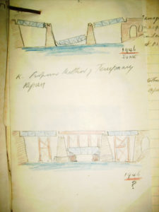
The bridge after the explosion and a proposed solution (Damage to Yarmuk Bridge No.2 – Km.93.400 H.R. Main Line on 16/17 June, 1946; Source: Mandate Railway engineering department 129/3227(2))
loading map - please wait...
Hi Gad
מניח שאפשר בעברית?
אחל׳ה כתבה עם תמונות ממקורות מדהימים!!! לגבי חלק מהתמונות- רואים בהן את גשר מספר 3, שממערב לבקעת אל חמה.
כמו כן- הסיפור על פיצוץ הגשר ב1916 או 1917 בתגובה להסכמי סייקס פיקו כנראה אינו נכון ולא נמצאו לכך סימוכין למעט בעבודה הגדולה של מאיר שפירא ז״ל.
אתה מוזמן לצפות בכתבה שלי על הגשר
https://arcyonatan.blogspot.com/2021/04/
שבת שלום
יונתן
Thank you for your comment –
I have written that the first the bridge have been blown up – “might been the Ottomans on their retreat or as a protest against Sykes–Picot Agreement”. It is still not clear as you mentioned here.
בתמונות אחרי הכותרת RE CONSTRUCTION OF THE BRIDGE
שתי התמונות הראשונות הם מגשר מספר 3שבת שלום שוב
יונתן
Thank you! 🙂
I have updated the text