
Hi,
Today I went visiting the border triangle which is where the Ruqqad river (the Israeli – Syrian Border) is flowing into the Yarmouk (the Israeli – Jordanian border) what makes it a Israeli – Syrian – Jordanian border triangle. The place is on the Yarmouk river east El Hamme bridge and the railway tunnel, but for Atzva it all just seems the same, this is why I was hiking with my brother of my brother in law.
The place in Israeli territory but over the border fence. This is to time to clear up this point: Israel has international borders (some are based on peace agreement or on cease fire agreement) those are lines marked up on maps. In order to defense those borders fences were built. The fences are not necessarily on the border itself, and sometimes far the border hundreds of meters away.
The reason the fences doesn’t follow the border line is it hard to physically follow a straight line drawn on a map – the are creeks and cliffs that need to be govern over. Sometimes the distance is to avoid fights over areas in disagreement.
This is why crossing the fence does not always mean you are crossing the border. Along the all hike our foot did not crossed the border but we still needed the IDF defense as we got close to it.
In one of the my first military reserve, I crossed the fence around this area and set a minefield of anti men mines. Back then I thought it is something we do quite regularly in military reserve but is not.
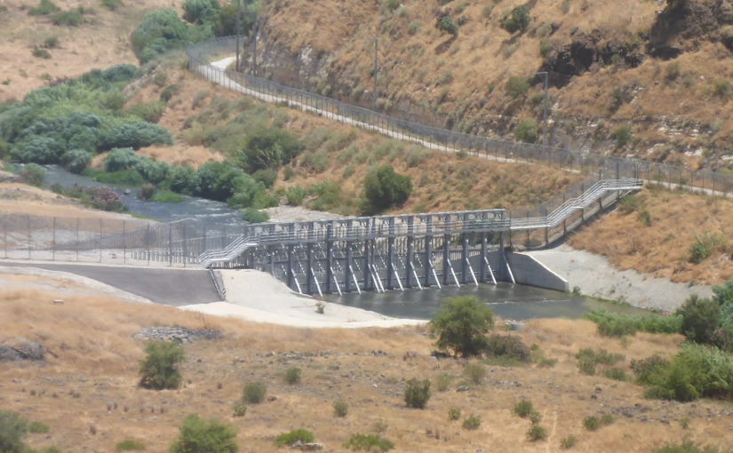
We got close to the obstacle set on the Yarmouk, but were not allowed to get down to it as earlier tours did. We were also watching Wadi Khaled abandoned Hejaz railway station and Tell El-Hawa (which means tell of the Winds, like Jisser El-Hawa is the Bridge of Winds).
The tell was barely explored and dig – Gottlieb Schumacher, who was both a civil engineer and an archeologist, visited the place as part of the survey done for the construction of the railway along the Yarmuch (it was a branch of the Hejaz railway). Since 2018 three expeditions have been visited the place, and more are planned, to find a sophisticated pottery factory which are products found as far as Cyprus. The place had what a settlements needed back in the days: water, agriculture, defense but barely had roads. The quality of the clay found here, which allow to produce both thick pottery for cooking and storage and thin pottery for dishes, govern the distance from main roads.
After it we were driving along the Israeli – Jordanian border fence along the Yarmouk river and up to Mukheiba tunnel.
Take Care
Gad
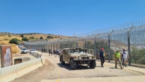
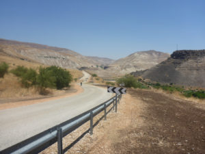
The line of cars along the border fence and an IDF Hummer
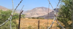
The border triangle behind the fence
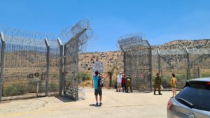
The open gate in the border fence
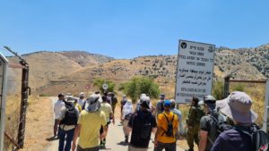
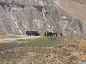
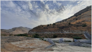
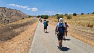
Getting in the military zone
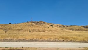
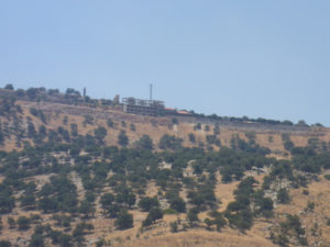
The Israeli IDF post on top of us to the north
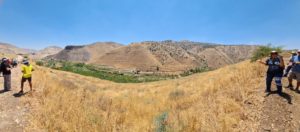
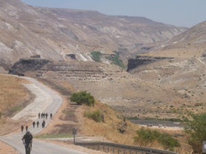
The Yarmouk valley, the border triangle on the left. The next pics are shown from left (East) to right (West):
The UN post where you can view over the border triangle without crossing the fence.
Getting closer to the border triangle
IDF soldiers standing on the edge, just above the border triangle
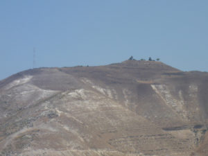
Tell El-Hawa to the East
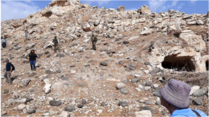
One of the expeditions to the tell (Source: Walla.co.il, Evyatar Lichtman, Keshet Yonatan)
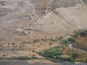
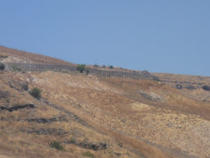
The vertical white line (which is a trail) is where the Syrian – Israeli really is. The herd of sheep (brown dots at the middle of the picture) you see is probably Syrian and is in Israeli territory
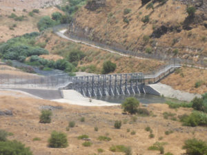
Below the tell there is on an obstacle on the Yarmouk river. This just after the Ruqqad flows to the Yarmouk. Ruqqad in Arabic means quietly as it flows slowly.
The obstacle to prevent Syrian penetrations A close look on the obstacle (Source: Walla.co.il, Evyatar Lichtman, Keshet Yonatan)
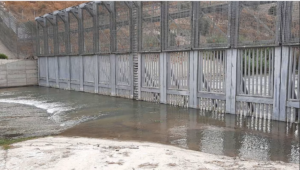
A close look on the obstacle (Source: Walla.co.il, Evyatar Lichtman, Keshet Yonatan)
Above the obstacles is a Syrian military post. Those kind are called Syrian Pita as they round and low
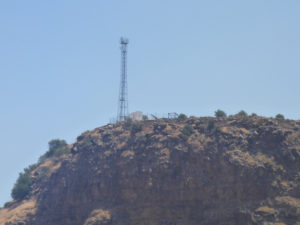
Jordanian antenna to the East and over the Basalt cliff
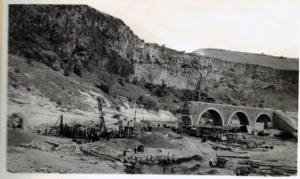
Wadi Khalid railway bridge with 3 stone arches to the south of us
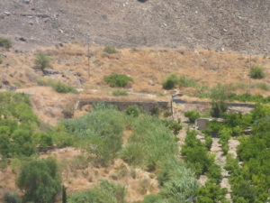
Wadi Khalid abandoned Hejaz train station to the south of us
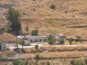
The train station support buildings. All the green fields along Yarmouk between the river and the road here are Jordanian agriculture but is on Israeli territory.
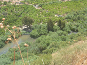
The Yarmouk
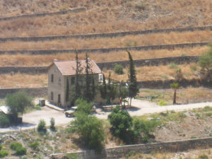
Jordanian military building
Going up and back to cars
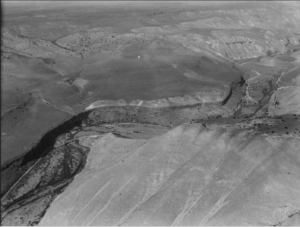
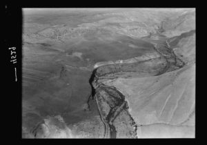
Two Aerial photos of the border triangle from 1932, look on the top of the pics (Source: Wikimedia, Wikimedia)
._Wadi_Yarmuk_showing_R.R._(i.e.,_railroad)_in_the_wadi_bed_and_the_bridge_of_arches_across_the_river_LOC_matpc.15963.jpg)
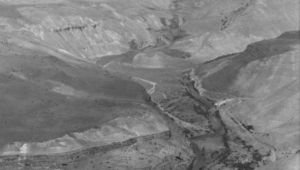
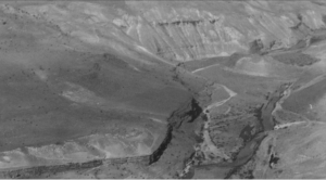
And a closer look from each of the pics above: the tel in the middle, the Yarmouk flowing from the right, the Ruqqad from the left and it join the Yarmouk in the bottom of the pic
PAGE 27 OF A WORLD WAR II PHOTO ALBUM Top photo Entrance to the Yarmuk Gorge near el Hamma Middle photo Railway bridge washed out at Wadi Khalid Lower photo Diversion at Wadi Khalid (Source: Flicker.com)
loading map - please wait...
גד שלום רב
האם אפשרי להשתמש בתמונות שלך של תחנת הרכבת עבור פרסום אצלי בבלוג? כמובן שאתן לך קרדיט
שיהיו ימים שקטים
יונתן
Hi,
I will be happy if you use pics from the website for you blog.and credit for. If you can a link to my website that will be great.
Gad