
Hi,
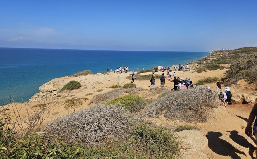
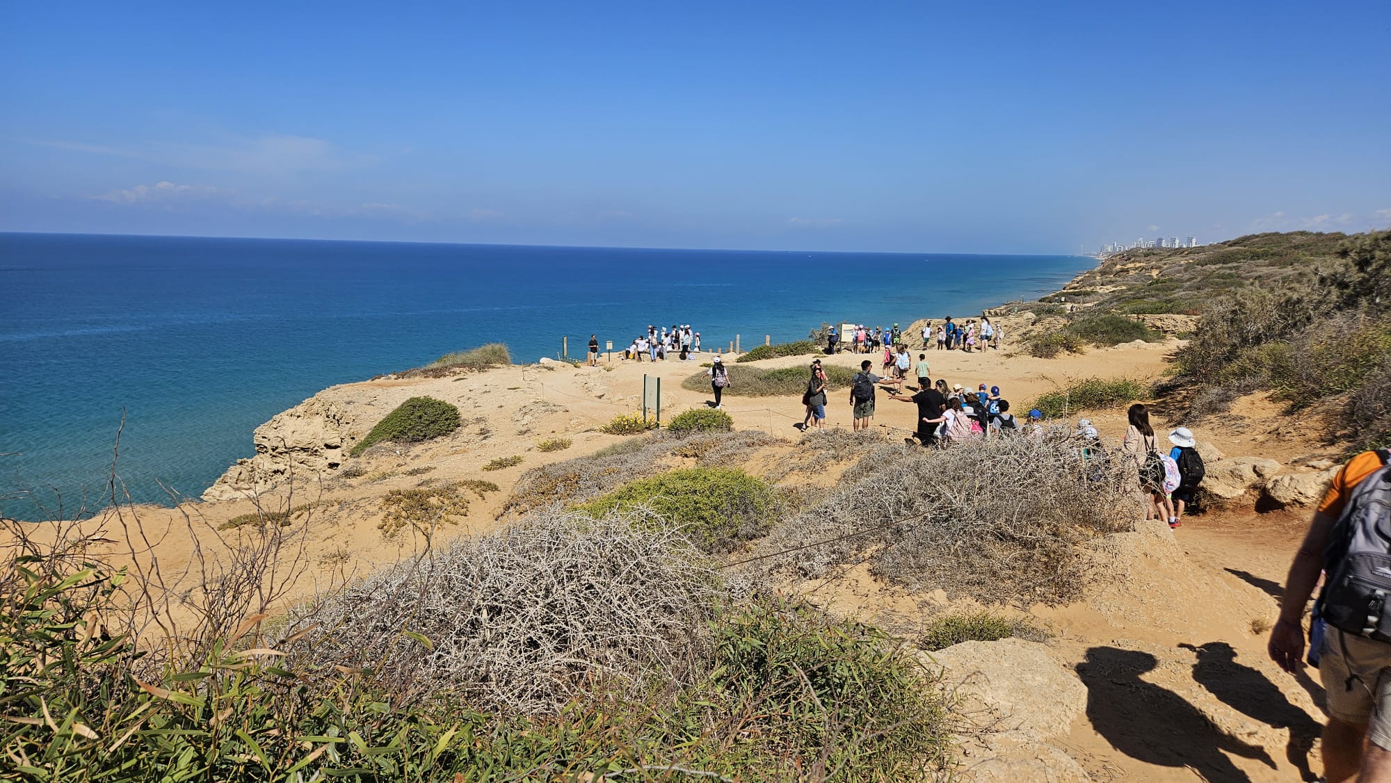
I visited Hof HaSharon National Park as part of Mindal 2nd class yearly school hike. We took the cliff trail which walks on top of the cliff and gives beautiful view of the sea, as well as view of the fauna.
It is an short easy trail (fits for 2nd grade kids), but all of it is in the sun and and in the sand. So keep those in mind when you plan your visit here. There are signs along the trail in Hebrew and Arabic only.
Take Care
Gad
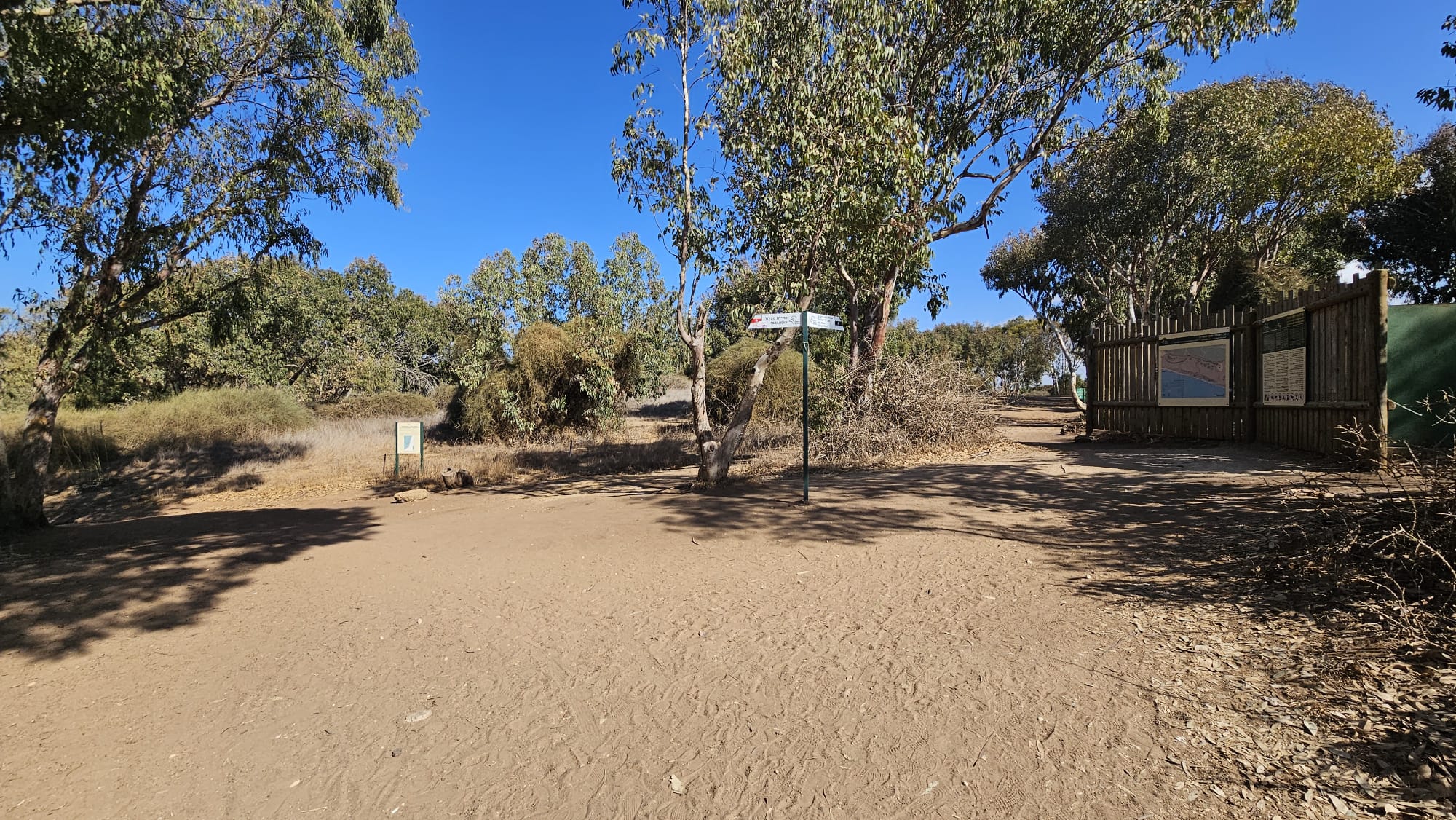
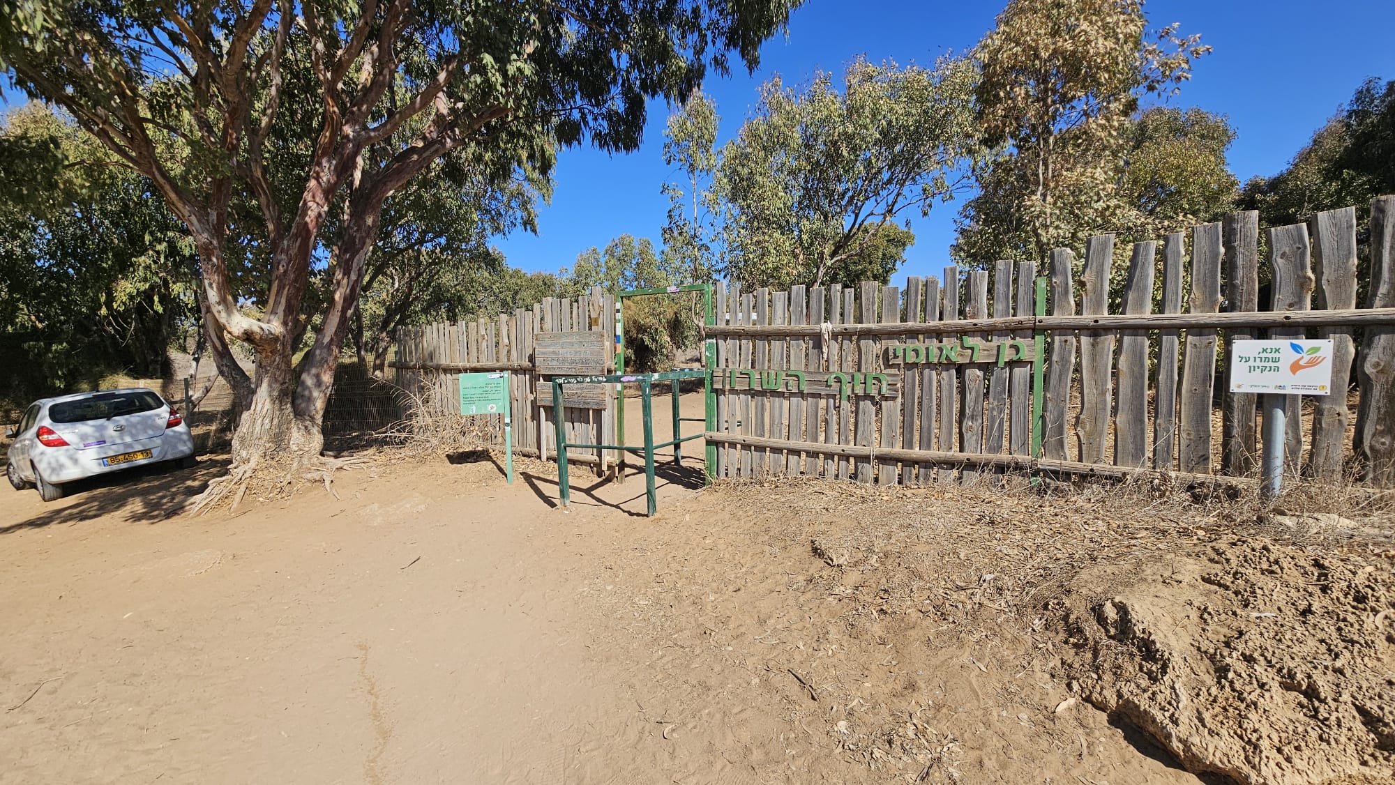 Hof HaSharon National Park Entrance
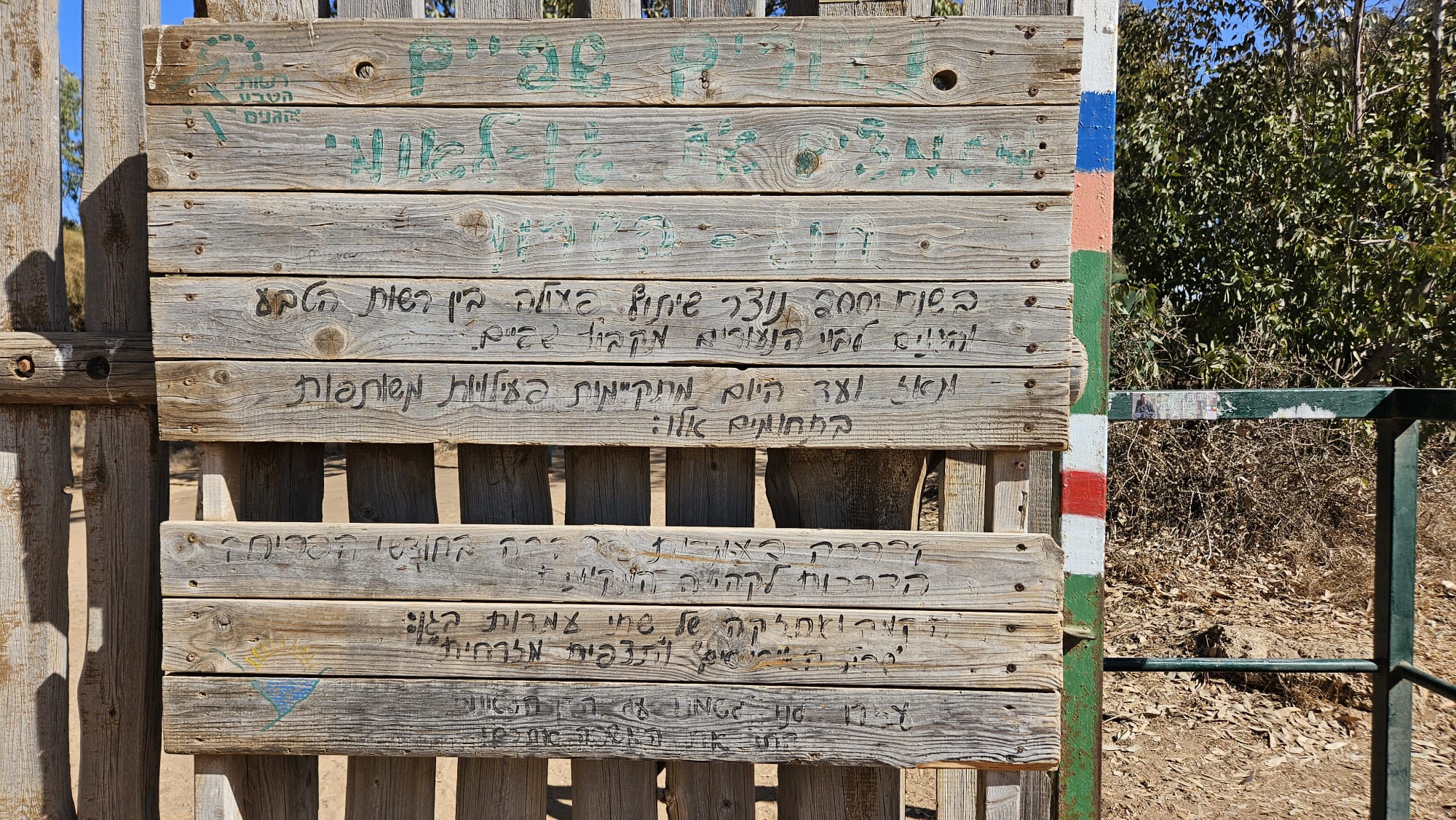 The cooperation between Israel Nature and Parks Authority and Kibbutz Shefayim youth in Hof HaSharon National Park
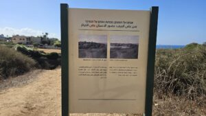
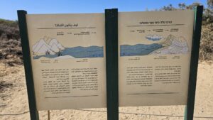
 Wood wall with some information about the the park
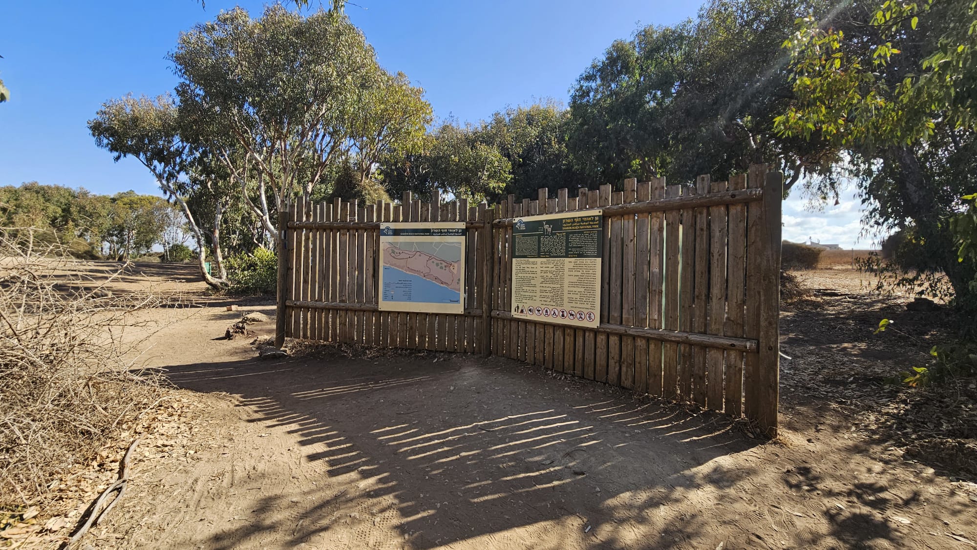
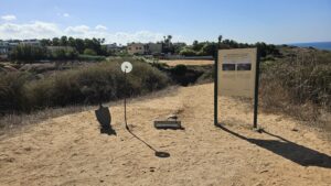
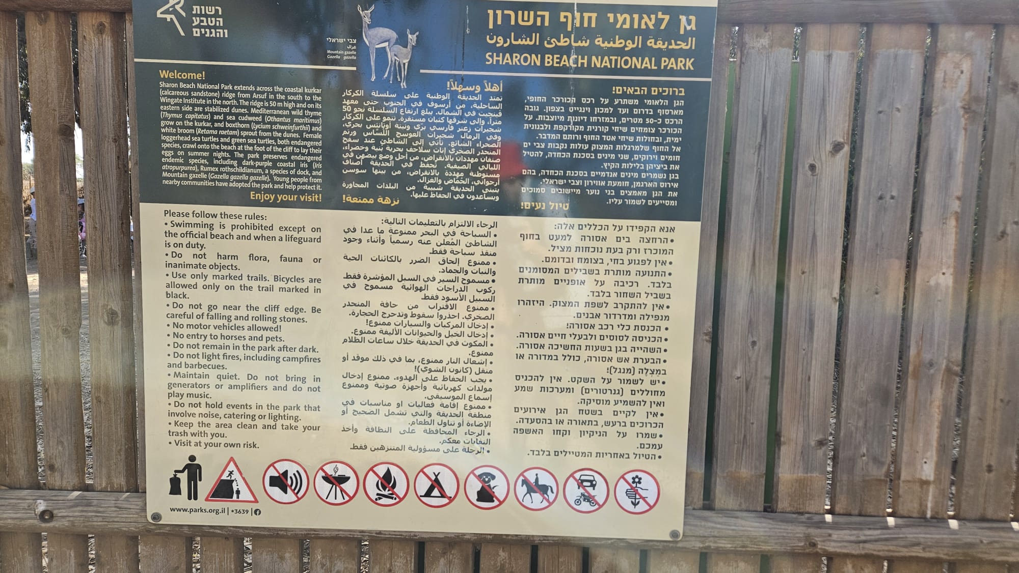 First sign – Sharon beach national park
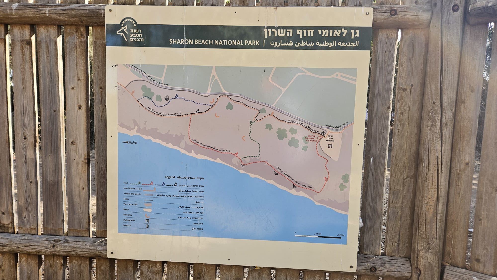 2nd sign – map of the Hof HaSharon National Park
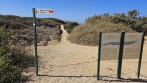
 Trail signs – we took the cliff trail
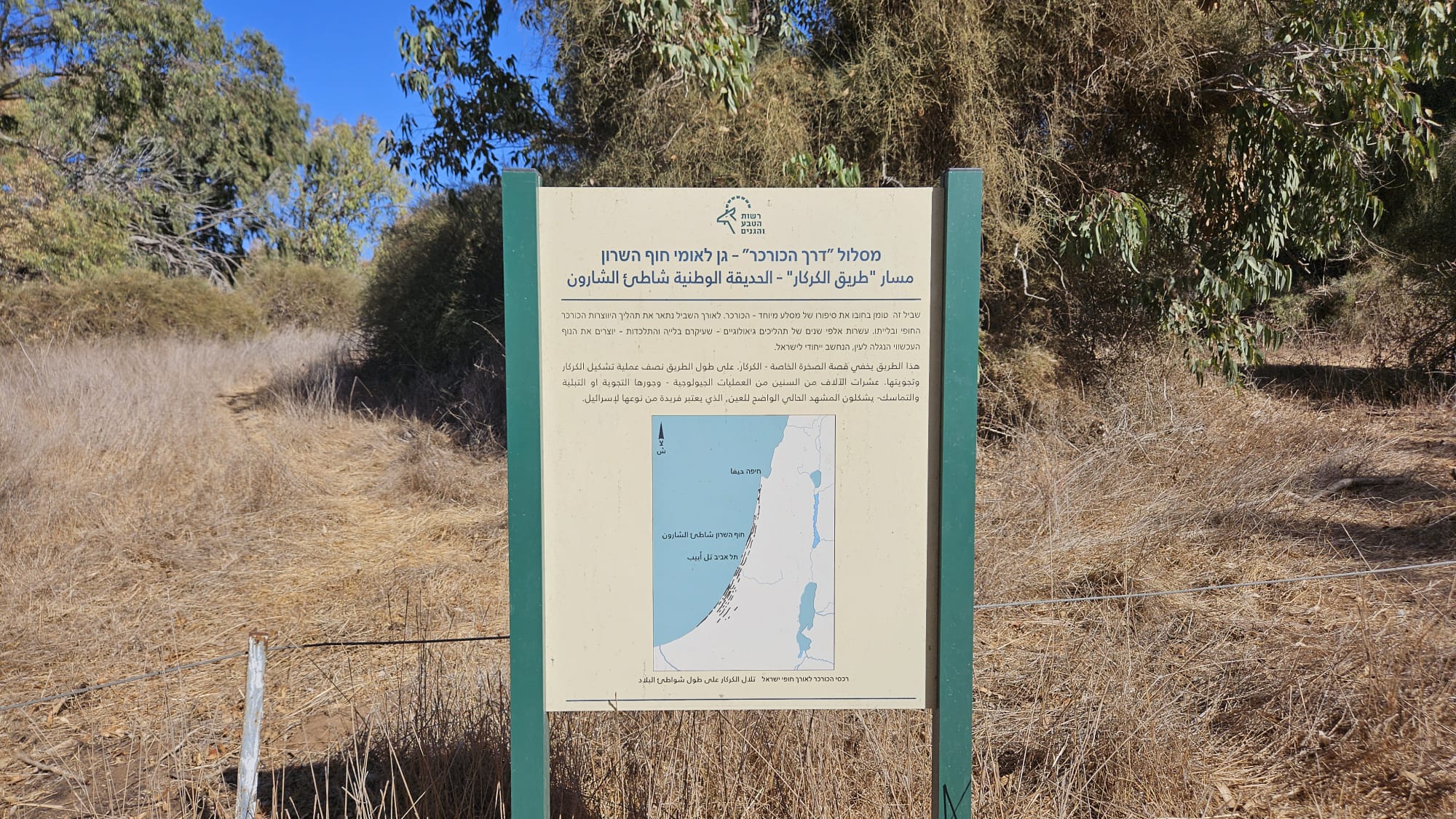 The Kurkar trail (halting in the map and signs it is the cliff trail…)
This trail contains the story of a special rock – the Kurkar. Along the trail, we will describe the process of coastal Kurkar formation and weathering. Tens of thousands of years of geological processes – mainly weathering and coalescence – create the current visible landscape, which is considered unique to Israel.
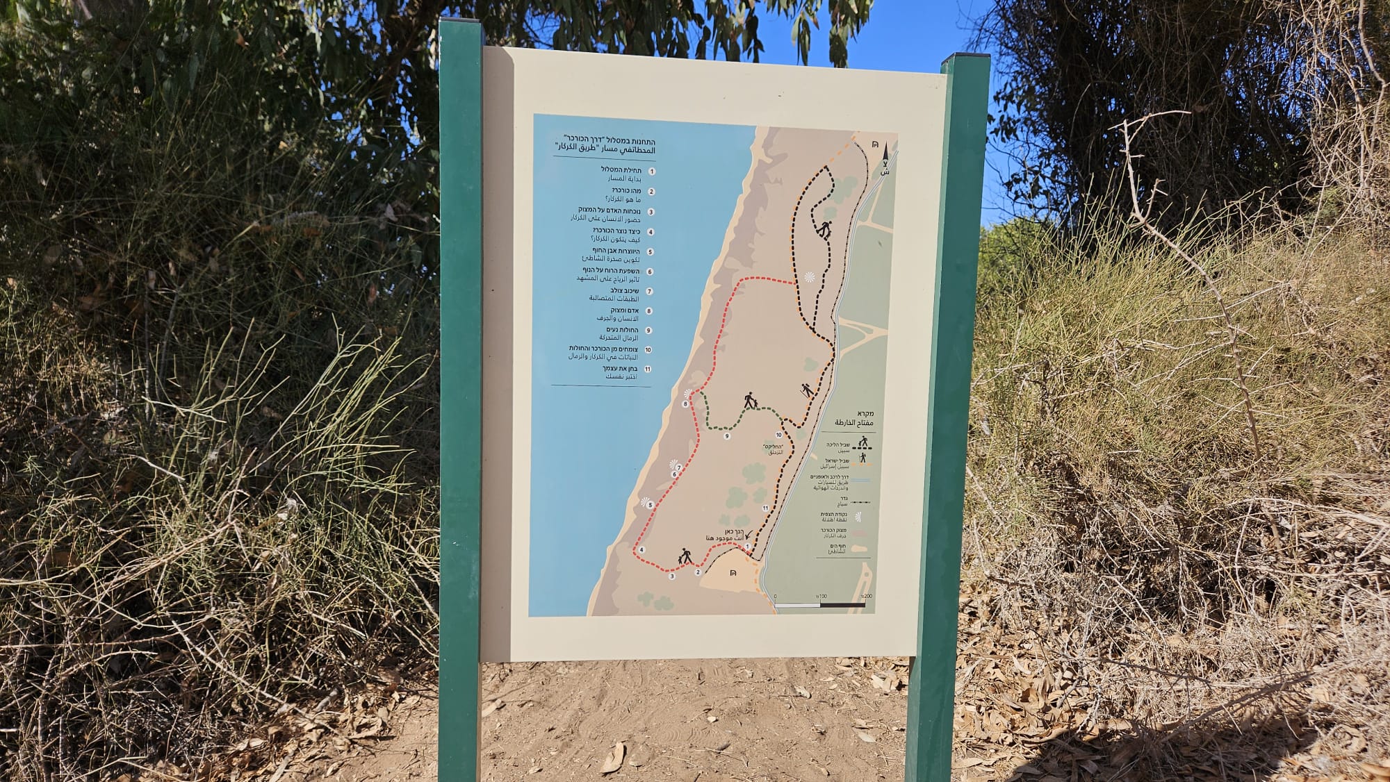 The stations along the Kurkar trail
1 The beginning of the route 2. What is Kurkar? 3. The presence of man on the cliff 4. How is Kurkar formed? 5. The formation of beach stone 6. The influence of the wind on the landscape 7 Cross-bedding 8 Man and the cliff 9 The sands move 10. Growing from Kurkar and sands 11. Test yourself
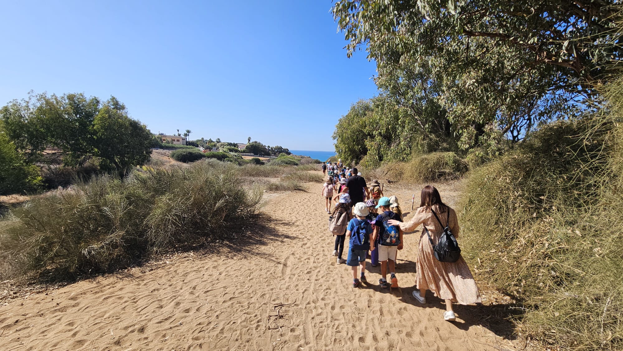 2nd class yearly school hike
We are on the cliff: the human presence on the Kurkar
Arsuf before and after construction – visualization The houses of the settlement of Arsuf, south of you, are built on the Kurkar cliff. You can imagine the view of the cliff and the sea without the construction. Further along the route, we will be exposed to the effects of development on the Kurkar cliff, unique to the Land of Israel.
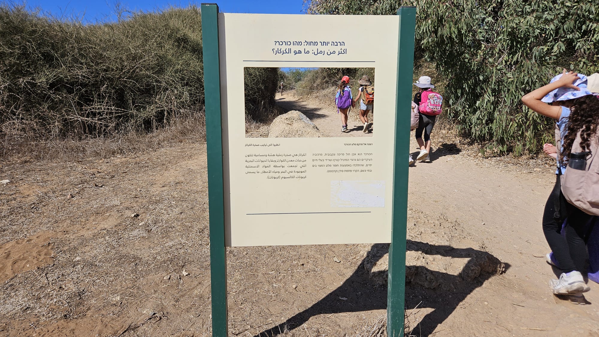 Much More Than Sand: What is Kurkar?
A Look at the Texture of Kurkar Rock.
Kurkar is a brittle and porous sandstone. Its main components are grains of the mineral quartz and the remains of marine animals, which have been bonded together by a cementing substance found in the sea and rainwater, called calcium carbonate
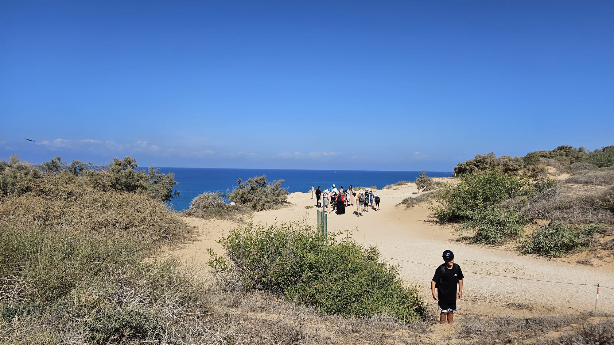 The sea!
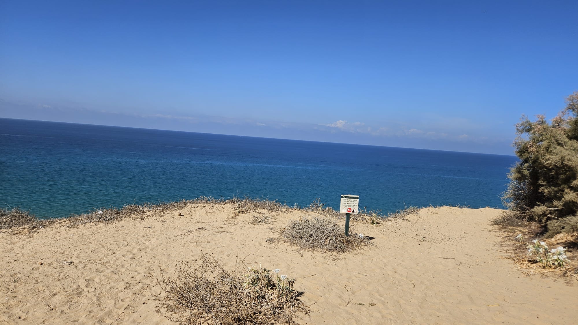 The trail meet the cliff above the sea. The cliff is danger of collapsing, so you better keep a distance from the edge
Kurkar is Born: How Did the Rock Form?
On the image top: Weathering and erosion => Marine transport and erosion => Sand Whipping on the Beach => Dissolution and Consolidation => Consolidation into Rock
Bottom of the image above: East African mountains | Nile River | Mediterranean Sea | The Mediterranean Sea | The Beach in Israel | The Kurkar Ridge
The Kurkar hills along the coastal plain began as grains of sand blended with the debris of marine animal skeletons. Over the years, this mixture dissolved and re-consolidated due to the cementing material – carbonate (calcium carbonate) and seawater.
Rainwater that percolates into the sandy soil causes the carbonate to dissolve and re-consolidate during the dry seasons. When this action repeats itself over many years, it leads to the consolidation of all the components and their transformation into kurkar rocks.
The sand currently found on Israel’s beaches originated in the mountains of East Africa, in the area of the Nile River sources, thousands of kilometers south of here. Over ages and ages, rocks in those mountainous areas eroded and were washed into the wide river, and were transported north by it, to the Mediterranean Sea. The long journey wore the rock fragments down into sand. Sea currents brought the sand to our region, and the waves whipped it onto the shores of the land
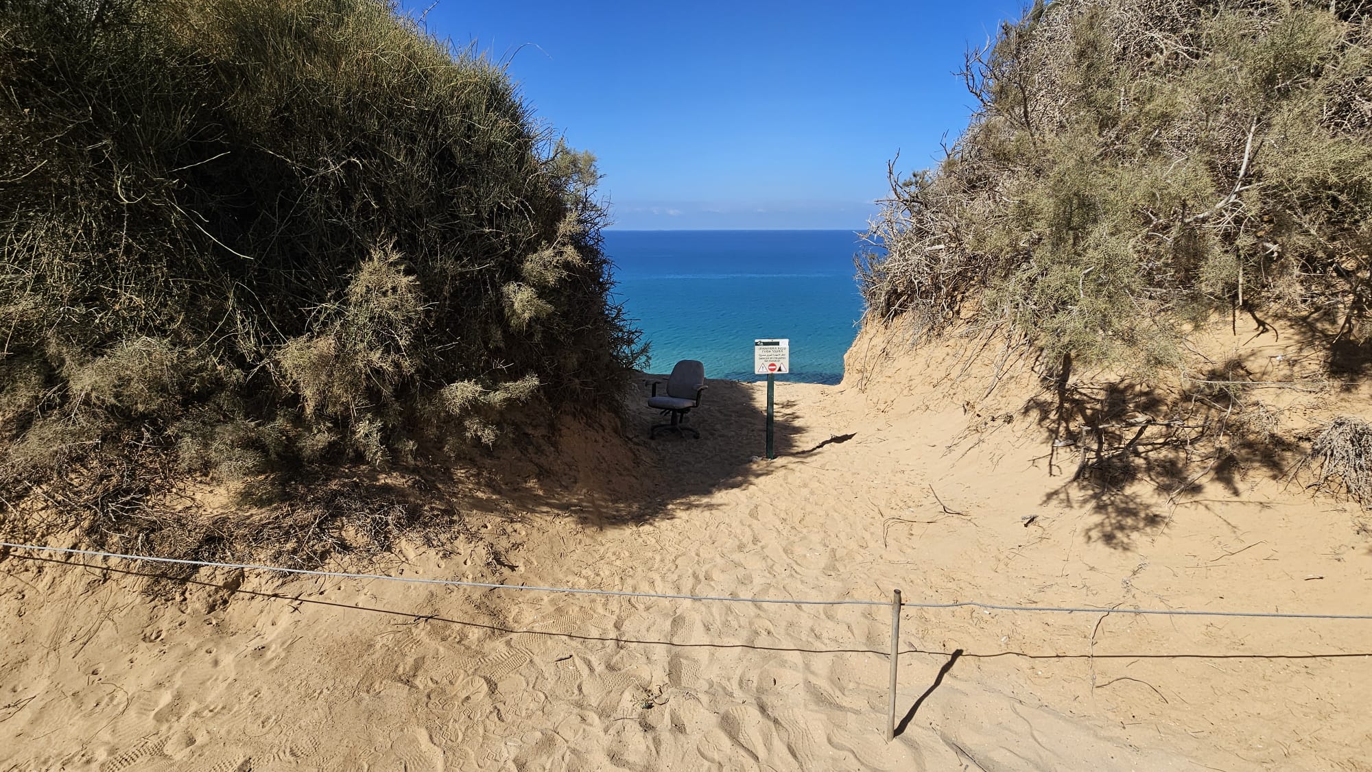 Although it is over the rope – it is a nice place to sit, and there is already a chair here
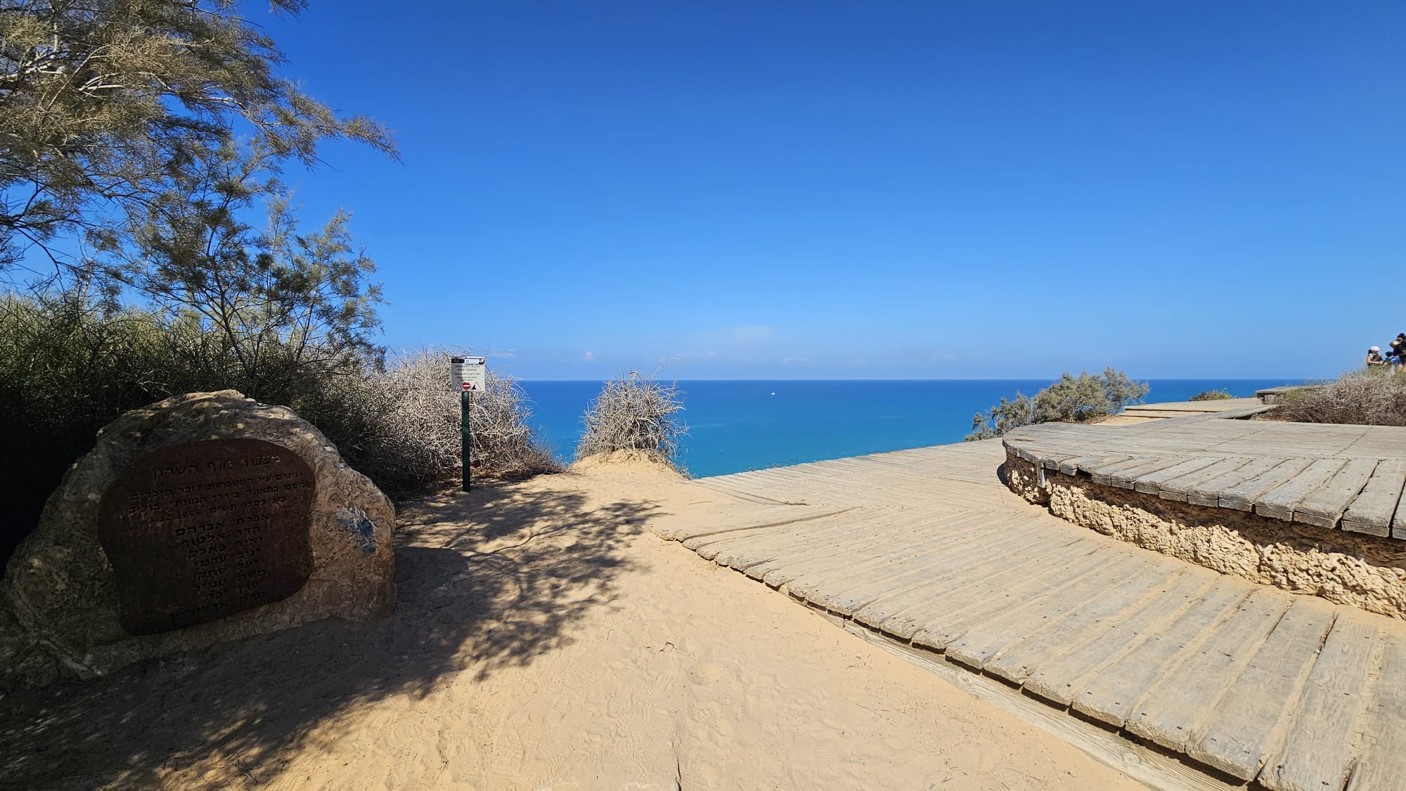 A view point and a walkway
 HaSharon beach view point
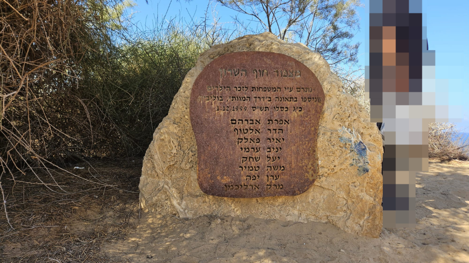
Was donated by the families in memory of the kids we died in an accident in the Death Road, Bolivia. Kislev 23 5766, 1.12.1999.
Efrat Avraham, Hadar Altuf, Yair Flack, Yaniv Armi, Yael Shahak, Moshe Tamir, Eran Yaffe, Mark Arlichman
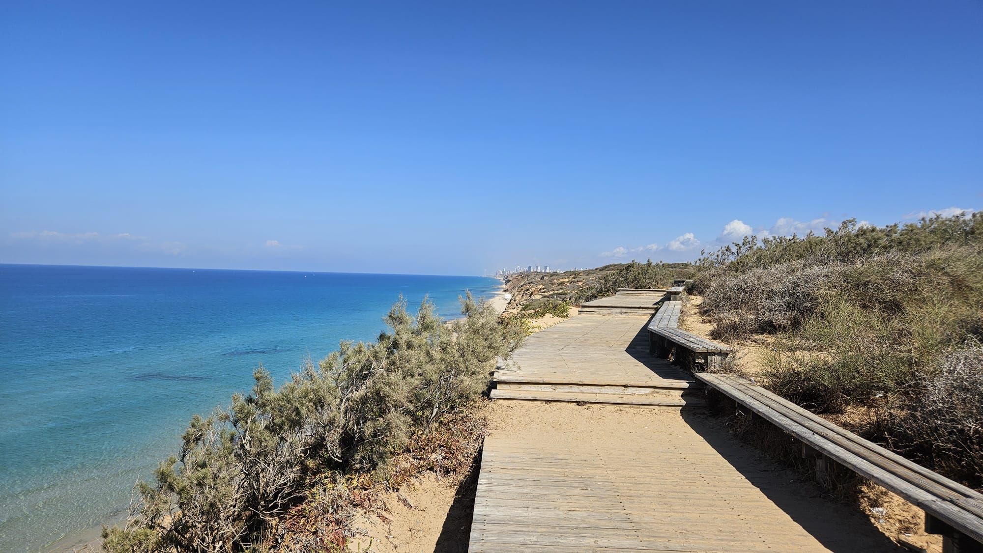 The walkway over the cliff
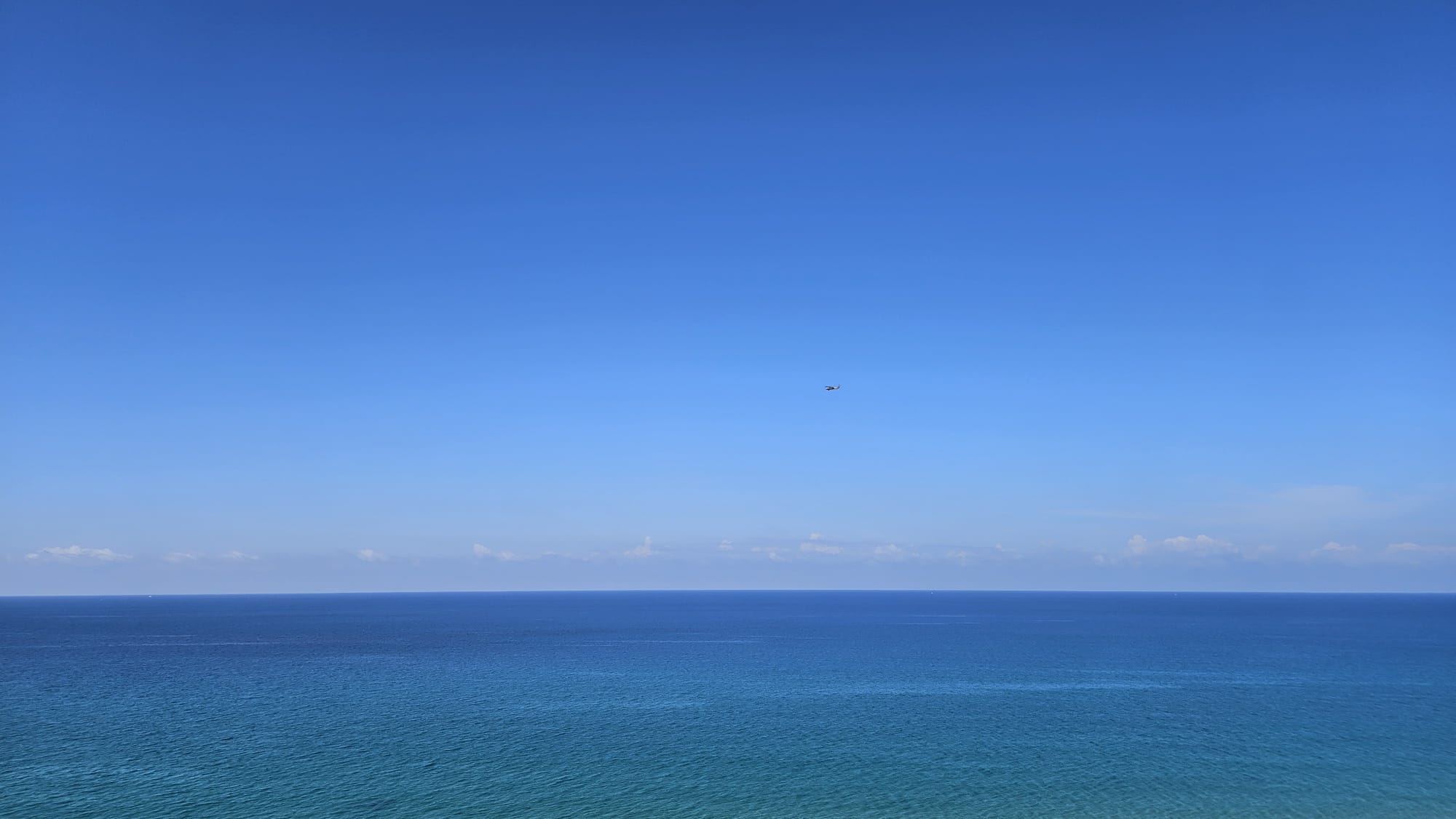 Where the sky meet the water
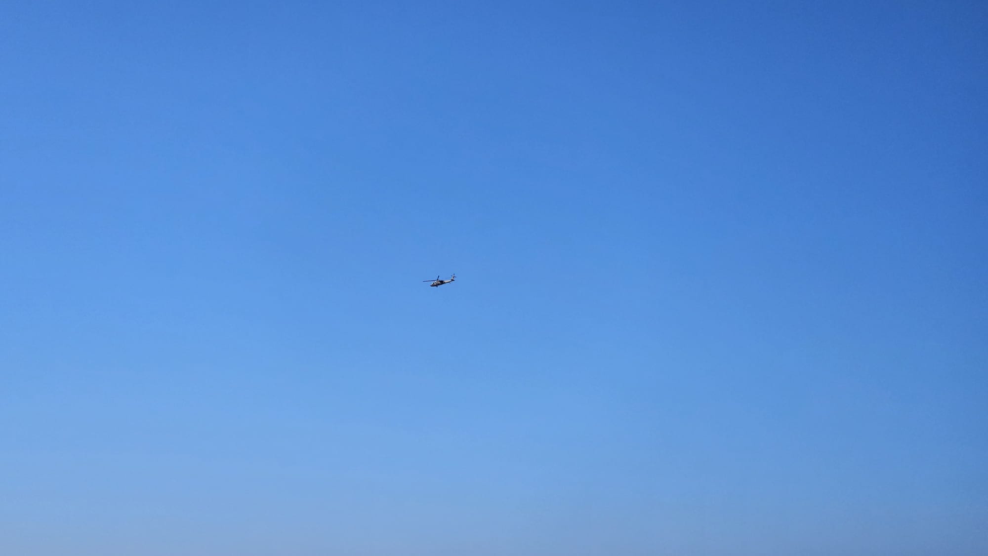 Military Helicopters were running north and south along the shore
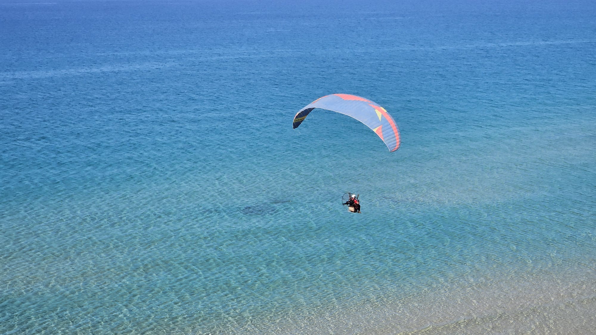 As well as paragliders (some are low and some are low)
 Or view
 Or view
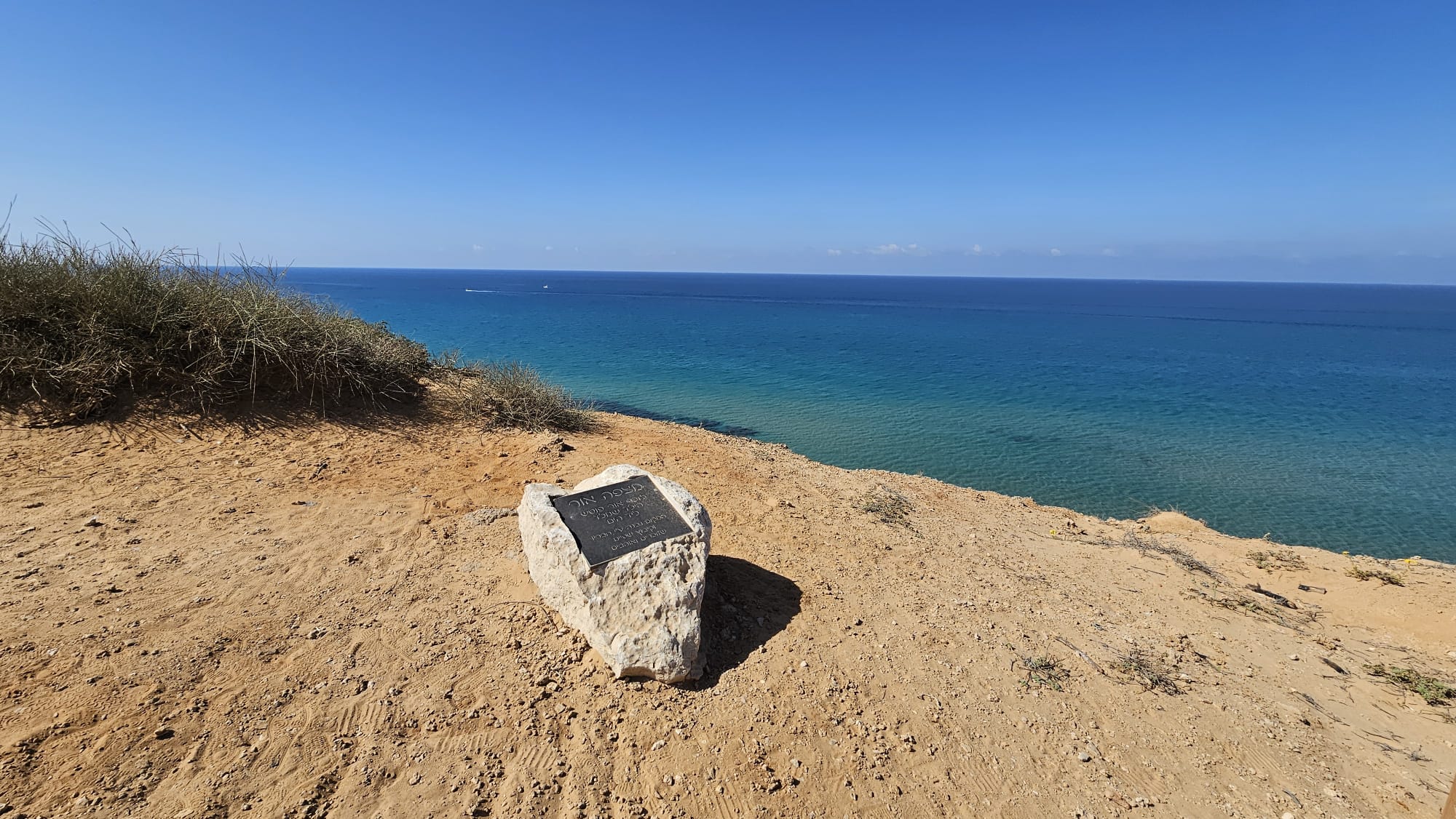
In memory of Or Potsh, the kid who was born by the sea
The place was built by his friends and Kibbutz Shefayim who remember and love
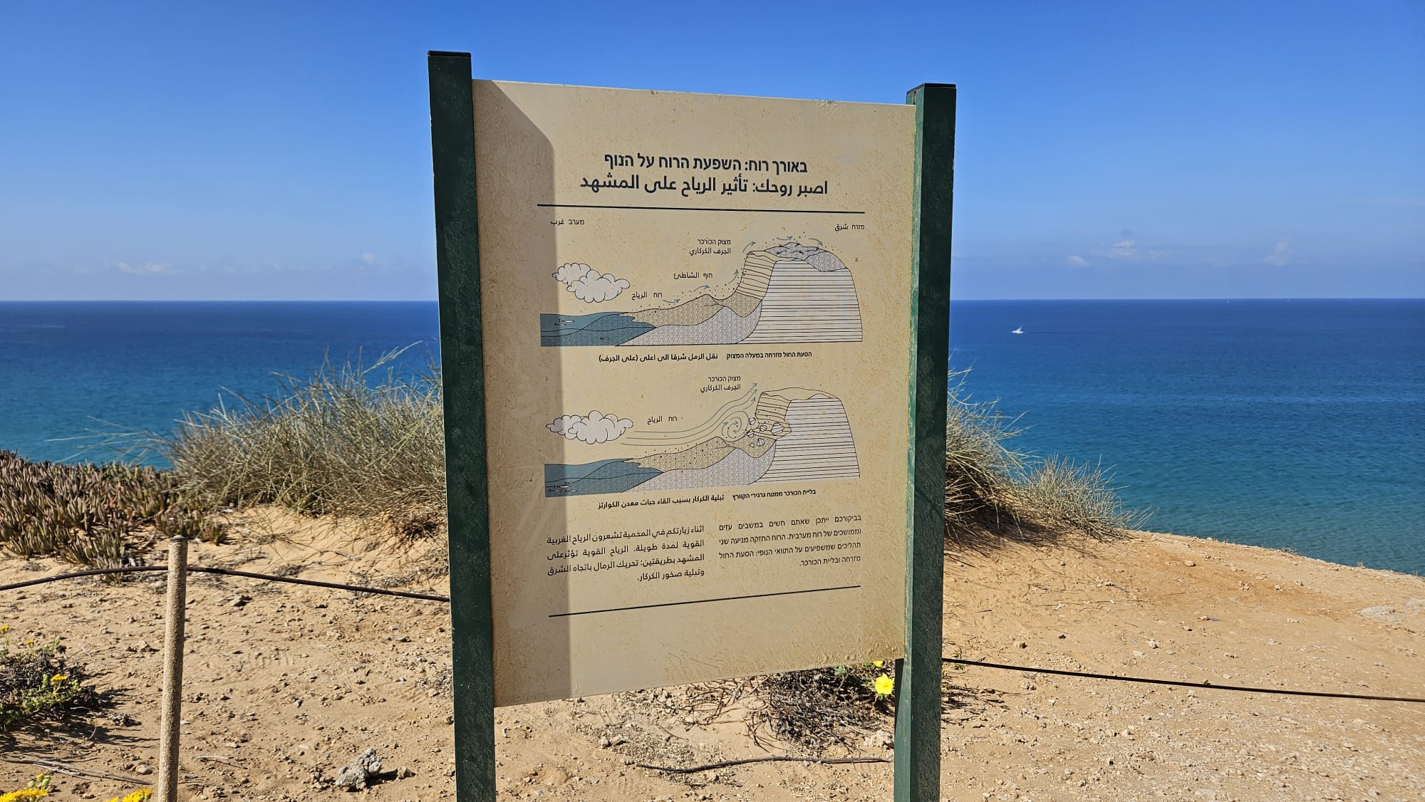 In Longevity: The Effect of Wind on the Landscape
On the image above Wind, Beach, The Kurkar Cliff
The Kurkar Cliff During your visit, you may feel strong and prolonged gusts of westerly wind. The strong wind drives the sand to the east and wears down the Kurkar.
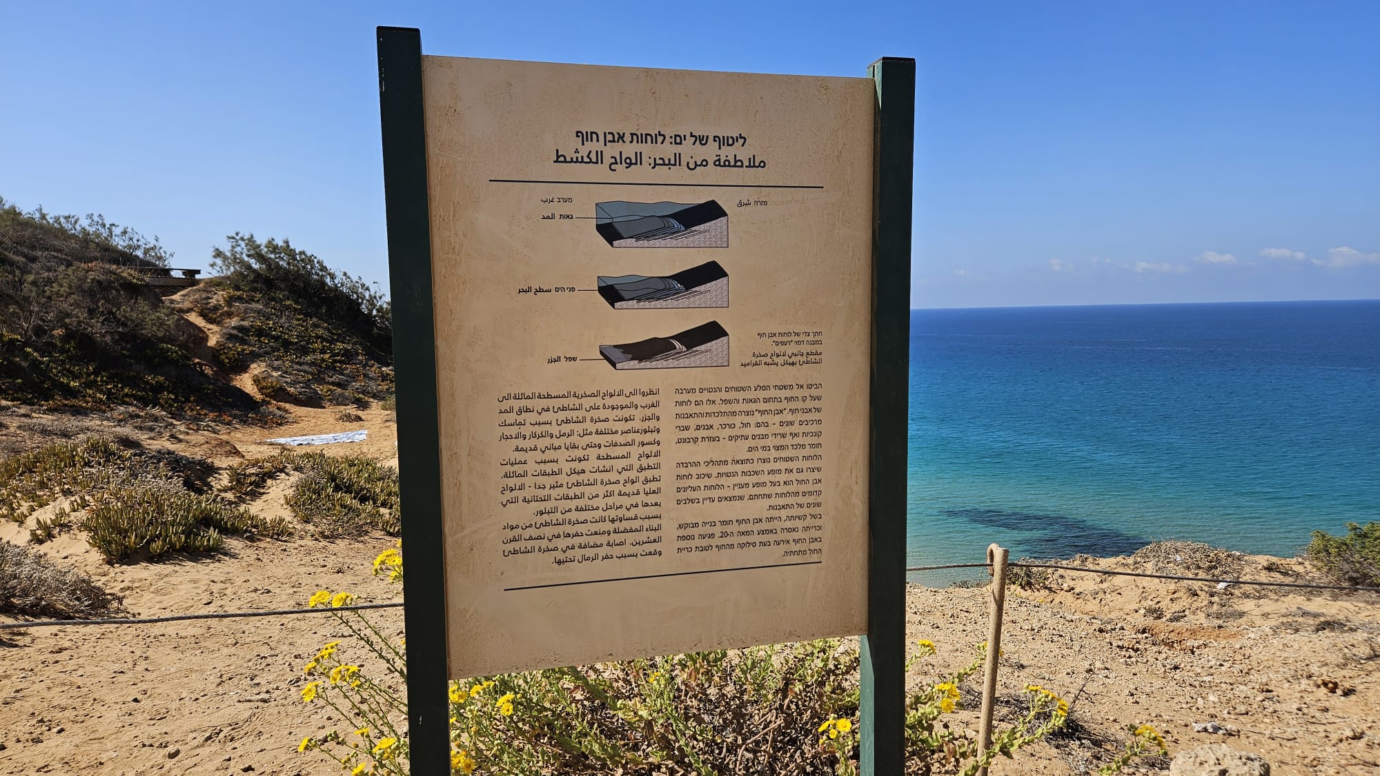 A Caress of the Sea: Beachrock Slabs
Right of the image above: Side profile of beachrock slabs in a “tile-like” structure.
Look at the flat, westward-sloping rock surfaces on the shoreline within the intertidal zone. These are slabs of beachrock. “Beachrock” was formed from the consolidation and fossilization of various components – including: sand, Kurkar, stones, shell fragments, and even remnants of ancient structures – with the help of carbonate, a cementing material found in seawater.
The flat slabs were created as a result of the deposition processes that also created the appearance of the tilted layers. The stratification of the beachrock slabs has an interesting appearance – the upper slabs are older than the slabs beneath them, which are still in various stages of fossilization.
Due to its hardness, beachrock was a sought-after building material, and its quarrying was banned in the mid-20th century. Further damage to the beachrock occurred when it was removed from the beach in favor of quarrying the sand beneath it
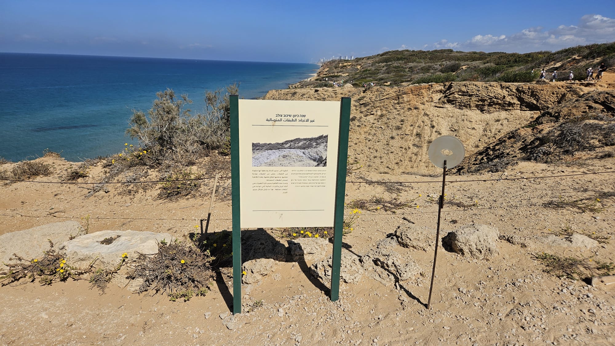 Change direction: cross-bedding. Look at the Kurkar rocks and notice that the rock is built up in layers. Some are parallel and some are inclined diagonally and cross each other. This phenomenon is called “cross-bedding”. The phenomenon occurs due to the frequent change in direction of winds and even water currents, which tend to swirl in different directions and shape the shape in which the Kurkar has stabilized.
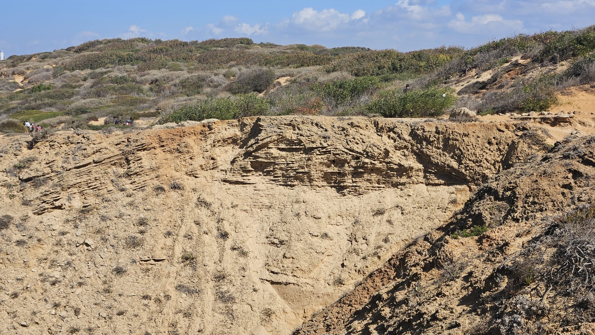 The directions of rock layers across the creek
 Memorial sticker for Maoz Morall on the back of the sign
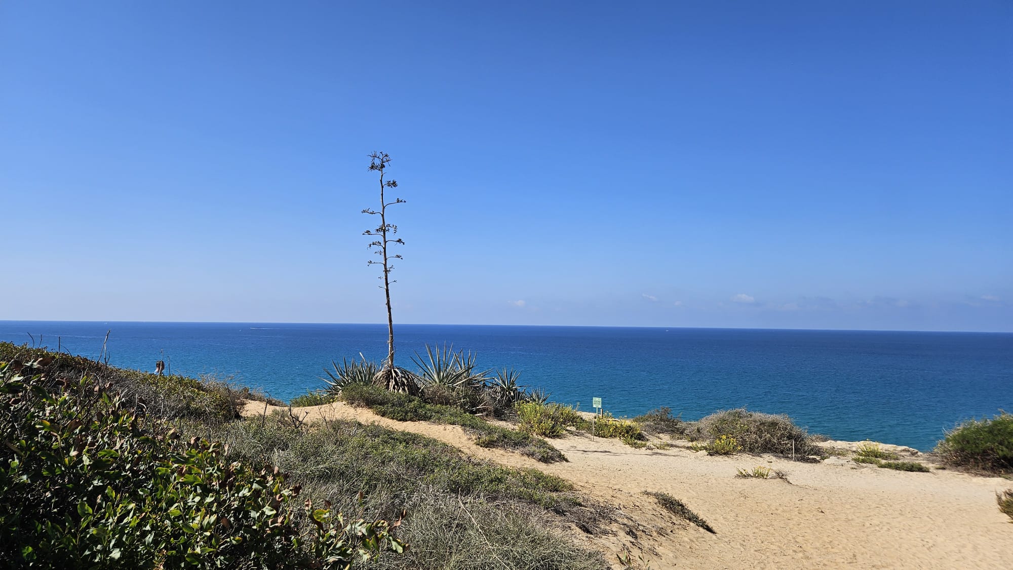 Agave in Hof HaSharon National Park
 Growing up from the Kurkar rock
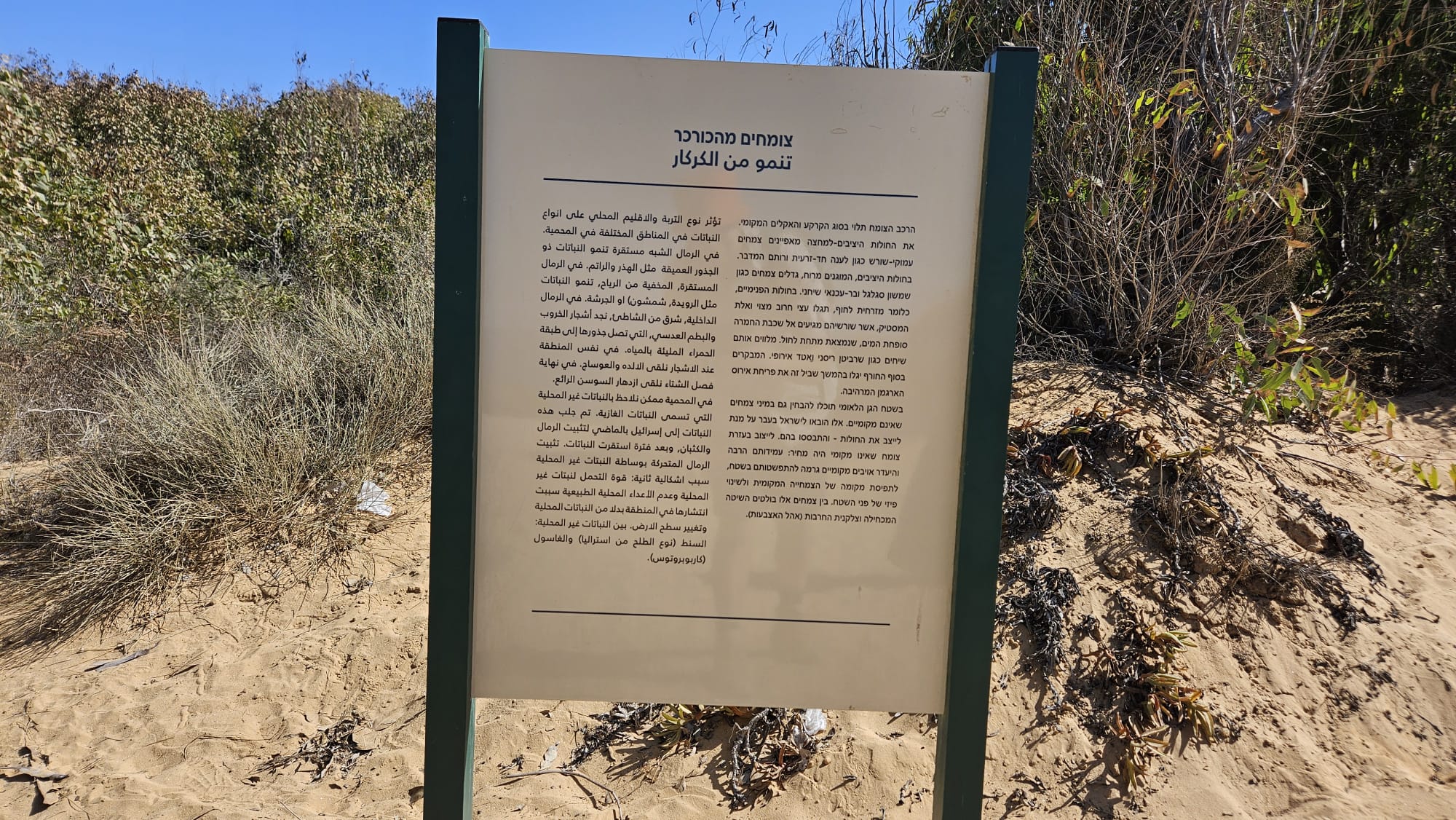
Visitors at the end of winter will discover further along this trail the magnificent blooming of the crimson iris. Within the national park area, you can also notice non-native plant species. These were brought to Israel in the past to stabilize the dunes – and became established there. Stabilization using non-native vegetation had a price: their high resistance and lack of local enemies caused them to spread throughout the area, taking the place of local vegetation and physically changing the surface of the terrain. Among these plants, the Blue-leafed Acacia (Acacia saligna) and the Hottentot-fig (Carpobrotus edulis, lit. sword-like ice plant/fingered Aizoon) are prominent
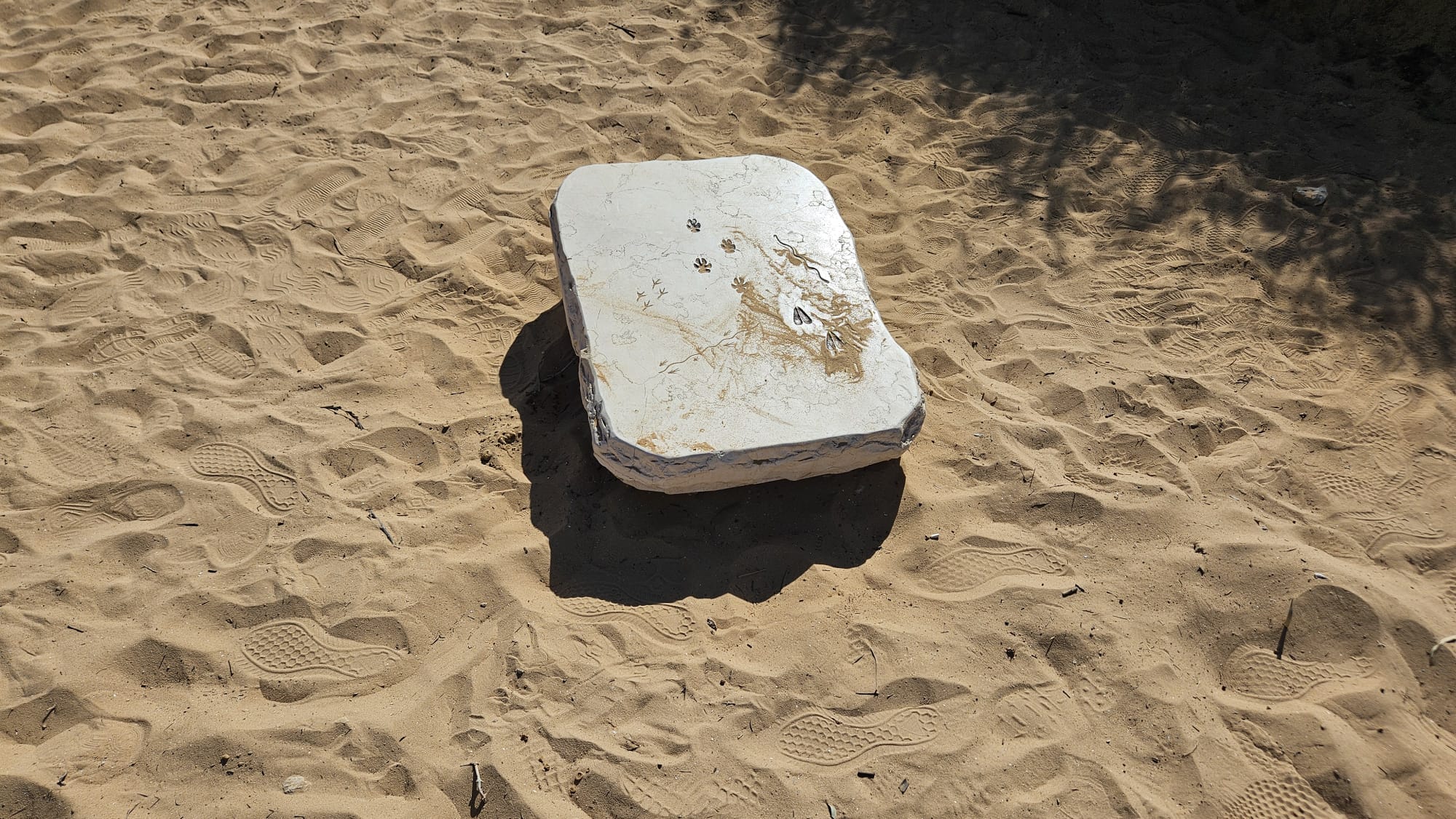 A stone with the park animals footprints cravings
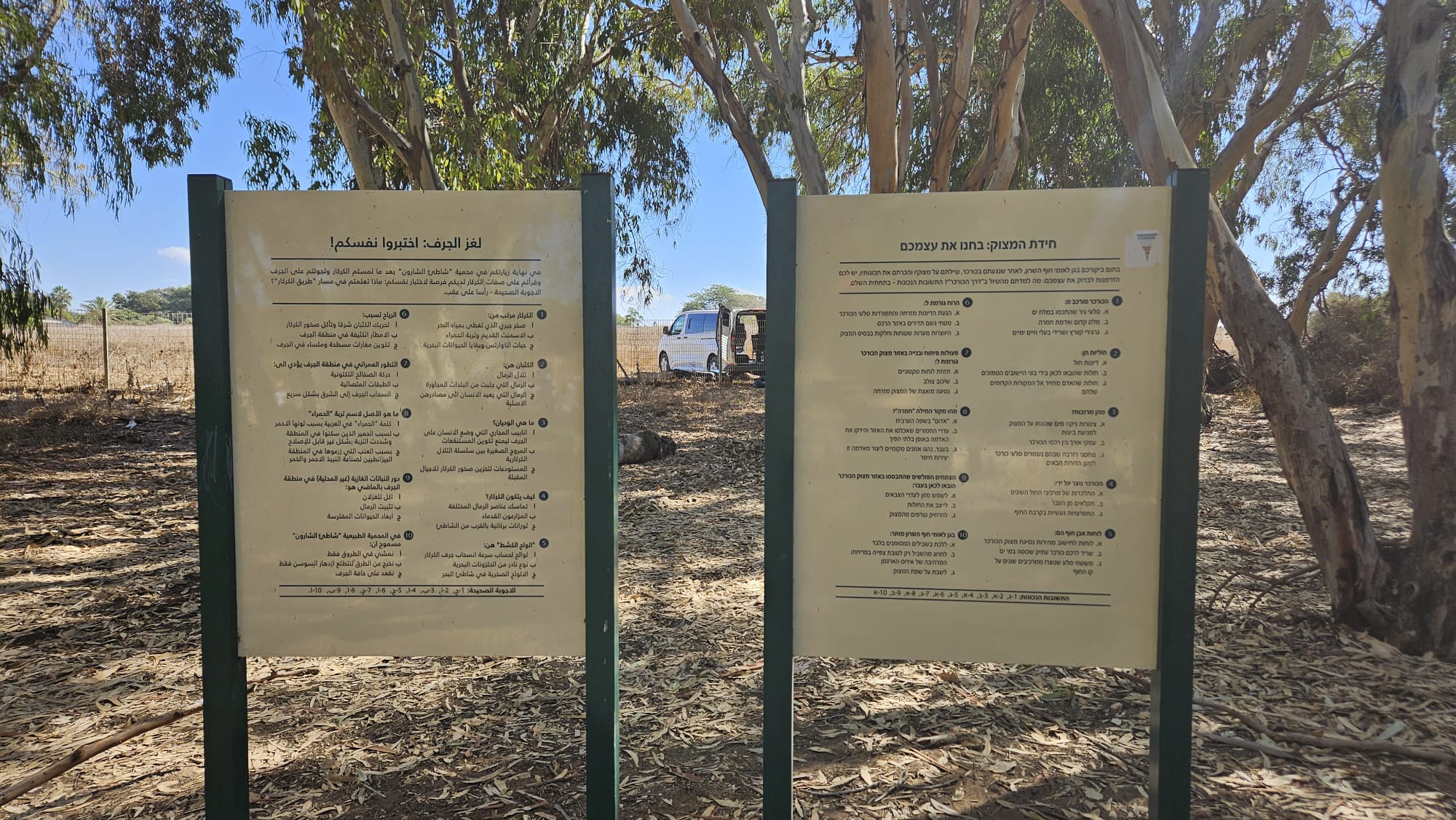 Cliff quiz: Test yourself
The Cliff Riddle: Test Yourself
At the end of your visit to the Sharon Coast National Park, after you have touched the Kurkar, walked along its cliffs and experienced its properties, you have the opportunity to test yourself: What did you learn from walking along the “Kurkar Road”? The correct answers – at the bottom of the whole.
1. The Kurkar consists of: A. Limestone rocks that were covered with sea salt B. Ancient cement and clay soil C. Quartz grains and remains of marine animals
2. Dunes are: A. Sand dunes B. Sands brought here by the builders of nearby settlements C. Sands that man has restored to their ancient sources
3.What are gutters A. Water drainage ditches placed on the cliff To prevent swamps B. Long valleys between the Kurkar ridges C. Reserve warehouses where Kurkar rocks are preserved For future generations
4. The Kurkar was formed by: A. Cohesion of the various sand components B. Past farmers C. Volcanic eruptions near the coast
5. Coastal stone slabs are: A. slabs for calculating the speed of retreat of the Kurkar cliff B. a remnant of an ancient Kurkar ridge covered by seawater C. rock surfaces formed from various components on the shoreline
6. The wind causes: A. the movement of the dunes eastward and the disintegration of the Kurkar rocks B. frequent rain showers in the ridge area C. the formation of flat, smooth caves at the base of the cliff
7.Development and construction activities in the Kurkar Cliff area Shamrot Laza A. Tectonic plate movement B. Cross-bedding C. An attempt to extract the cliff to the east
8.What is the origin of the word “hamra” A. “Red” in Arabic B. The herds of donkeys that inhabited the area and irreversibly hardened the C. soil D. In the past, local people enjoyed creating clay sculptures from this soil
9. The invasive plants that have established themselves in the area of the Kurkar Cliff were brought here in the past: A. To serve as food for the deer herds B. To stabilize the sands C. To keep predators away from the cliff
10. In the Sharon Coast National Park, it is permitted A. To walk on the marked paths only B. To deviate from the path only to view the expansive bloom of the Hagman Iris C. To sit on the edge of the cliff
The correct answers: 1-C, 2-A, 3-B, 4-A. 5-C, 6-A. 7-C, 8-A. 9-B, 10-A