
Hi,
We stopped on Mizpe Revivim on our way to the vacation in Eilat. My agreement with Atzva was we will hike (or visit sites) on the way there and back and take a night to go out and watch the stars, and Mizpe Revivim was chosen on the way there.
It is not far away from Ze’elim, where I have spent many days in past months as part of my reserve duty. I did think about go and visit the place, but I happy I did it with Atzva. Unlike Mizpe Gvulot (we all visited as a family and were not so interested), this Mizpe is more interesting with caves, planes, communication trenches and the castle (fort) itself.
The third Mizpe is Beit Eshel, (out of the three lookouts) which not much left of it – only some ruins of the buildings inside Be’er Sheva park.
Take Care
Gad
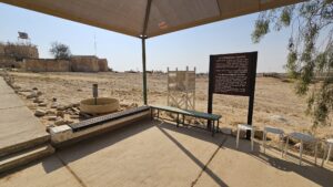
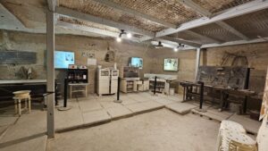
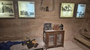
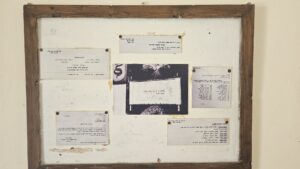
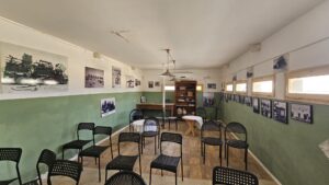
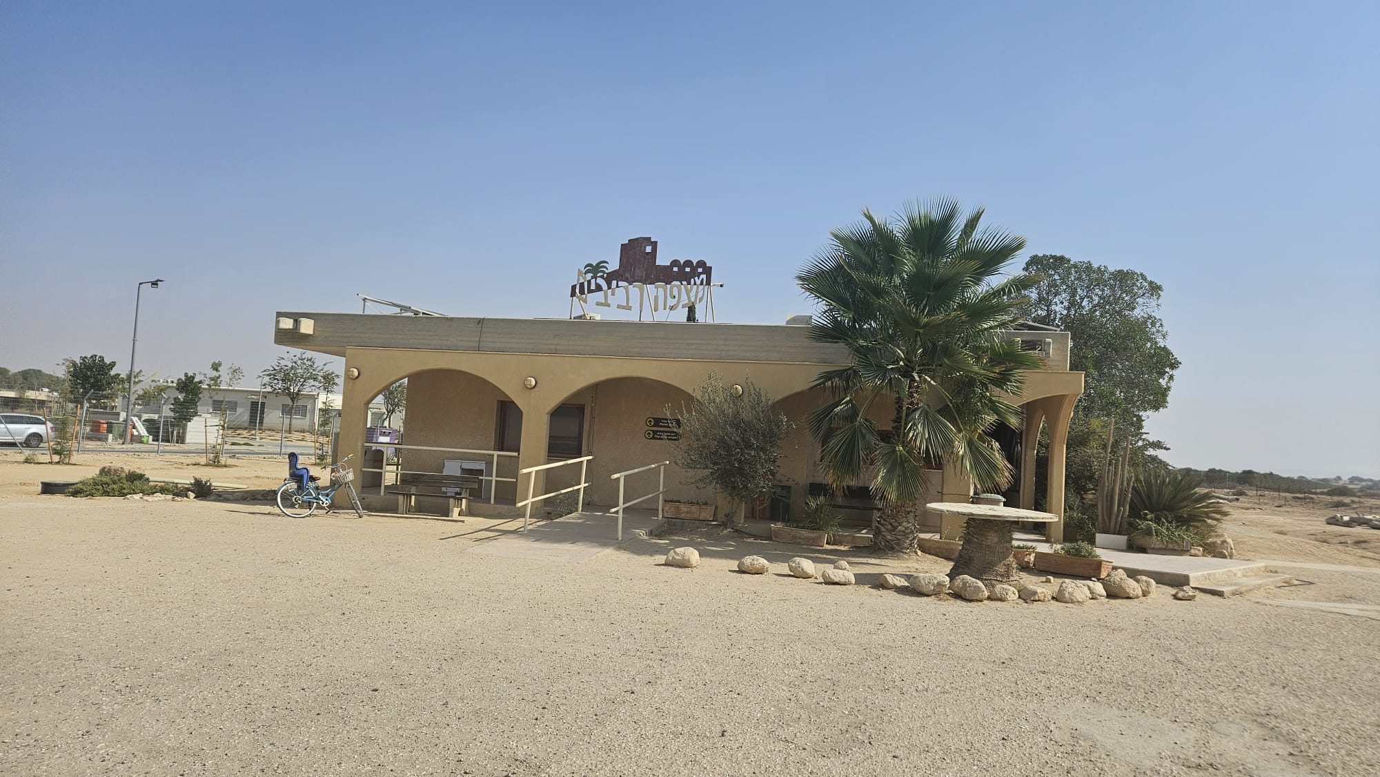 The site visitor center
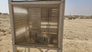
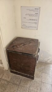
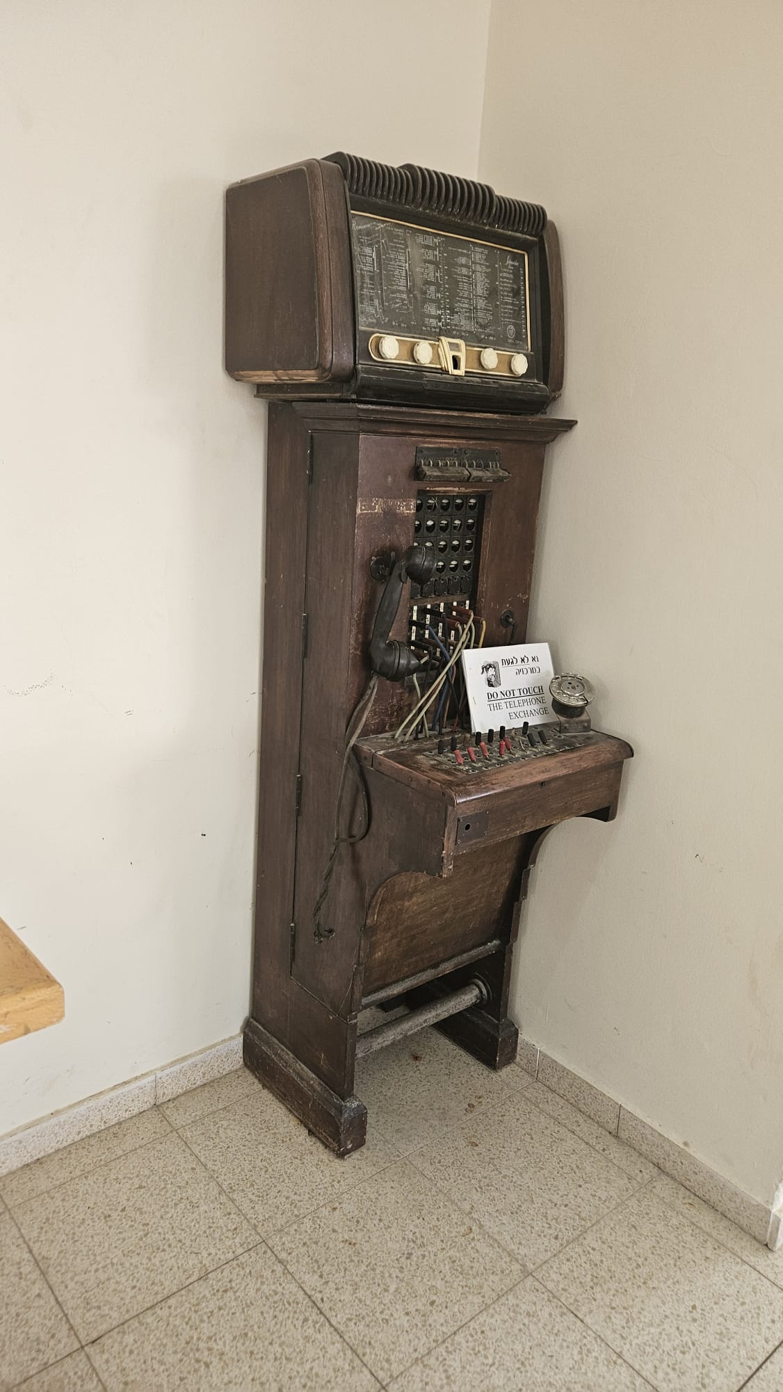 An old telephone exchange in the visitor center
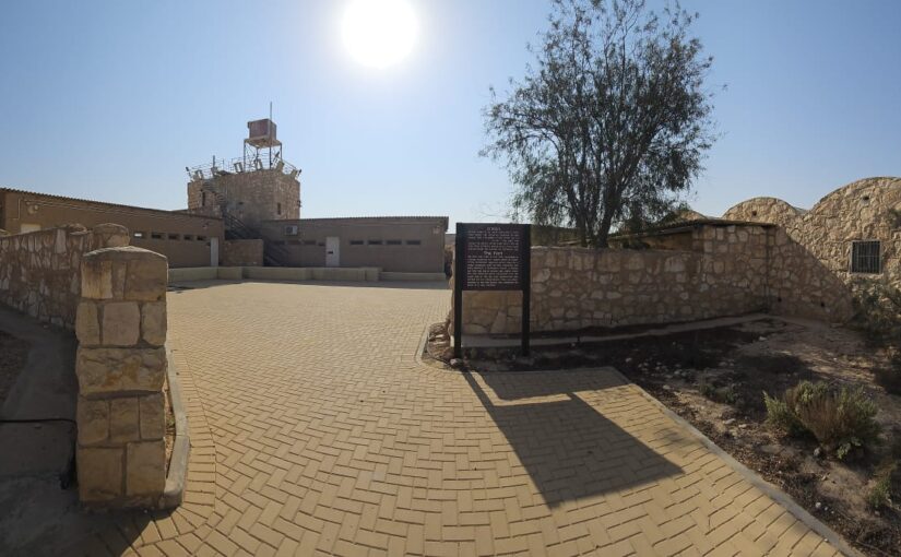
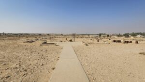
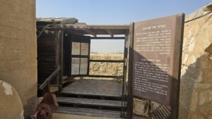
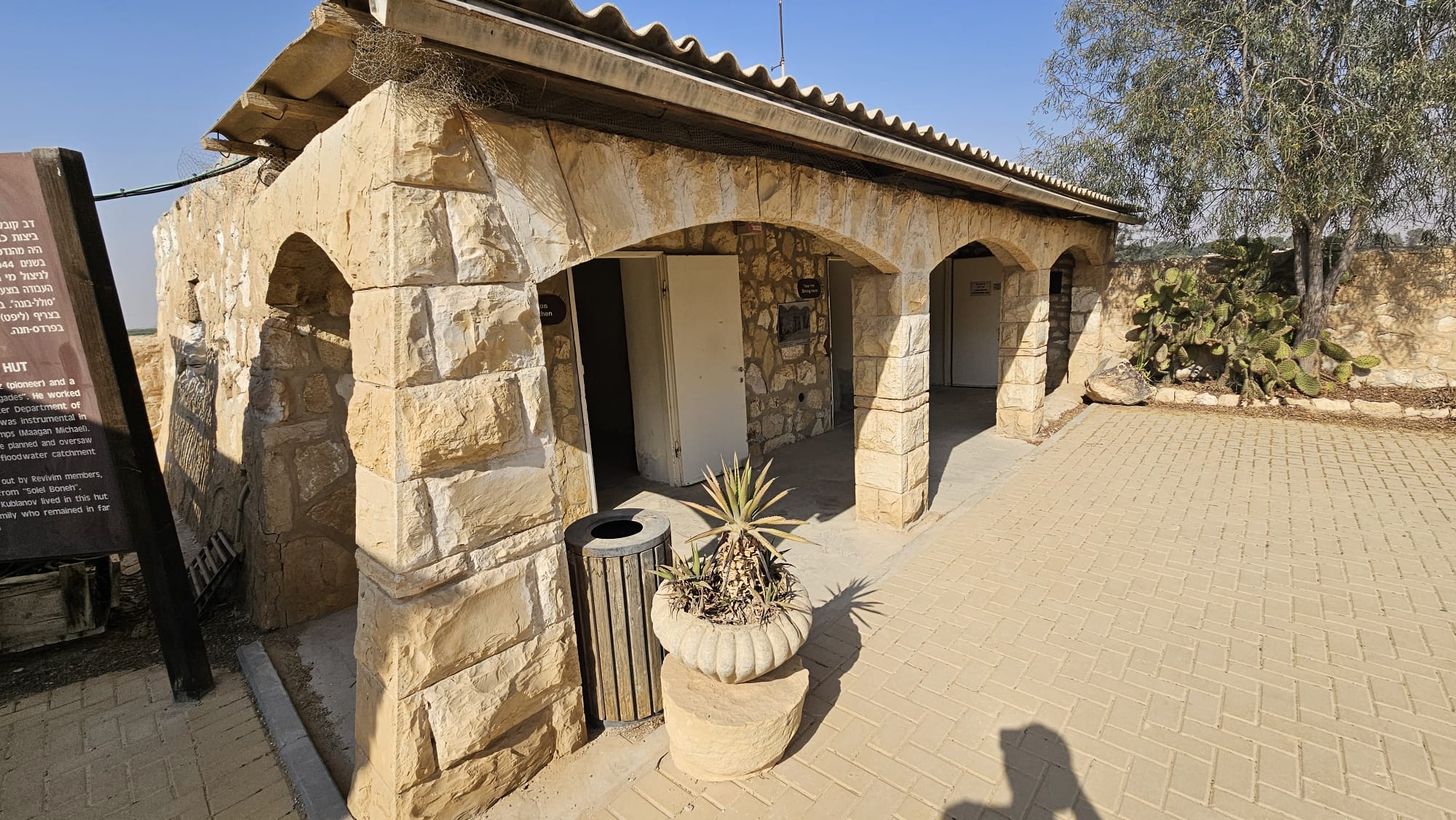
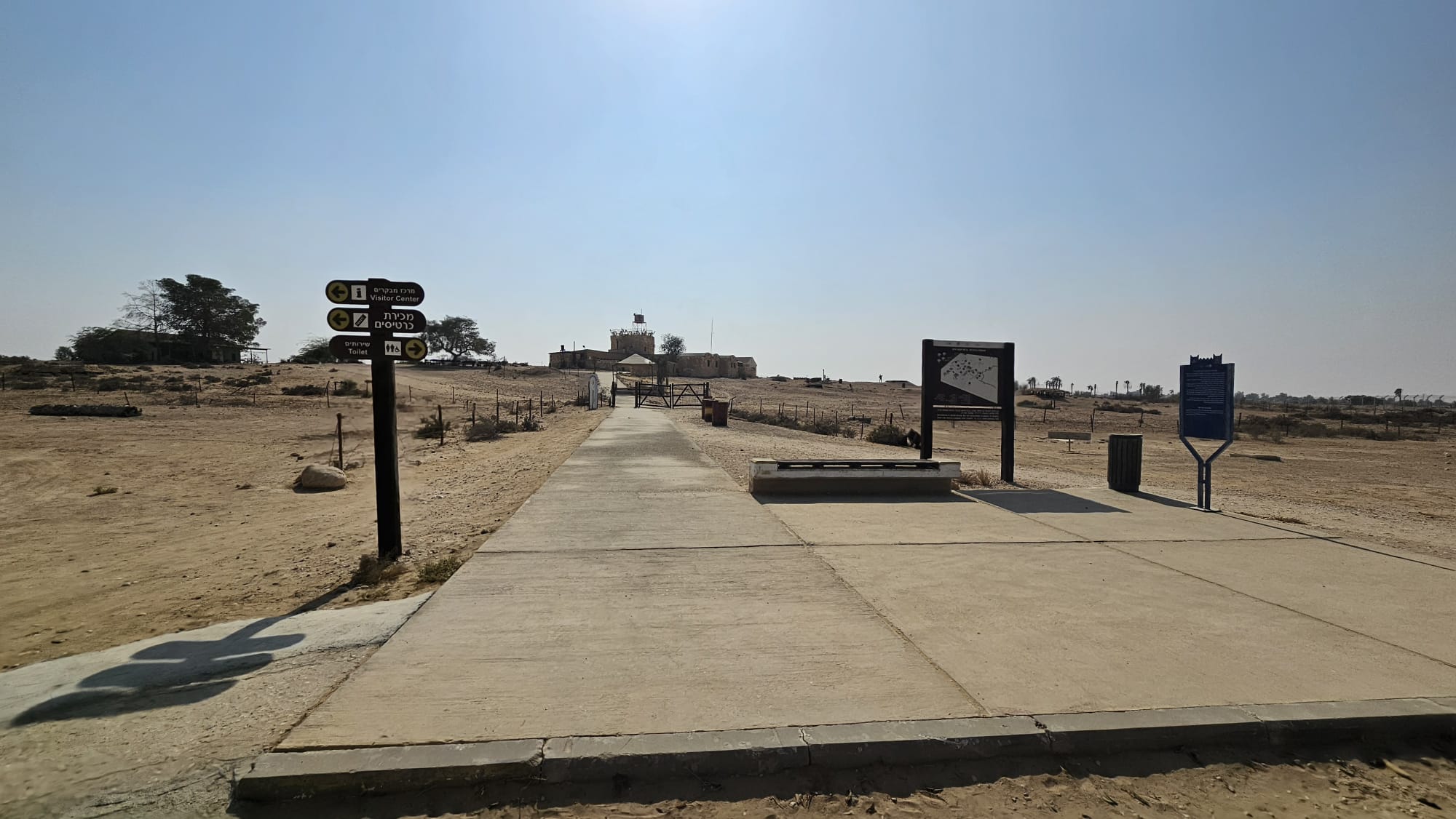 The entrance to site
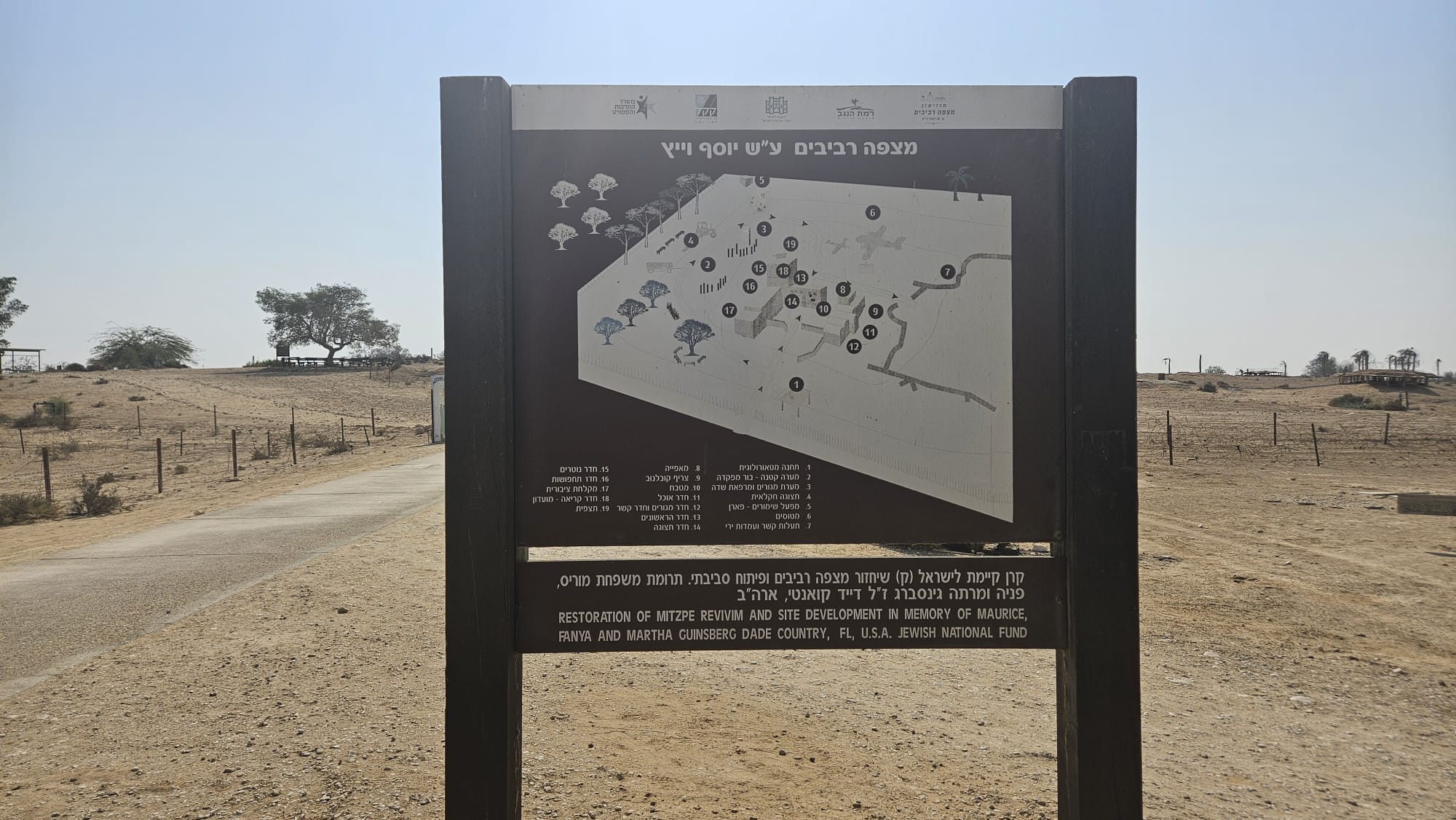 Mizpe Revivim on name of Yosef Weitz
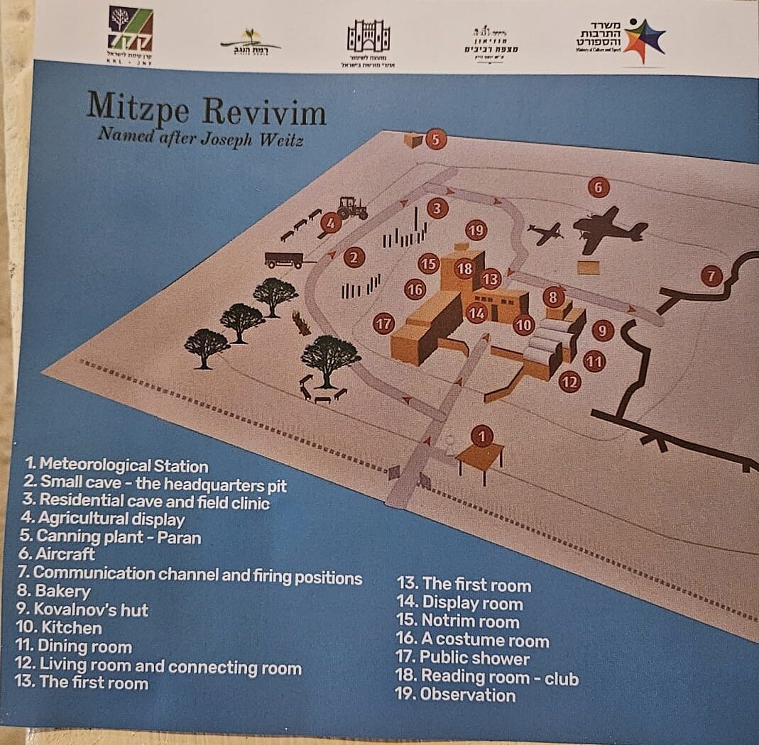 And in english on the map we got of Mizpe revivim
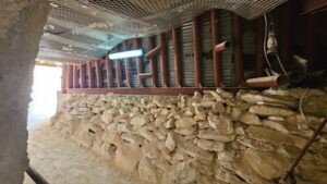
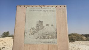
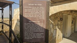
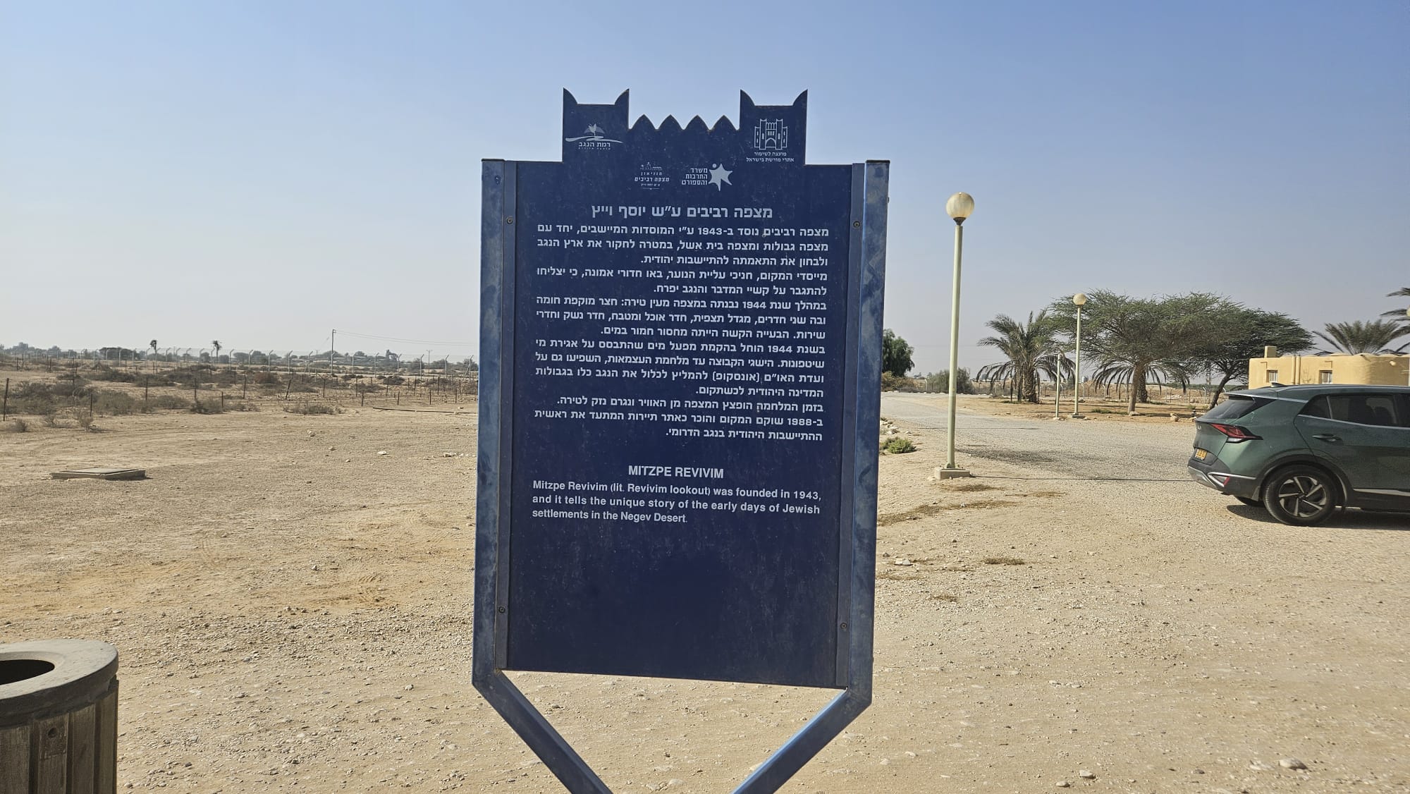 The blue sign of Council for Conservation of Heritage Sites in Israel – Mizpe Revivim was founded in 1943 by the settlement institutions, together with Mitzpe Gvulot and Mitzpe Beit Eshel, with the aim of researching the Negev region and examining its suitability for Jewish settlement. The founders, members of Youth Aliyah, came filled with faith that they would overcome the hardships of the desert and make the Negev flourish. During 1944, a structure resembling a fortress was built at the outpost: a courtyard surrounded by a wall with two rooms, a watchtower, dining room and kitchen, armory, and service rooms. The biggest challenge was the severe shortage of water. In 1944, construction began on a water system based on the collection of floodwaters. The achievements of the group prior to the War of Independence influenced the UN Special Committee (UNSCOP) to recommend including the entire Negev within the borders of the future Jewish state. During the war, the outpost was bombed from the air and damage was caused to the fortress. In 1988, the site was restored and recognized as a tourist site documenting the beginning of Jewish settlement in the southern Negev.
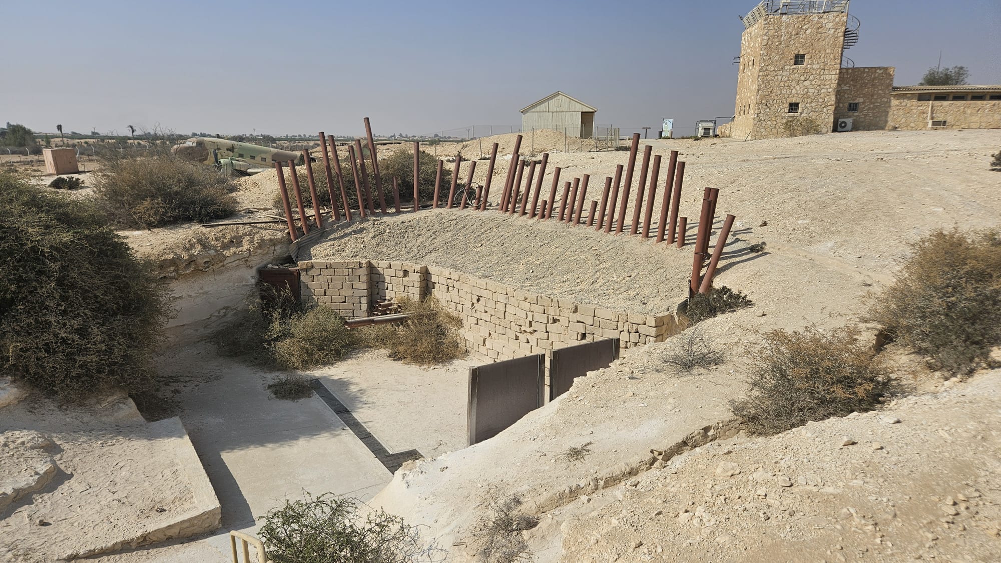
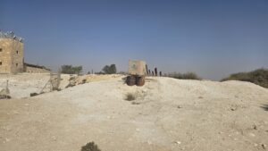
 The guarding posts around the castle
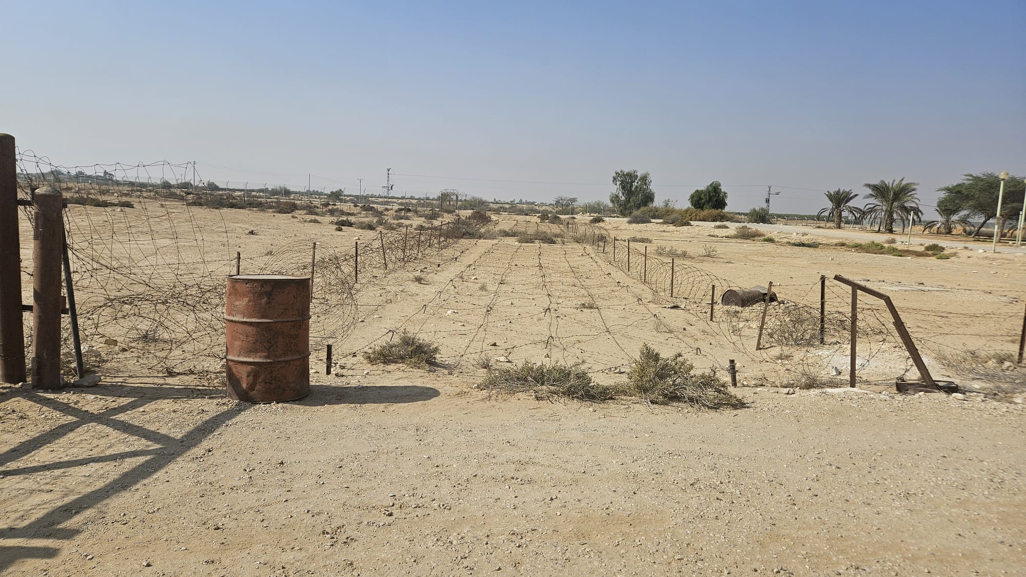 And the barbed wire fortification around the wire
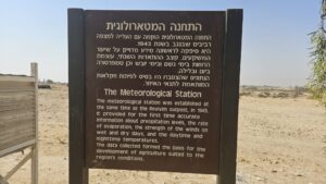
The Meteorological Station – The meteorological station was established at the same time as the Revivim outpost, in 1943. It provided for the first time accurate information about precipitation levels, the rate of evaporation, the strength of the winds on wet and dry days, and the daytime and nighttime temperatures. The data collected formed the basis for the development of agriculture suited to the region’s conditions.
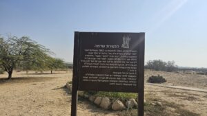
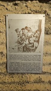
Sdehama Training Group (Hachsharat Sdehama) – The Sdehama training group began to form in 1943, about two years after the establishment of the Palmach. Its members were 11th-grade graduates from Tel Aviv and the Borochov neighborhood, most of them members of the “Working Youth” movement. The training started at Kibbutz Ginnosar. After a year, the group moved to Kibbutz Yagur, where they were joined by graduates of youth companies from Ein Harod and Givat Haim. From there, the group joined the ranks of the Palmach as one of the first enlisted training groups, affiliated with Company A, Battalion 1. Five of its members fell in battle.In November 1945, the group was discharged from the Palmach, and in the same month, its 38 members arrived to reinforce Mizpe Revivim. During the War of Independence, the members of Hachsharat Sdehama formed a significant force in the defense of the settlement. Palmach Heritage.
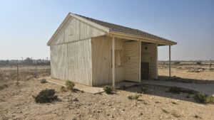
 A cabin, not clear from which time and what is used for now
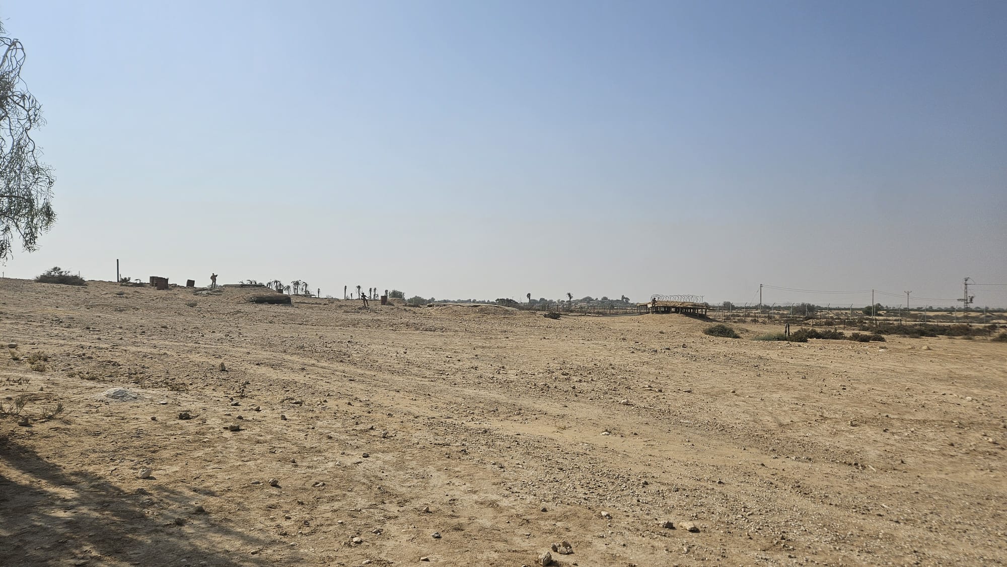
 Going around the castle to the interest point around
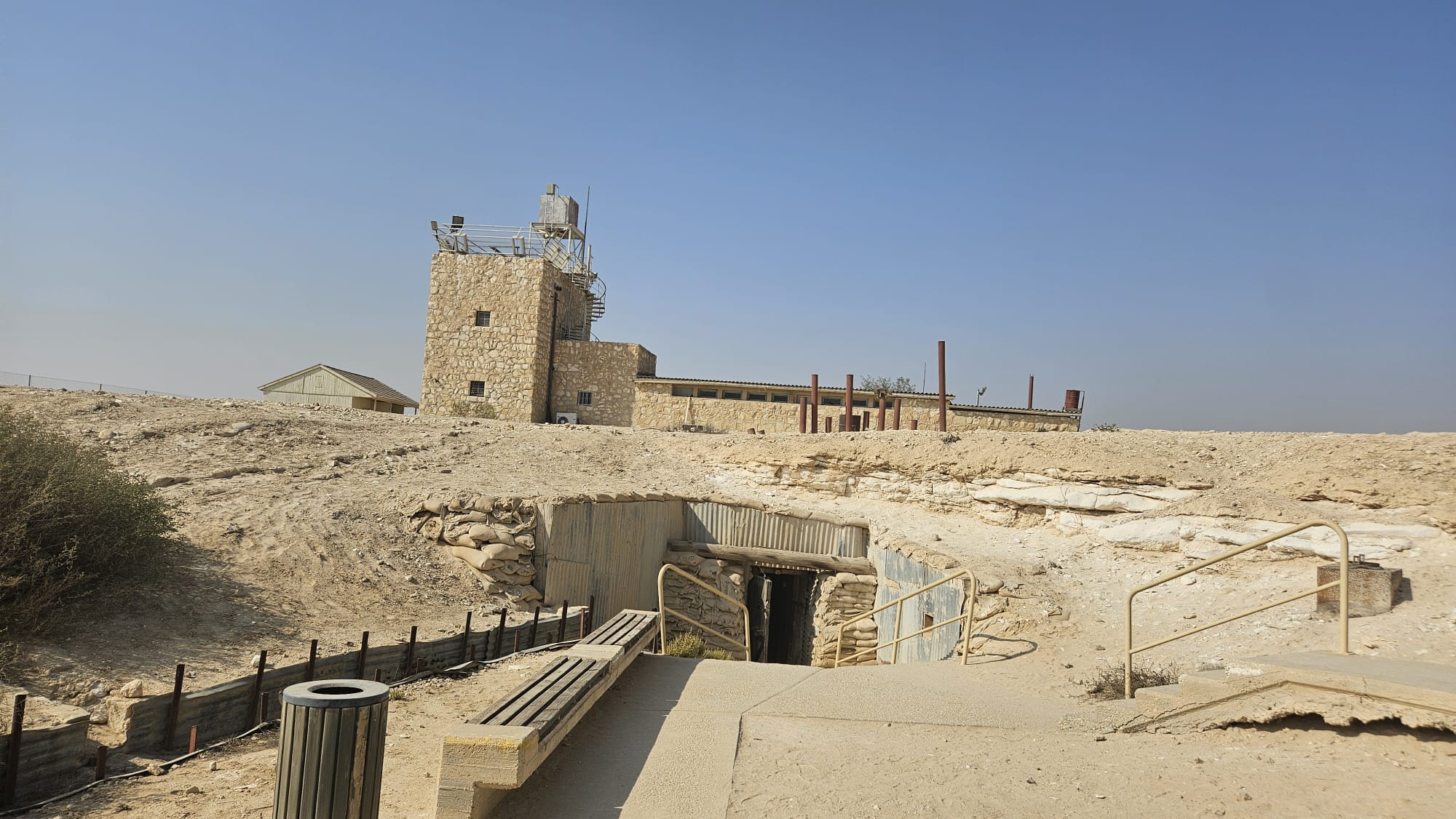
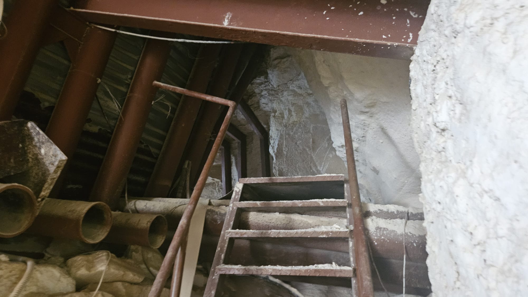
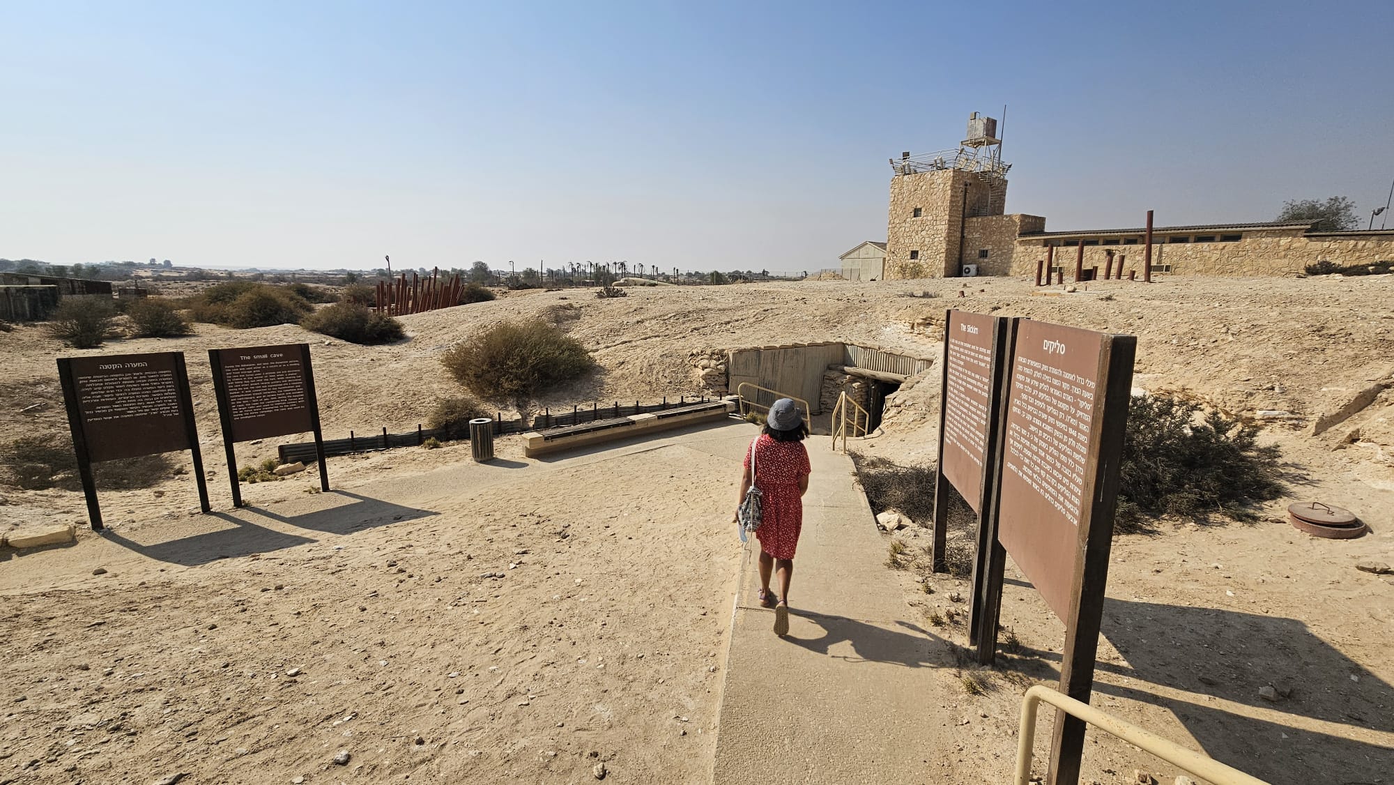 Going down to the Slickim and the small cave
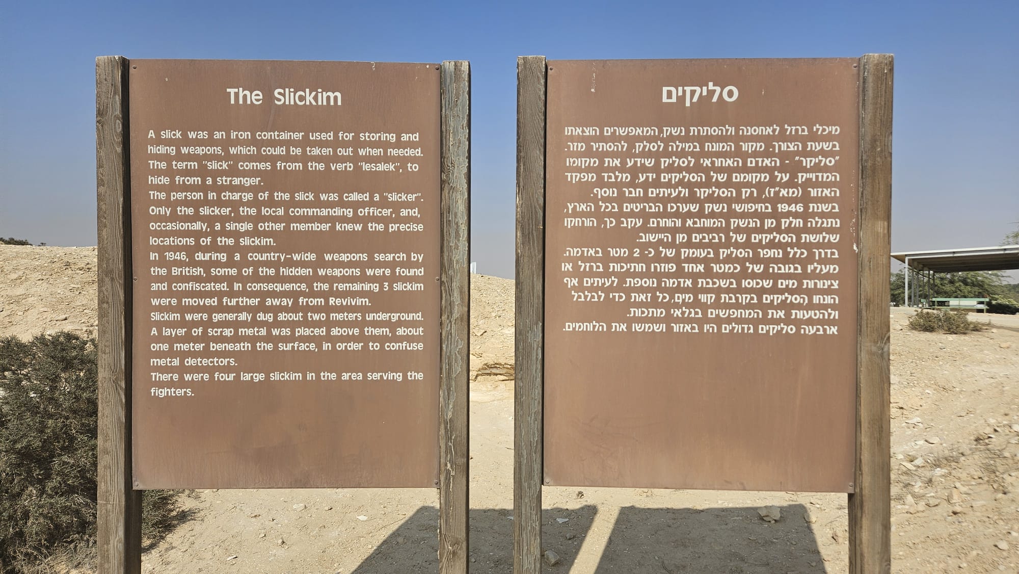
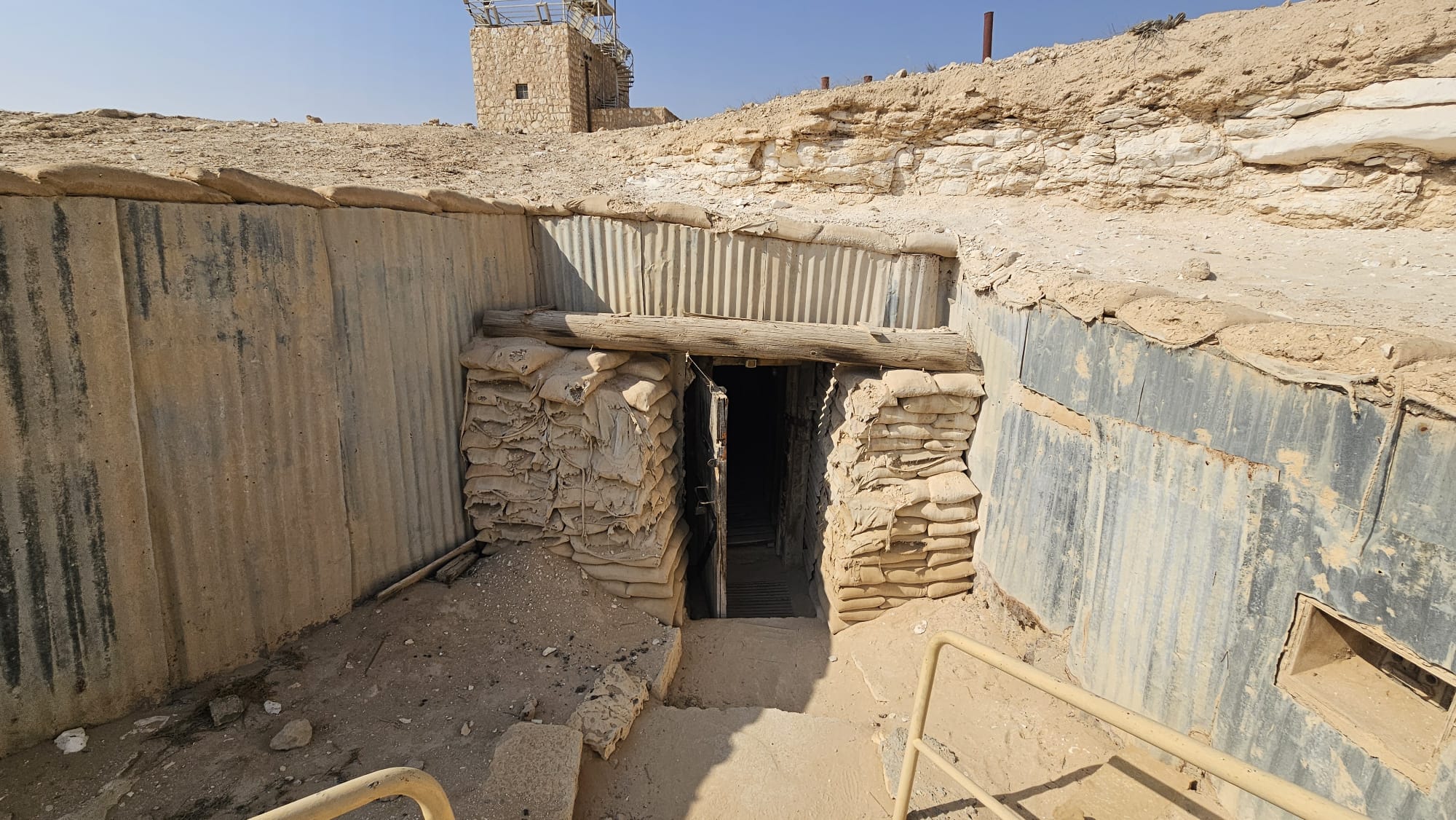
The Slickim – A slick was an iron container used for storing and hiding weapons, which could be taken out when needed. The term “slick” comes from the verb “lesalek”, to hide from a stranger. The person in charge of the slick was called a “slicker”. Only the slicker, the local commanding officer, and, occasionally, a single other member knew the precise locations of the slickim. In 1946, during a country-wide weapons search by the British, some of the hidden weapons were found and confiscated. In consequence, the remaining 3 slickim were moved further away from Revivim. Slickim were generally dug about two meters underground. A layer of scrap metal was placed above them, about one meter beneath the surface, in order to confuse metal detectors. There were four large slickim in the area serving the fighters.
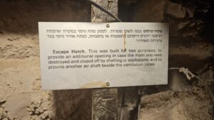
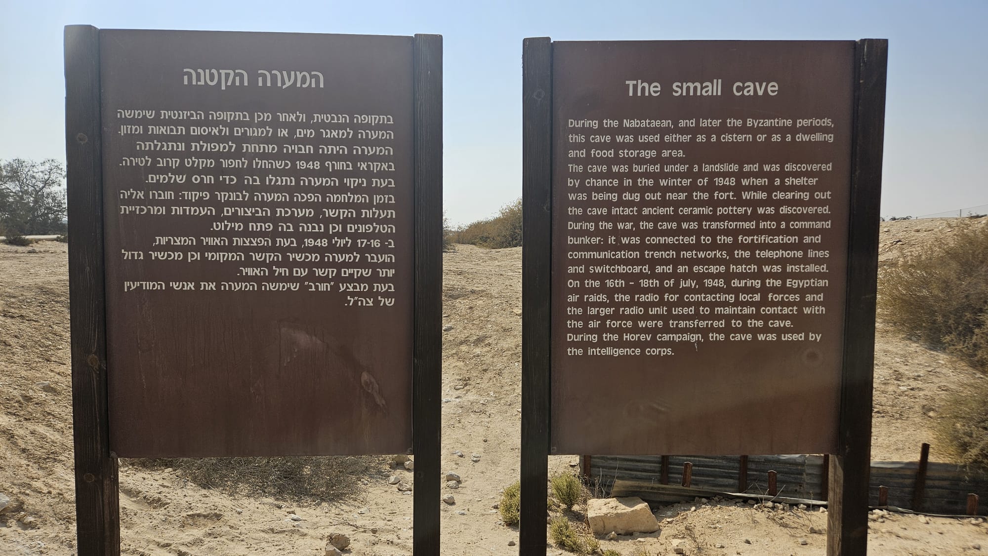 The small cave – During the Nabataean, and later the Byzantine periods, this cave was used either as a cistern or as a dwelling and food storage area. The cave was buried under a landslide and was discovered by chance in the winter of 1948 when a shelter was being dug out near the fort. While clearing out the cave intact ancient ceramic pottery was discovered. During the war, the cave was transformed into a command bunker: it was connected to the fortification and communication trench networks, the telephone lines and switchboard, and an escape hatch was installed. On the 16th – 18th of july, 1948, during the Egyptian air raids, the radio for contacting local forces and the larger radio unit used to maintain contact with the air force were transferred to the cave. During the Horev campaign, the cave was used by the intelligence corps.
 The small cave and the castle above it
 The entrance to the small cave
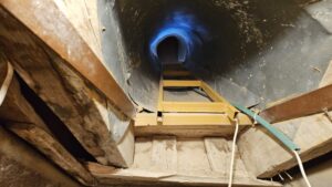
Inside the small cave
 The entrance to the Large Cave
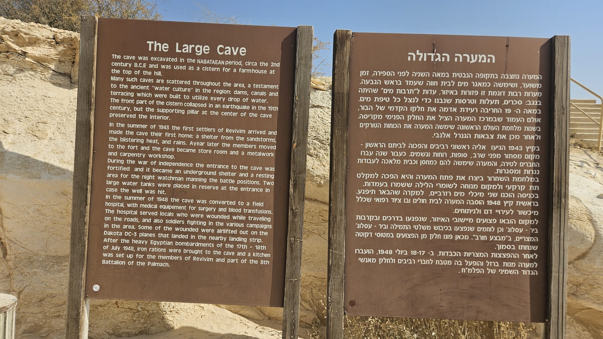
The Large Cave The cave was excavated in the Nabatean period, circa the 2nd
century B.C.E and was used as a cistern for a farmhouse at the top of the hill.
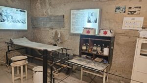
Many such caves are scattered throughout the area, a testament to the ancient “water culture” in the region: dams, canals and terracing which were built to utilize every drop of water. The front part of the cistern collapsed in an earthquake in the 19th century, but the supporting pillar at the center of the cave preserved the interior. In the summer of 1943 the first settlers of Revivim arrived and made the cave their first home: a shelter from the sandstorms, the blistering heat, and rains. A year later the members moved to the fort and the cave became store room and a metalwork and carpentry workshop. During the war of independence the entrance to the cave was fortified and it became an underground shelter and a resting area for the night watchman manning the battle positions. Two large water tanks were placed in reserve at the entrance in case the well was hit. In the summer of 1948 the cave was converted to a field hospital, with medical equipment for surgery and blood transfusions. The hospital served locals who were wounded while traveling on the roads, and also soldiers fighting in the various campaigns in the area. Some of the wounded were airlifted out on the Dakota DC-3 planes that landed in the nearby landing strip. After the heavy Egyptian bombardments of the 17th – 18th of July 1948, iron rations were brought to the cave and a kitchen was set up for the members of Revivim and part of the 8th Battalion of the Palmach.
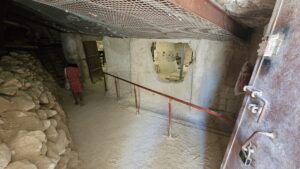
Inside the big cave
 Inaccessible part of the big cave
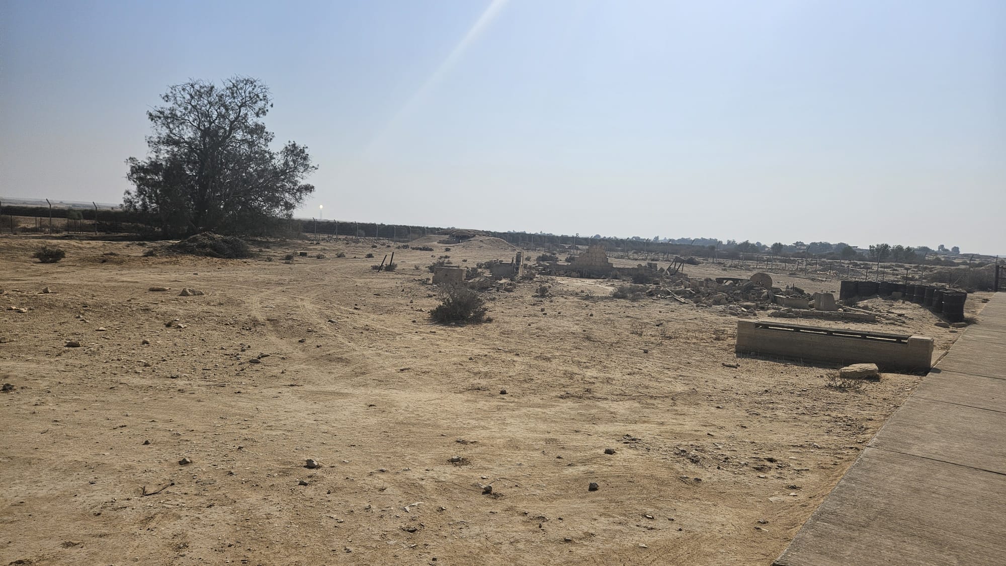 The bright dot near the tree? This is Ashalim Solar Thermal Power Station
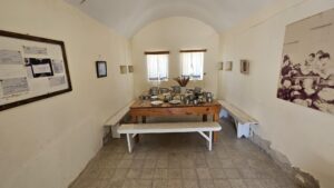
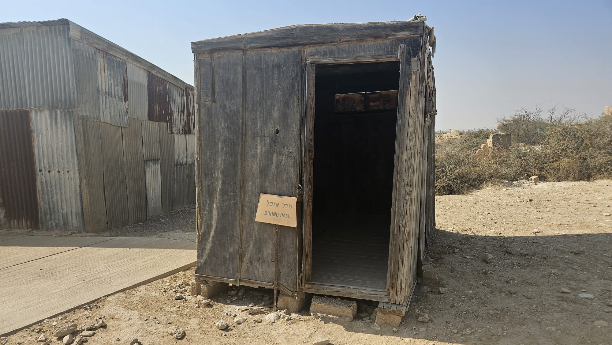 The Dining hall (the Hebrew wirting says dining room, which more fit here…)
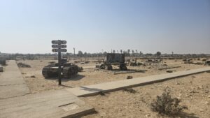
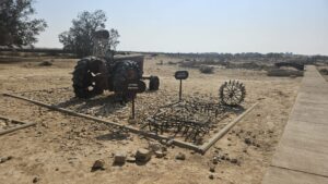
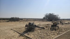
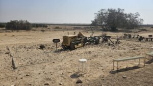
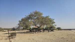
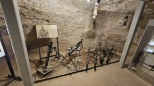
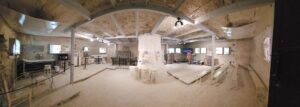
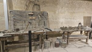
Some of Mizpe Revivim old agriculture equipment and among it the tractor that was brought here on the first day and a D-2 (as you can see, it is much smaller than the D-9…)
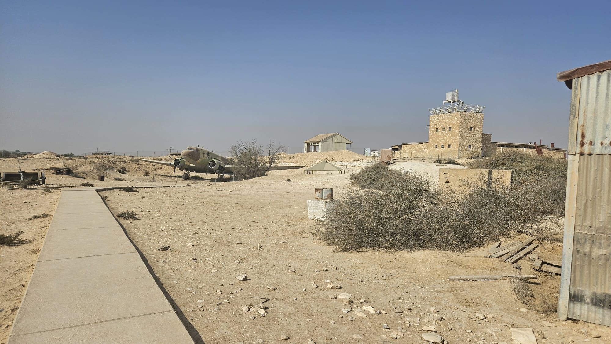 A planes and the castle above
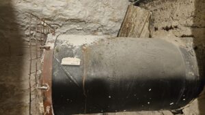
First water storage tank that was used as a shower
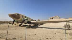
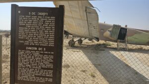
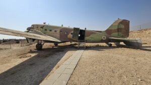
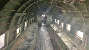
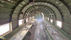
DAKOTA DC 3 – The twin engine supply plane was made by the Douglas Aircraft Company. During the war of independence, when access to the Negev was cut off by the Egyptian army which controlled the Ashkelon – Faluja line, the plane was used to fly in troops, evacuate the wounded and to bring in supplies. The plane was flown by foreign volunteers Michael Weimers, a member of Revivim, suggested building a landing strip for the Dakotas in the area east of the settlement. When the planes landed, the air strip was marked by burning paraffin soaked rags in tin cans (Goznikim). The loading and offloading was risky and had to be done quickly because the Egyptian army controlled the surrounding hills. The wounded received first aid in the field hospital at the cave, and were then air lifted out to hospitals across the country.
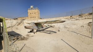
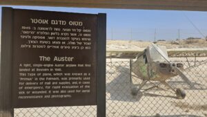
The Auster – A light, single-engine Auster airplane that first landed at Revivim in 1945. This type of plane, which was known as a “Primus” in the Palmach, was primarily used for delivery of mail and supplies, and, in cases of emergency, for rapid evacuation of the sick or wounded. It was also used fort aerial reconnaissance and photography.
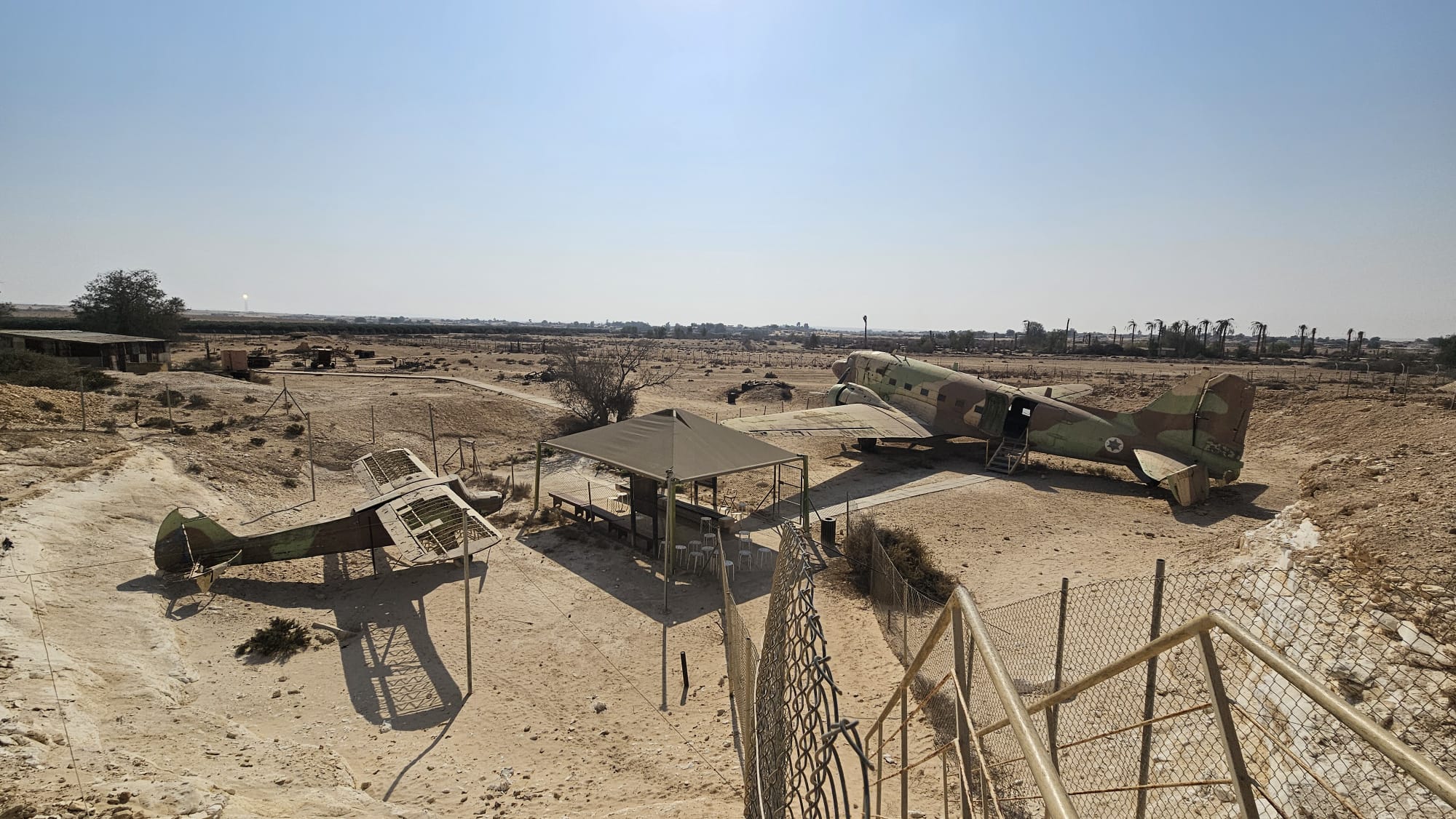 The two airplanes from above
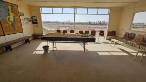
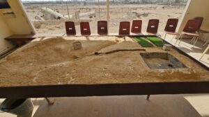
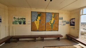
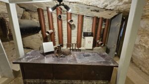
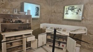
A cabin with the map of the United Nations Partition Plan for Palestine and map of the Peel Commission as well as a table with the water system built here.
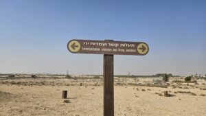
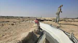
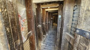
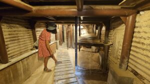
Getting in the connecting trenches, that were renovated and a note saying Revivim is rain.
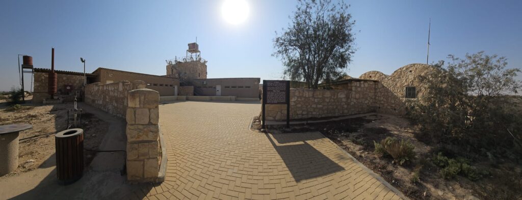
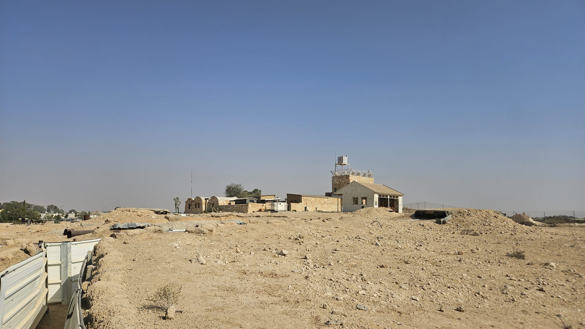 The fort (or the castle as it called here) from a different angle
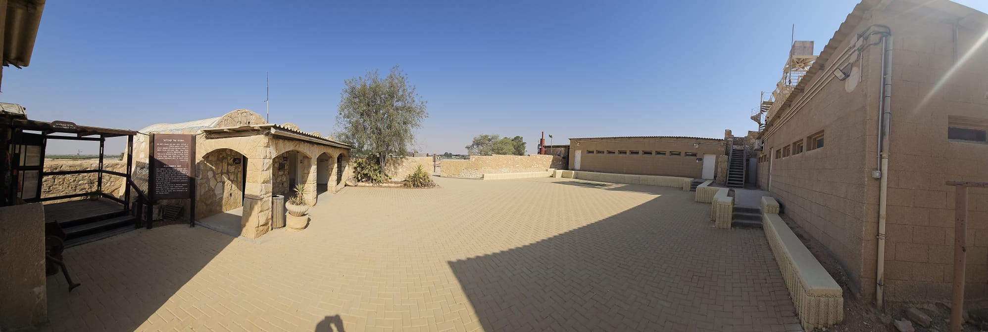 The castle yard
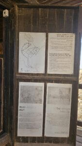
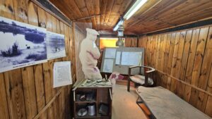
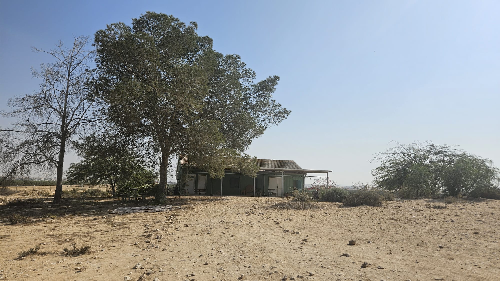
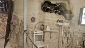
Kublanov’s hut – Dov Kublanov was a Halutz (pioneer) and a member of the “Work Brigades“. He worked as a engineer in the Water Department of the Jewish Agency and was instrumental in draining the Kabara swamps (Ma’agan Michael) In the years 1944-1947 he planned and oversaw the construction of a floodwater catchment system at Revivim. The work was carried out by Revivim members, alongside workers from “Solel Boneh“. From 1944 to 1945 Kublanov lived in this hut away from his family who remained in far off Pardes Hanna.
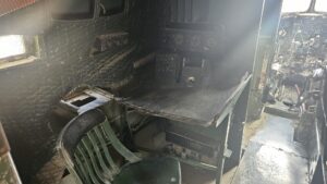
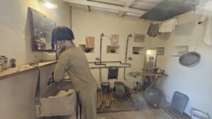
 The first rooms of the castle – Kitchen and Dining room and Living room
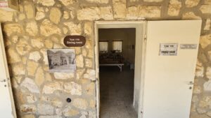
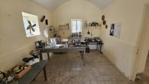
The kitchen and dining room
Dining room
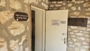
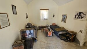
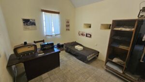
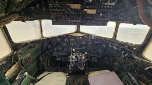
Living room and communication room
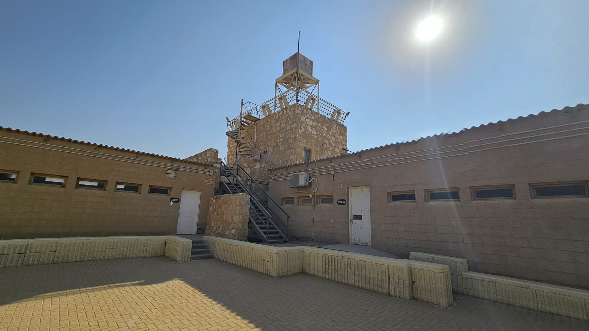 The castle tower and newer buildings, which not hosts the First stories room and the costume room
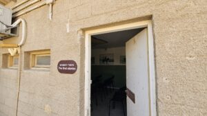
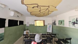
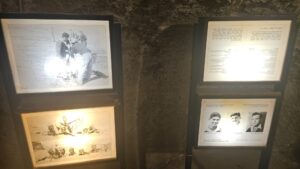
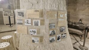
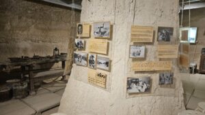
The first stories room – with short videos of the first days of Mizpe Revivm
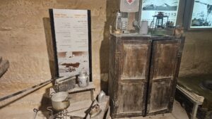
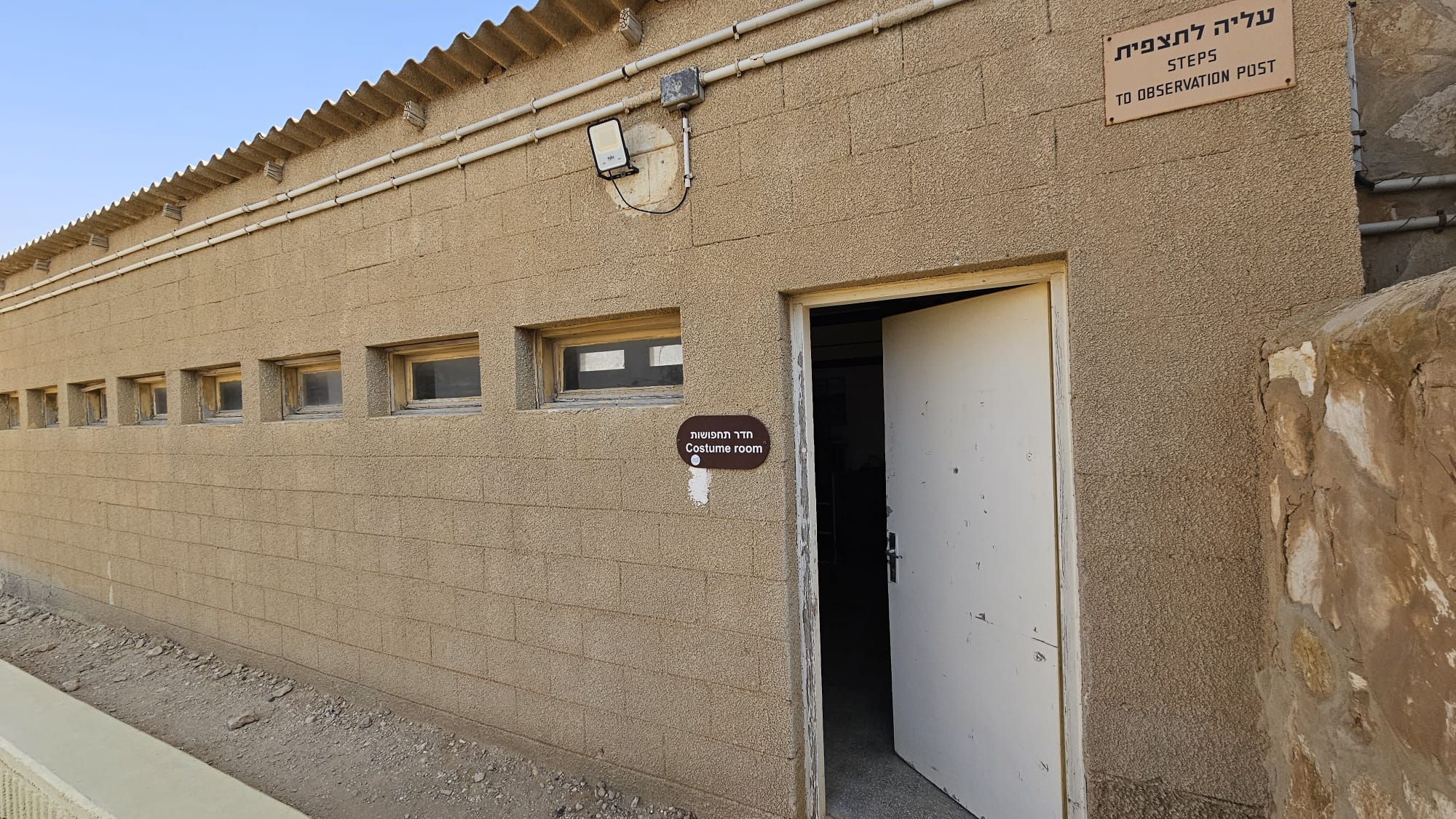 The costume room – where you can wear costumes from the days of the pioneers

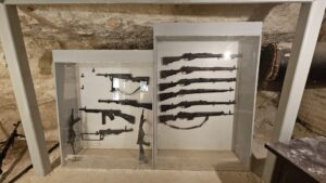
The guard room (the exhibition room was closed) – one the ground floor of the tower
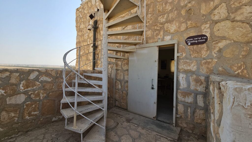
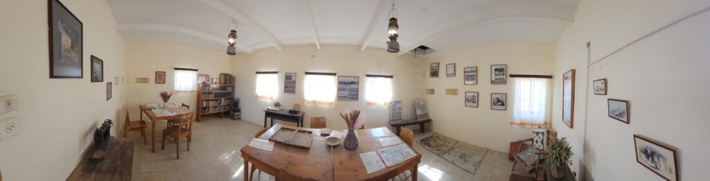
Reading room – on 1st floor of the tower
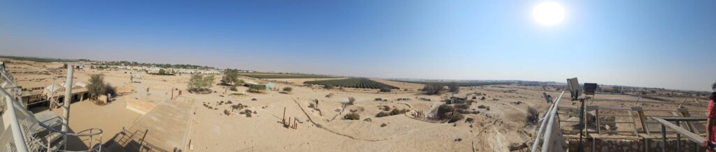
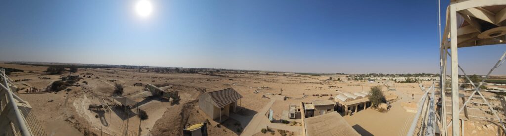
360 around view from the top of the tower.
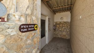
Public shower, from the early days of the place (if you push the button to the left of the door, you can hear him sings)
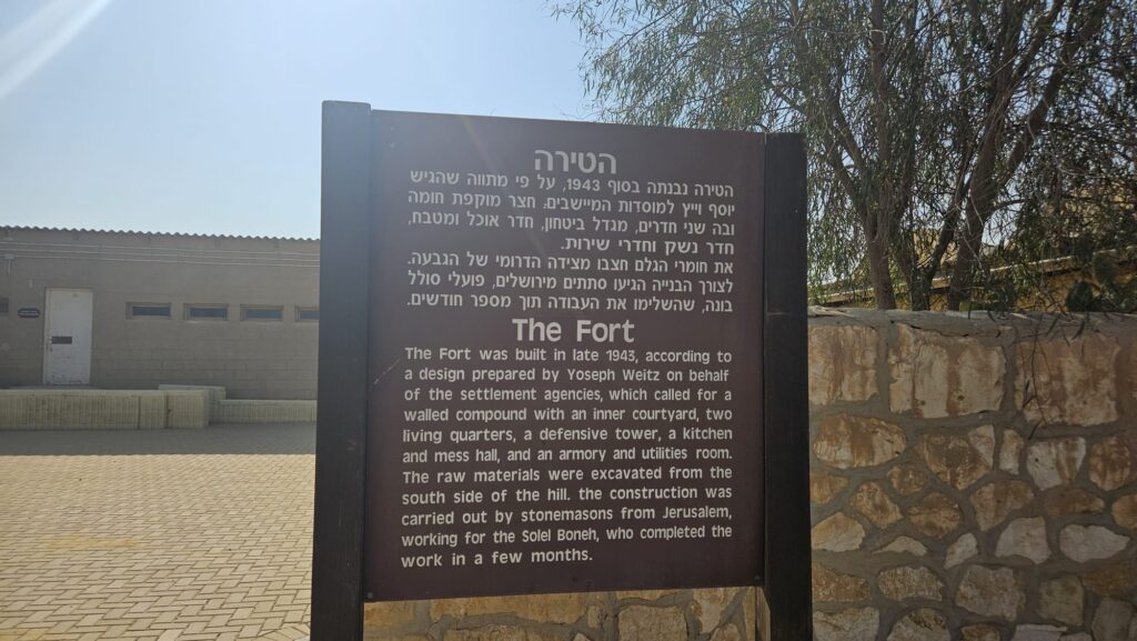
The Fort (in Hebrew it called the castle) – The Fort was built in late 1943, according to a design prepared by Yoseph Weitz on behalf of the settlement agencies, which called for a walled compound with an inner courtyard, two living quarters, a defensive tower, a kitchen and mess hall, and an armory and utilities room. The raw materials were excavated from the south side of the hill. the construction was carried out by stonemasons from Jerusalem, working for the Solel Boneh, who completed the work in a few months.